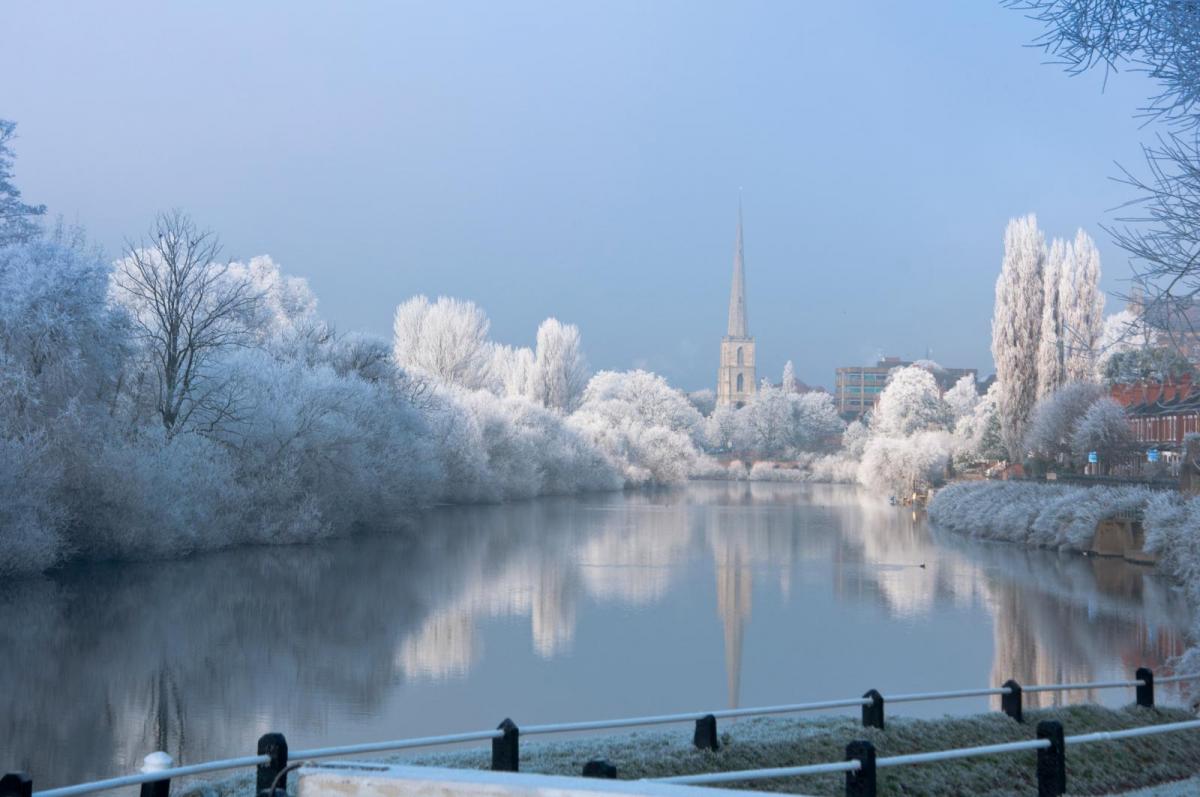
It's going to feel more like February, as a couple of fronts bring in air of polar origin today. However, the air has been tempered by the Atlantic Ocean, making it less cold than it would otherwise have been. Nevertheless, it'll be cold enough in the next few days and into the weekend for the return of night frosts and some snow, mostly over hills in the North. More wet weather, perhaps preceded by snow over hills in the North and East, looks set to move in from the South West on Sunday.
It's a mild but blustery start across the East and South East with a few showers and temperatures close to 10 or 11C, but it won't be long before a band of squally, heavy rain stretching from North East England, through the Midlands and down to the South West moves in. There'll be strong gusts of wind ahead of the rain, which will be torrential in some parts briefly, maybe with a crack of thunder. And with the ground already saturated, there'll be further local flooding.
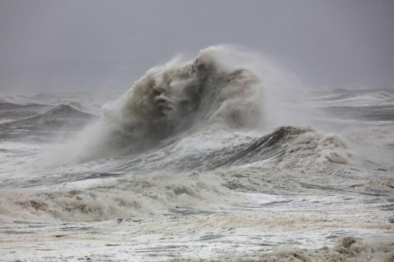
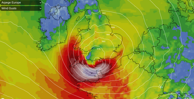
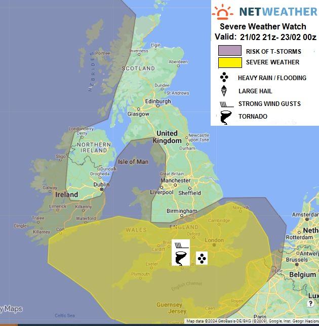
A severe storm watch has been issued for today.
Following on is a clearance that's already reached the North West and is now moving into Wales. This'll bring a noticeable drop in temperature, but it could be after dark before this finally reaches East Anglia and the South East.
Across Scotland and Northern Ireland, it'll be a day of sunny spells and showers. Some of the showers will be heavy in the West, giving local hail and thunder, these spreading to the East of Scotland after a brief lull here with some sunshine. Snow is likely on Scottish hills above about 200m. It'll feel cold in an increasingly blustery South West wind, with temperatures no higher than 4 or 5C in the North and 6 or 7C across Northern Ireland and further South.
Once any wet weather in the East has cleared, we'll all be in the 'same boat' after dark with a mix of clear intervals and showers. Some, particularly in the North and West, will be heavy and squally, giving hail, local thunder and some snow, mostly over Scottish and northern hills. Sheltered eastern areas see fewer showers, but even here, should you catch one, it could be heavy and squally.
A rather raw West or South West wind will be blustery in the North and West, giving strong gusts. It'll also be cold enough for a touch of frost in sheltered spots by dawn leading to icy patches, with temperatures mostly falling to between 2 and 5C but perhaps as low as -2C over parts of East Scotland.
Friday brings sunny spells but also showers, particularly to the North and West, where some will be heavy. Embedded troughs will occasionally enhance the showery activity, pushing them further East, but here you have a better chance of it staying dry. The showers fall as snow on northern hills and perhaps at lower levels across the North of Scotland. A rather raw South West wind shouldn't be as blustery, but temperatures get no higher than 3 to 6C in the North and 7 or 8C further South.
Showers, wintry in places, become more confined to the North and West as winds decrease still further. The showers continue to fall as snow on hills and locally at lower levels in the North. Clear spells, especially in more sheltered eastern areas, will lead to a frost and icy patches where showers have fallen, with lowest temperatures mostly in the range -2 to +3C.
Loading recent activity...