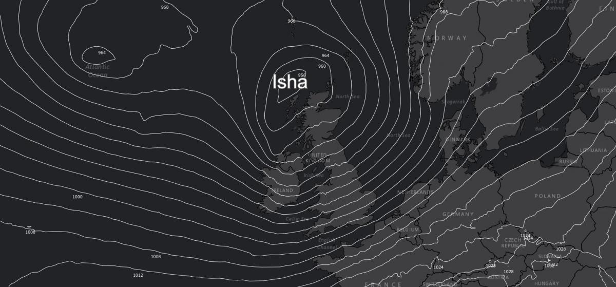
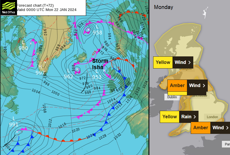
Storm Isha has been named by the UK Met Office. A low pressure will move across the North Atlantic on Saturday and reach Ireland and the UK later on Sunday. The current forecast takes the centre of the rapidly deepening low pressure near the Western Isles on Sunday night and then over Sheltnad on Monday morning. This would put the strongest winds on the southern flank and there is already an amber wind warning over southern Scotland including the Central Belt, Northern Ireland, northern England and down western parts of Britain through Wales to Cornwall.
“Storm Isha will bring a spell of very strong winds during Sunday evening into Monday. Disruption to travel and utilities is likely.” MO
There will be gales from the southwest with gusts of 50 to 70mph, perhaps 80mph for exposed parts with severe gales. The winds will start from the southwest and then veer to a westerly which will continue for the Monday morning commute. The Met Office warning matrix shows “a medium likelihood and medium impacts.”
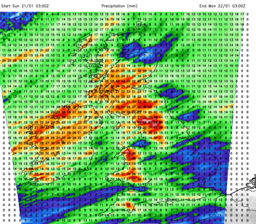
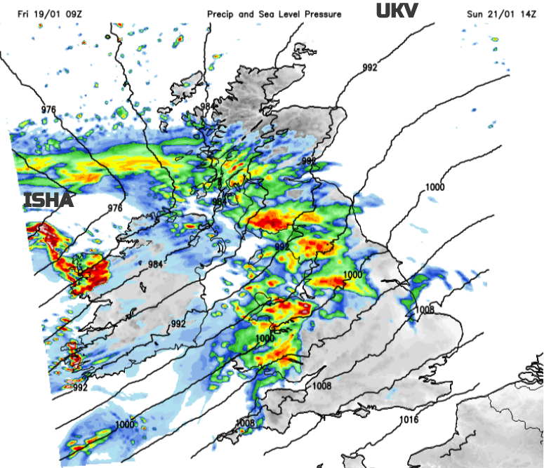
There will be a noticeable change in the weather this weekend as we lose the cold Arctic air and see this wet and windy but milder Atlantic flow. There will be bouts of windy weather with sudden gusts and downpours on Saturday and a more lively spell on Saturday night however, Isha doesn’t arrive until later on Sunday. It has been named due to the strength of the winds but there are also concerns about the amount of heavy rain for western Britain and the start of a thaw at lower levels. This will especially be an issue for northern Scotland where there has been heavy snowfall.
“Flooding from rivers and surface water is likely in central areas on Saturday afternoon and evening due to a band of heavy rain…Flooding from rivers and surface water due to further rain and snowmelt could occur on Sunday in most areas of Scotland.” SEPA
It will feel mild on Sunday with temperatures of 9 to 14C and there could be a slight lull in the morning. There are differences in the model runs with how soon frontal rain will reach Ireland on Sunday from Isha. After the meandering jetstream of last week, we are faced with a strong zonal jetstream throwing low pressures our way. ‘Isha’ to end the weekend and then another deep low on Tuesday.
Although the worst of the winds look to occur overnight Sunday into Monday, there is a significant change in our UK weather during the weekend. Disruption is likely to occur, to travel and power, on Monday morning from the strong, gusty winds and possibly the heavy rain. Coastal parts of SE England have an amber wind warning for Monday morning and travel issues are likely here too.
More discussion and chat about Isha in the Netweather community forum
Loading recent activity...