


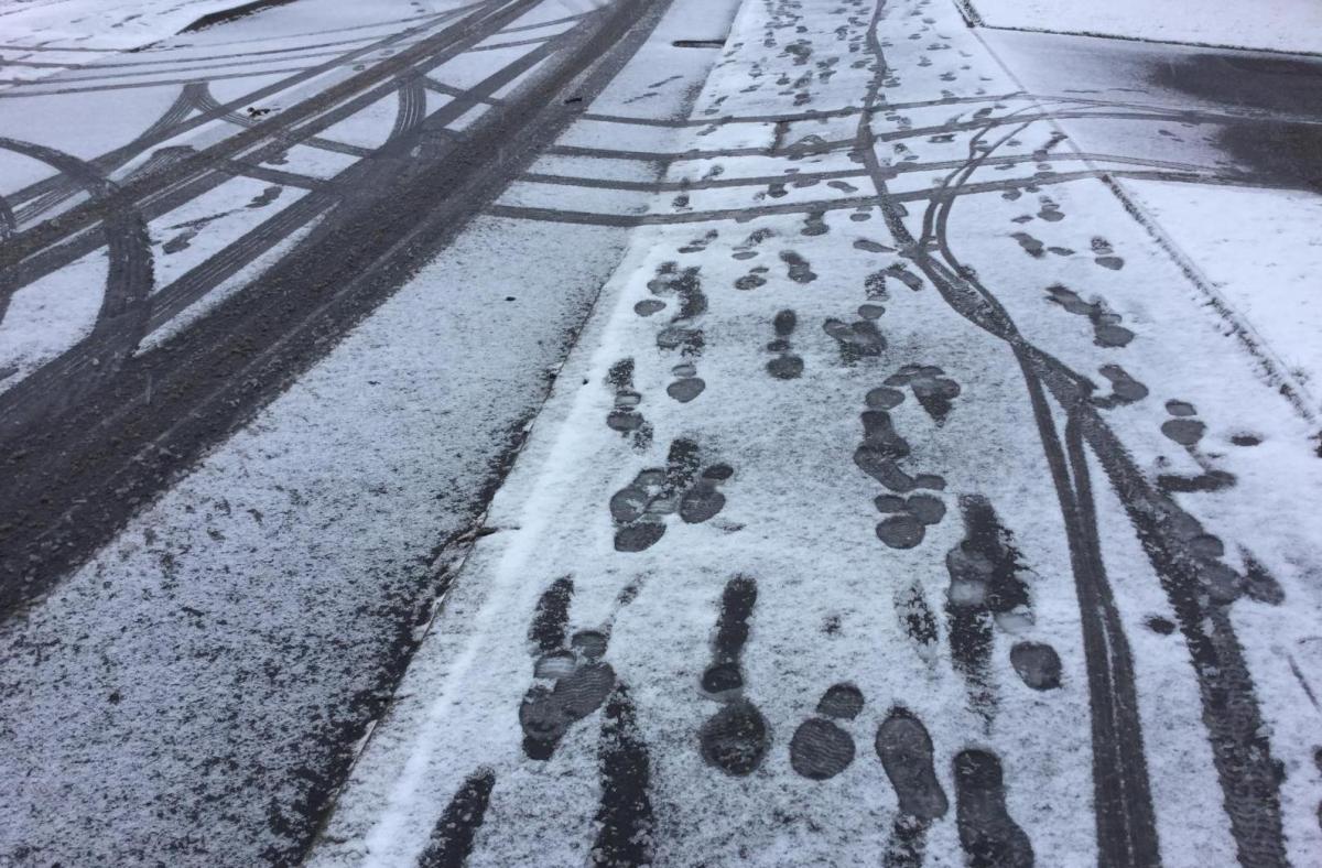
A cold start to the working week with frost, ice, fog and a few wintry flurries. There will be a scattering of sleet and snow showers heading west today and tonight. Dry and chilly for most.
For many, it is back to school today with more heading back to work after the festive break. That might be enough of a shocker but it is cold out there. Many parts of the UK have seen temperatures dipping near to freezing with the risk of ice this morning. Glasgow has been close to -5C overnight and in the Highlands, down to -7C.
High pressure is centred over the North Sea, between Scotland and southern Norway. Here the winds are very light and this week there will be frost with the risk of ice and freezing fog. Disruption to travel this week is more likely to come from the freezing fog and poor visibility than from snow. Ireland was covered with yellow Fog and Ice warnings this morning. The UK Met. Office had an ice warning for counties Armagh and Down and also inland southeast England where there has been early rain or sleet, "Icy patches and wintry showers" MO.
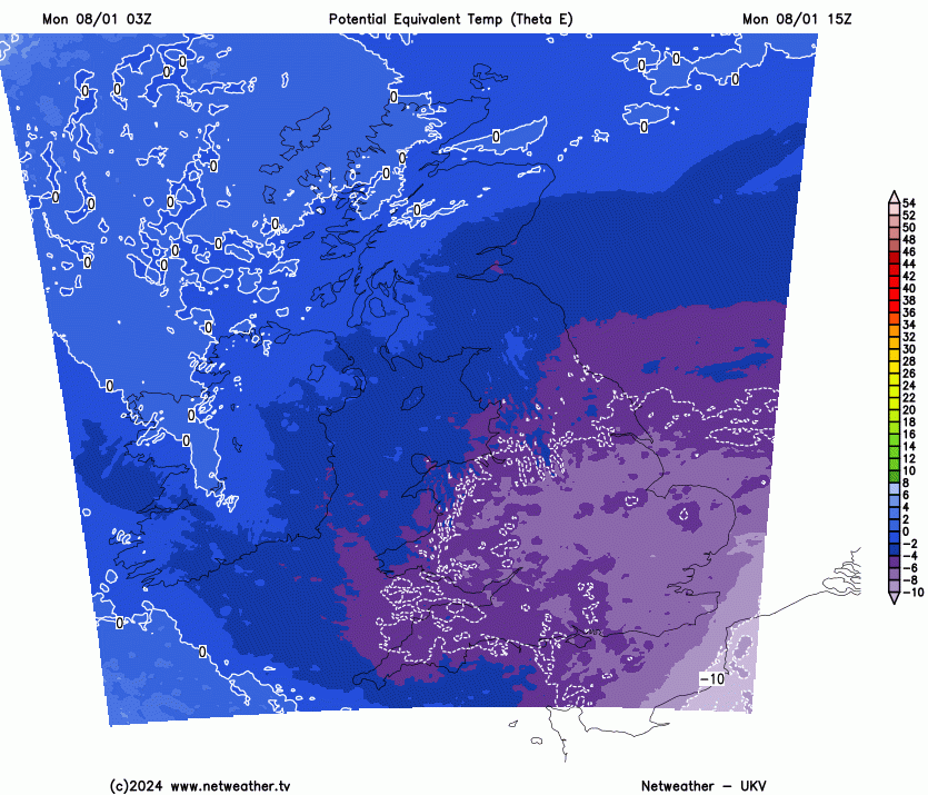
There is cold air over the UK for Monday and it will spread over England and Wales by this evening helping any precipitation stay frozen. That cold air (shown in purple) will pull away to the southwest on Tuesday and less cold air will arrive from the north during Wednesday and Thursday. The UK Met. Office does run a paid-for service called Weather-Health alerts which the Health Service in England receives. This is currently at Amber and Yellow and helps health boards plan - "The alerts are weighted on adverse affects to public health and healthcare capacity" They are not the same as the usual Met Office severe weather warnings.
With a low pressure over Italy and the central Mediterranean, more of a gradient develops for southern England today with a raw northeast then easterly wind. That will add to the cold-feeling January weather, particularly along the east coast of England. It will stir the air enough over southern Britain tomorrow morning to keep the fog at bay.
Although the outlook is reassuringly dry, after the recent flooding, there has been a bit of wintry precipitation for the Monday morning commute.
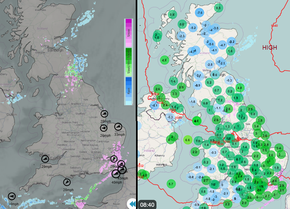
Northeast England saw rain, sleet and, well inland, hill snow. The focus through today will be over southeast England as the wind veers. In Kent, the day started with sleet, snow grains (a frozen form of drizzle) and a bit of snow over the Kent Downs. In a moderate northeast flow, this clipped coastal Suffolk, near Ipswich and Essex and it will be these lines, these streamers which will be of interest today. The wind will veer, to more of an easterly. That will push the sea effect showers inland, along the Thames and will reach more of the Home Counties, East Anglia and even along the M4 and M3 corridors. However they will remain well scattered so many will only see a wintry flurry, if anything today. Others will see a bit of snow settling as these lines develop and with the cold breeze it will look and feel much more like winter than it has done recently.

The Met. Office synoptic charts show black lines or twig-like lines which represent these streamers, troughs or convergence zones. Their locations shouldn’t be taken too literally but viewed as an aid to the kind of setup and likely region of development.
After dark more of the showers will be feeding along the English Channel and a few will have reached Wales. This evening and overnight the focus of the showers will drift towards SW Britain and to SE Ireland with accumulations over the Moors and Brecons but nothing widespread.

Tuesday looks dry with just a few wintry showers appearing for Tuesday night from the northeast with a mix of rain, sleet and hill snow off the North Sea for the start of Wednesday. The air won’t be as cold by then so rain is more likely in the north to northeasterly flow. Also with more cloud in this flow off the sea, there won’t be such a hard frost for much of northern Britain.


.jpg?w=350)


.jpg?w=175)