The weekend is looking much drier. High pressure is heading our way and will remain nearby throughout next week. This will block the onslaught of Atlantic low pressures with their heavy rain and gusty winds and hopefully give time for the flood waters to recede.
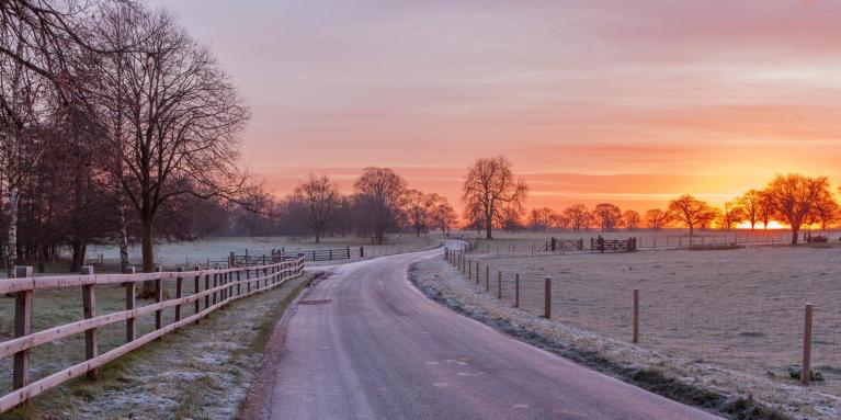
It is also turning colder so there will be the risk of frost, ice and freezing fog as different hazards for the main back-to-work and school travel next week.
Ed Hawkins referencing the floods in England “flooded again, a reminder that one key reason is that our winters are getting wetter as the world is warming. Lots of variation from year-to-year but winter rainfall has increased by ~27% overall since records began in 1837.”
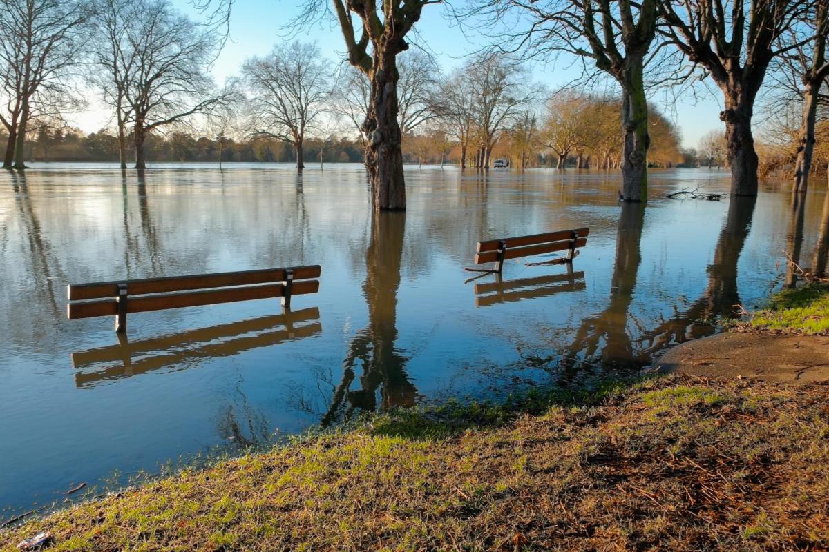
Many will remember areas that flooded in decades past. Some will live in parts of the UK, especially in England where flooding is an ever-present part of life now, thinking of York and Tewkesbury, areas along the River Trent and those devastated in storms such as Desmond and Babet. This is not going away, it will happen more often and affect even more people and land.
Even as it stops raining larger river catchments like the Severn and the Trent will keep responding as masses of water from this week continue to work their way into the main river system. Don’t become a Youtube/TikTik or Instagram numpty by trying to drive through flood waters. You may think you are going to forge your way out of the other side but we’ve seen enough clips now to know that a wrecked, stranded vehicle is not a great look for the start of 2024.
There is more information on Council websites and social media accounts. Also the local Environment Agencies in England, Natural Resources Wales and SEPA in Scotland. The forecast is improving so if journeys can be delayed it may be worth not joining the tailbacks today or the disrupted rail services due to submerged or damaged tracks. If you haven’t already, signing up for the flood warning systems is recommended, even if that is just to become familiar with the available information.
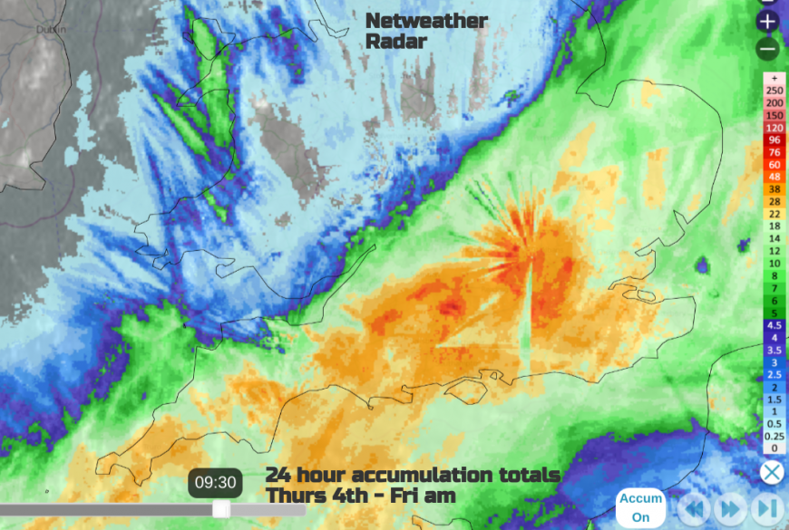
This radar image shows the 24-hour accumulation til 0930 Friday 5th Jan. All of this adding to the already saturated ground, high river levels and rainfall from Storm Henk. Radar imagery does need some interpretation. There can be obstructions in the way of the beam (even some tall trees) and it blocks the outward range and recording. You can see some of the straight lines from one site (Chenies). Shannon radar in southern Ireland is out again after an upgrade.
Jersey Met “In the first 4 days of January we've already recorded 50.2mm of rain at Maison St. Louis, which is over half the average January rainfall! “
The winds will fall light through the weekend as colder air moves in. This will allow nighttime temperatures to fall away with frost and ice forming. There is plenty of water and moisture around to freeze over.
By next week with the high centre over the North Sea and Scotland, there will be a brisk east to northeasterly flow developing over the rest of the UK. This will make it feel colder. By midweek, the high looks to be centred to the northwest of the UK and there will be a northeasterly flow bringing a good deal of low cloud off the North Sea and a damp, chilly feeling to the air.
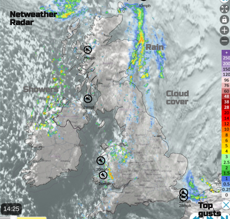
We have a blanket of cloud over the North Sea and eastern Britain with persistent rain for eastern Scotland. Aberdeen has already been very wet and the dangling weather front just keeps on bringing rain. It finally fades and drifts offshore on Saturday. Wales and Cornwall continue to see showers through the night but these also fade tomorrow. The showers coming into the north of Northern Ireland take their time to ease off. For most on Saturday, the divide continues with sunshine in the west but a blanket of cloud and a few showery outbreaks for central and eastern Britain on Saturday.
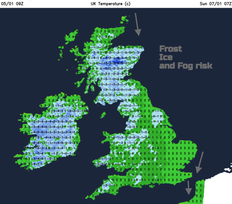
During Saturday night there will be clear spells with temperatures falling below freezing leading to frost, the risk of ice and freezing fog.
Sunday looks dry but will feel colder with temperatures around 3C to 6C and similar next week
What about snow?
Scandinavia has been very cold recently and southern Norway has seen masses of snow. Nothing like that in the UK. At most, there could be snow flurries in showers from the North Sea for Lincolnshire, maybe Kent Monday into Tuesday but don’t get excited yet.
The intense cold has, provisionally, resulted in the coldest Scandinavian temperature this century. In Lapland, those visiting Santa will often arrive at Enontekio airport in northern Finland, which fell to -44.3C this week.
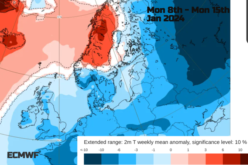
Milder conditions are on the way, with flow from the Atlantic over the top of our high pressure as the colder continental air is pulled in from the east towards the UK. It’s not a 'Beast from the East'. The key steps to reach that kind of setup have not really started, although there have been some tantalising hints and teasing with the upper air charts. We are only at the start of January, still a fair few weeks to go in this winter. More discussion and chat on that in the Netweather forum.
Loading recent activity...