There are occasionally times when the weather models at quite close range, 12 hours or even less, fail to simulate accurately areas of precipitation over the UK. This can be an issue if rainfall is heavy and persistent, thus requiring a weather warning for the hazards it may bring. But even more so if the precipitation falls as snow and causes widespread disruption which wasn’t warned with much advance notice.
Today was a good example of this. The 00z model runs this morning, run at midnight last night, generally failed to predict the extensiveness of rainfall across southern England this morning and early afternoon.
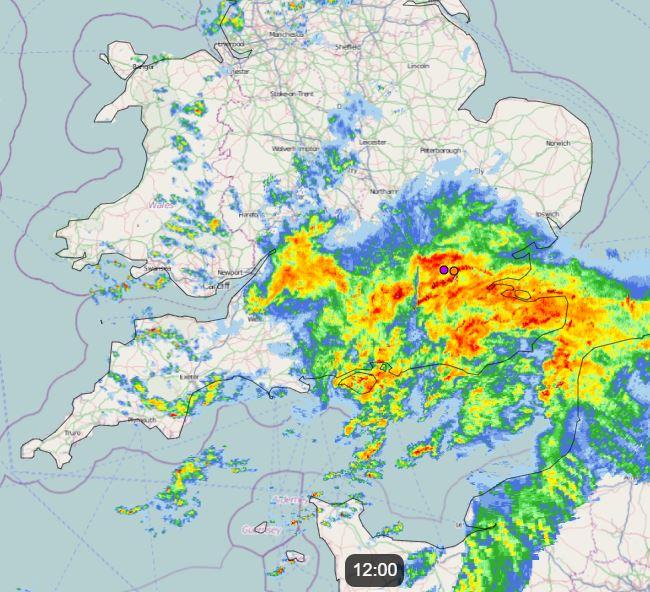
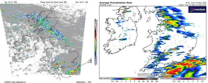
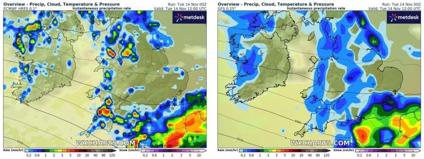
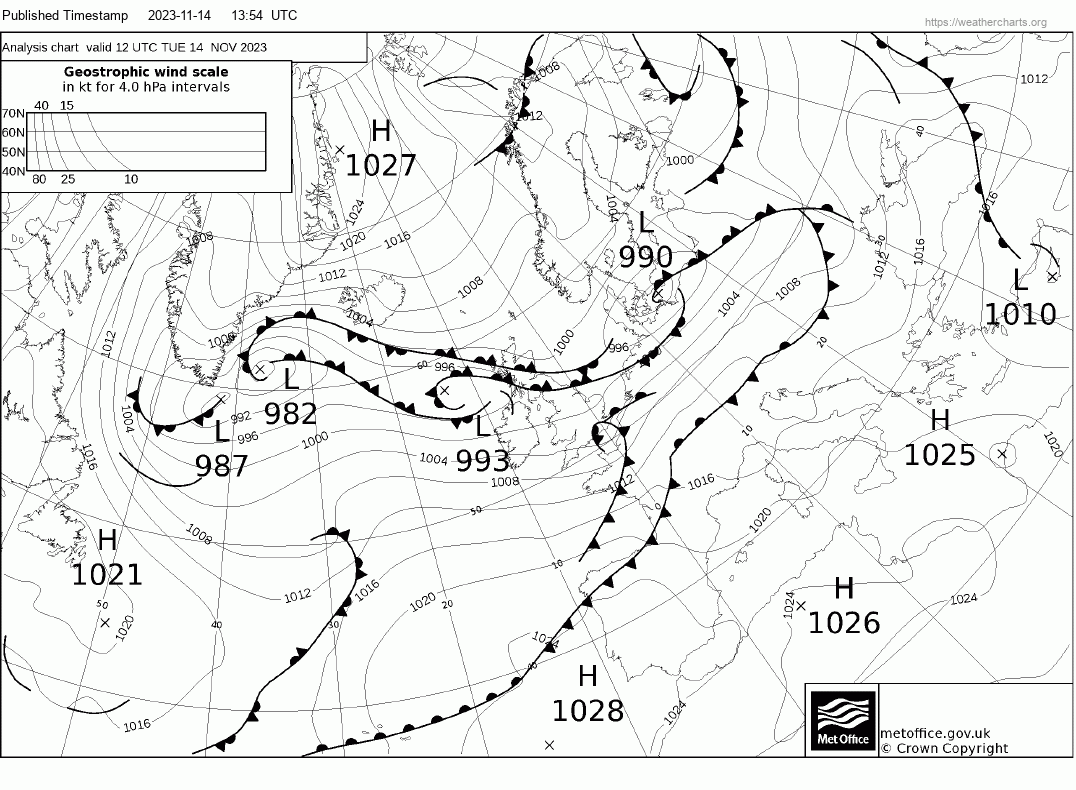
Comparing with the actual rainfall falling at 12 noon today, 03z UKV was way off with little rain across SE England, 00z ECMWF and 00z AROME only had rain across the far SE i.e. south and east of London. GFS best of a bad bunch but still not far enough north and west.
Actual rainfall at noon Tuesday 14th November 2023 from the Netweather radar
03z UKV and 00z AROME below, 00z ECMWF and GFS below that for noon today
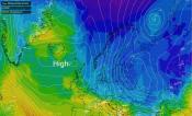
It appears there is a ‘blind spot’ in simulating rainfall on the on the northwestern side of a frontal wave that was running east through the English Channel – which was better simulated by models in terms of rainfall.
A shortwave trough was following the frontal wave from the west and it appears the models struggled with breaking out convection and eventually more extensive heavy rainfall that developed and moved east across southern England, some of it convectively-driven.
Another example was back in January 2021, when the UKV again performed badly with northward extent with an area of snowfall. It was too far south compared to the radar for the same time frame.
Weather apps would have been rather useless for southern England this morning, as they are based on weather models that were probably predicting a drier morning and early afternoon across many locations away from southern coastal areas.
There has been large advances in the reliability of weather models in predicting the weather up to 10 days at least and sometimes beyond, not thanks to increases in computing power compared to the 1980s, when the failure of the Met Office to forecast the Great Storm of October 1987 led to fundamental changes in UK weather forecasting. Following the storm, an internal Met Office enquiry was carried out, scrutinised by two independent assessors which identified changes that should be made to improve forecasts.
In the 1980s, the Met Office supercomputer was capable of 200 million calculations per second, increasing to 1 trillion per second by 1997. Today, the met Office supercomputer can do 16,000 trillion calculations per second. It has 460,000 cores (Central Processing Units, or CPUs). It weighs 110 tonnes - as much as nine double decker buses!
This increase in computing power over the years has allowed the weather models to not only become higher in resolution - but to be run more frequently.
In October 1987, the detailed forecast that focused on the UK ran just twice a day. Today it is run four times a day and at a much higher resolution, allowing more local detail to feature in forecasts.
However, today’s example and the snow event in January 2021 shows the limitations of even high-resolution models, particularly the Met Office’s UKV, in getting the position and extent of rainfall or snowfall correct and we aren’t talking 10-20 miles, we’re talking over 80 miles out. Which is not useful if warnings are to be issued in good time to allow people to change plans or make preparations.
The newest development in global weather models uses Artificial Intelligence. This newly developed global weather model bases its predictions on the past 40 years of weather data, rather than on detailed physics calculations. The simple, data-based A.I. model can simulate a year’s weather around the globe much more quickly and almost as well as traditional weather models, by taking similar repeated steps from one forecast to the next. These data-driven forecasts are produced by machine-learning-based forecasting models.
Machine learning is essentially doing a glorified version of pattern recognition. It sees a typical pattern, recognises how it usually evolves and decides what to do based on the examples it has seen in the past 40 years of data.
But, as the two examples I’ve shown show, even at short range the models can be inaccurate with rainfall extent less than 12 hours ahead. This tends to be more evident with thunderstorms in summer, as models can perform poorly with simulating convection, particularly in warm moist plumes that destabilise in the mid-levels. But it’s a good reason to nowcast using the Netweather radar for an hour or so ahead to see if rain / snow is moving your direction, rather than using relying on weather apps. There is a 'future radar' that allows you to look a few hours ahead of where rainfall may move and/or develop basedon current radar.
Loading recent activity...