The medium range weather forecast models continue to struggle with high latitude blocking (typically high pressure areas in the region between Greenland and Scandinavia).
Last weekend, there was a general consensus among the major models (e.g. GFS, ECMWF, UKMO) that the high pressure between Greenland and Scandinavia would fade, starting this weekend, with the jet stream tracking further north and resulting in a traditional northwest-southeast split across the UK, with wet weather in the north-west and frequent drier weather in the south and east of England, and mild weather with south-westerlies.
![]()
Currently, the whole pattern for next week has been shifted to the south of what was previously modelled because we are still set to have some high latitude blocking, with the jet stream running to the south. This will result in low-pressure systems tracking further south than average and bringing some wet weather to most of the UK but relatively dry weather to the north-west, especially north-west Scotland.
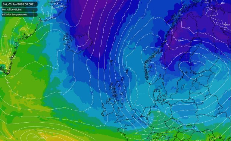
However, the blocking highs will not be strong enough to push any especially cold air to the British Isles from the north or east, with Britain mostly staying in a cyclonic pattern with low-pressure systems moving across the north of the country and mainly westerly winds in the south. There is still potential for it to turn very mild in the south of Britain towards next weekend, with south-westerly winds, but with temperatures probably staying close to the seasonal average for Scotland and Northern Ireland.
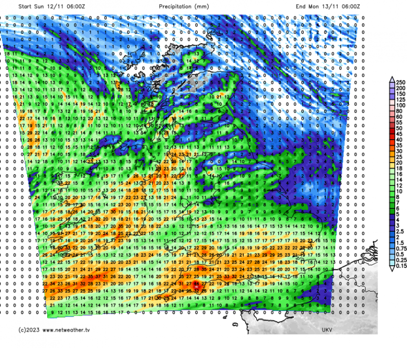
However, as with last week, the coming week won't be as persistently wet as we saw during late October. Persistent frontal rain will dominate mainly through Sunday and Monday, but from Tuesday to Friday we can expect the brighter showery weather to return, with eastern areas often staying dry.
 More bands of persistent rain may head in from the south-west into next weekend, but this is a long way off, and we could see the next batch of wet weather postponed until early the following week due to the forecast models often underestimating the strength of the blocking highs to our north.
We have a weak ridge of high pressure over the British Isles at present, which means that today will be dry, sunny and quite cold for most of the country. High cloud will increase in south-western Britain ahead of a frontal system advancing from the south-west, which will bring rain into Cornwall by the end of today, but for most of the country, it will stay dry and sunny, with scattered showers confined to coastal areas, mainly in northern Scotland and along North Sea coastal fringes.
Despite the sunshine, temperatures will be a little below the seasonal average for early to mid-November, reaching 10 or 11C in southern England and south Wales and 8 or 9C in most other parts of the country. With clear skies and light winds, frost will be widespread in Scotland and the far north of England tonight, with temperatures falling to between 0 and 2C in most places. It will be milder further south, because cloud and rain will continue to slowly spread from the south-west, with the rain reaching the southern half of Wales, the south of Northern Ireland and getting into parts of the Midlands by dawn tomorrow. However, in the Midlands and northern England there may be a slight frost this evening before temperatures rise ahead of the approaching frontal system.
Sunday will be overcast in most parts of England and Wales and Northern Ireland, with rain persisting in Northern Ireland for most of the day, and moving from south-west to north-east through England and Wales, though it will take until evening for the rain to reach northern England and East Anglia. Brighter weather will follow into Wales, Northern Ireland and south-west England during the afternoon and evening. In Scotland, it will start dry and sunny for most, though with scattered showers near north and east-facing coasts. It will stay sunny in northern Scotland, but central and southern Scotland will cloud over, with rain spreading into the south.
Milder air will spread into the south-west, with highs of 13 or 14C in south-west England, but generally, tomorrow will be another fairly cool day with highs of between 8 and 10C.
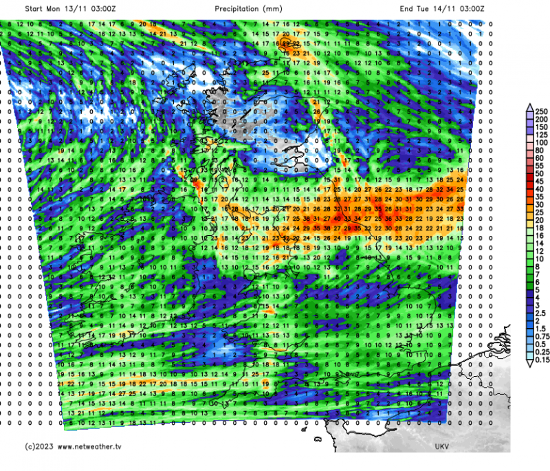
Looking further ahead, Monday will be another wet day, especially in England, with a band of persistent rain moving north-eastwards, followed by brighter showery weather. However, from Tuesday until Friday, for the most part, the weather will return to being somewhat brighter with scattered showers, with many eastern areas not seeing many showers. Temperatures will mostly be close to the seasonal normal.
Loading recent activity...