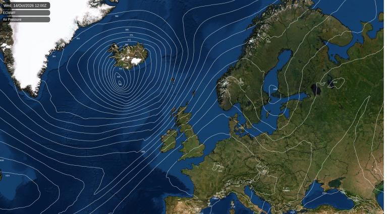
Storm Ciarán is rapidly deepening out in the Atlantic. It will reach the western end of the English Channel around midnight on Wednesday night and move across southern Britain on Thursday morning. It looks to be centred over East Anglia by lunchtime on the 2nd. As the low pressure undergoes its “Explosive cyclogenesis” (a rapid deepening of 24 millibars or more in under 24 hours) any small shift in the track would mean that different neighbourhoods could see a large change in wind speeds.
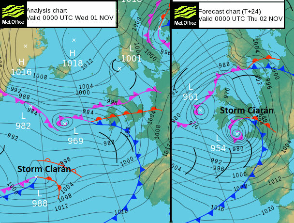
So don’t be too fixed about what kind of weather will affect your home, your commute or workplace. By Thursday morning, people in southeast England should check for the latest updates before heading out.
It is the southern side of the low pressure which will have the most intense winds. Rain will swirl around the storm and add to the saturated ground with a further risk of flooding.
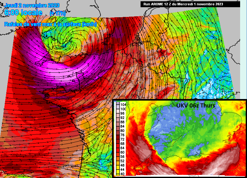
The main focus for the core of potent winds will be around the English Channel. In the Channel Islands, people have already been advised to stay indoors on Thursday. The inshore waters forecast mentions gusts of 95 knots (109mph) Also northern France there are red wind warnings, Brittany and the Cherbourg peninsula are looking particularly vulnerable. This will be in southerly gales earlier in the night and then veering to severe gale even storm-force westerly winds around 6am.
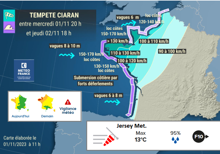
Cornwall could be hit hard by the following northwesterly flow 4am til 8am, The inshore waters forecast, for up to 12 miles offshore, mentions severe gale force 9 up to Violent storm force 11. Devon as people are starting their day. And the north coast of Somerset as the morning progresses. There are growing concerns about the eastern end of the English Channel, around Newhaven to Dover. The strong southerly winds will increase by dawn and then there is some uncertainty about how much of the southeast corner will be impacted by the gales. The winds will veer to a southwesterly and be strong to perhaps severe gale force for exposed coastal locations. There will be funnelling along the Dover Strait and the coasts of Kent and Sussex could be stormy.
All of these coastal areas could see large waves and potentially dangerous conditions. The risk of falling trees is high too as many more than usual are still in leaf and the ground is sodden.
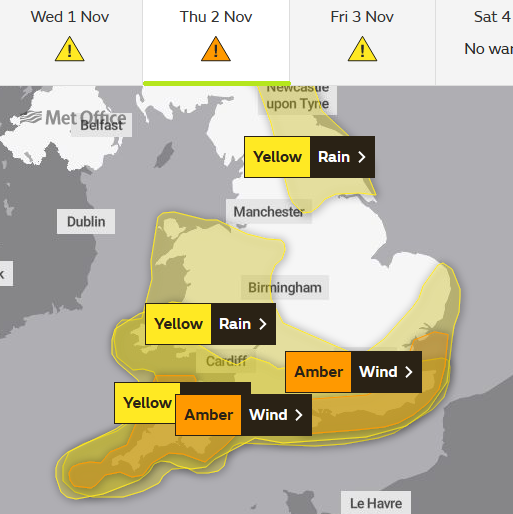
Once the westerly flow sets in for the Channel on Thursday afternoon Kent should move out of the windiest weather. However, the Bristol Channel and western Wales will see the winds pickup.
If you think of the winds circling around the low centre with a lull in the middle and the main fury at the bottom, on the south side, there will still be windy weather in other parts. A northeastly flow off the North Sea to the Pennines and down the Irish Sea to start Thursday. As the low centre reaches THe Wash, the NE winds will pickup for eastern Scotland, off the North Sea. A strong northerly for the Irish Sea and a strong NW wind for Gwynedd.
Things slowly change through the day as the cyclonic system stalls over the North Sea.
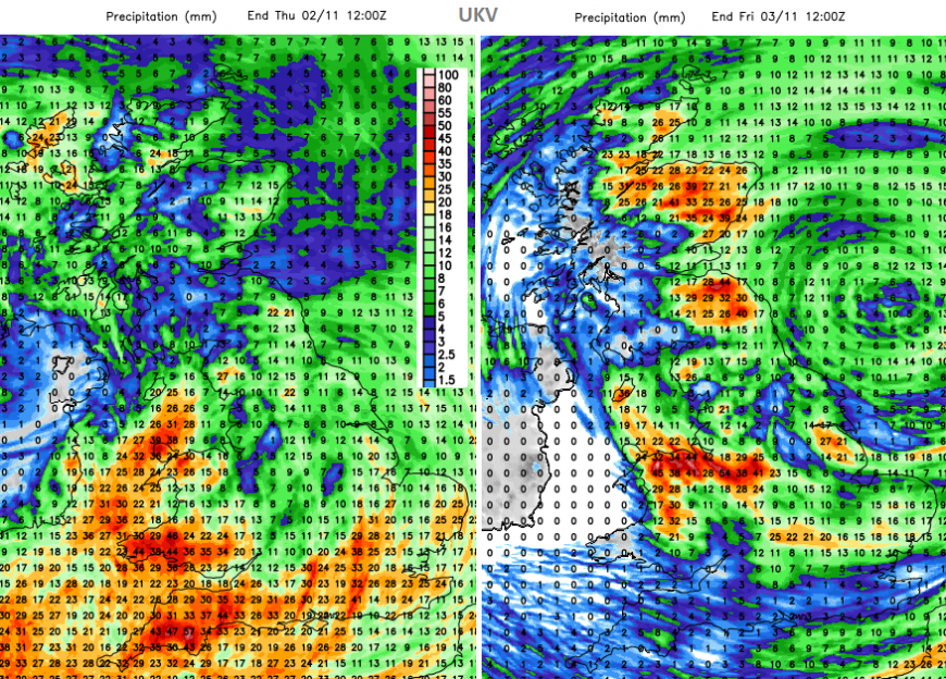
Around the low will be heavy rain, more rain, falling onto saturated ground. Ciarán’s rainbands will arrive this evening over southwest Britain and swirl over most of Wales and England during the night. A few showery outbreaks could clip Co. Down but most of the storm’s rain will miss Northern Ireland. The rain will add to the difficult conditions with poor visibility, surface water and spray and sudden gusty winds. There are already large puddles and high river levels.
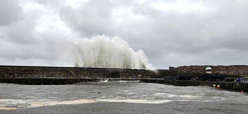
During Thursday night and Friday morning, there will be further bands of rain rotating off the North Sea over eastern and northeastern Scotland. Areas barely recovering from Storm Babet. And several coastal communities have sustained damage in last weekend's spring tides.
Channel Islands, Cornwall, southern Isle of Wight, prepare for stormy conditions overnight. Add to this list; Devon, north Somerset, West & East Sussex and Kent through Thursday morning, perhaps Pembrokeshire, the far east of Suffolk and of Norfolk by late morning. Expect gales and difficult conditions there are warnings about travel disruption and cancellations, power outages and even structural damage. Around these zones, do check the forecast in the morning.
Loading recent activity...