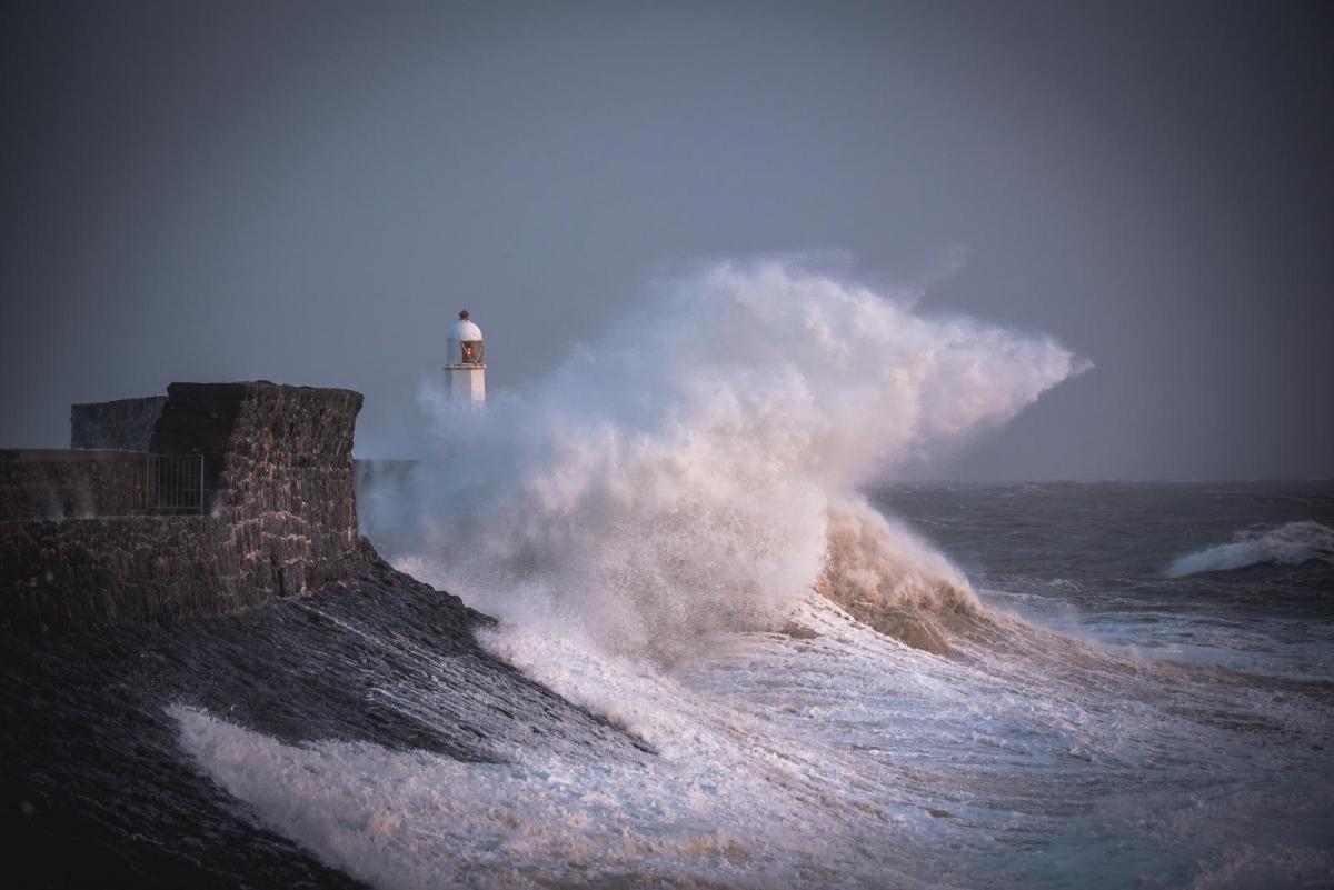
Storm Ciarán should hit southern Britain on Wednesday night and Thursday. There will be bands of rain before that, starting in the southwest on Halloween which spread northwards through the UK during Wednesday. There will also be brisk easterly winds as the main area of rain reaches Scotland and blustery showers from the southwest midweek, but none of that will be Ciarán
"Very strong and potentially damaging winds associated with Storm Ciarán are likely late Wednesday onwards into Thursday." MO
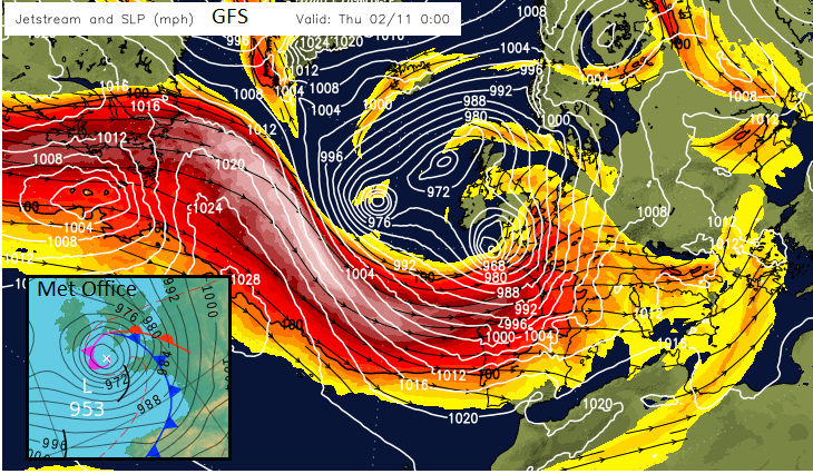
Strong jet, the low is engaged by the left exit area resulting in rapid deepening
Storm Ciarán will be a deep low pressure, perhaps down to near 950hPa. Reading and London saw 952mb back in February 1989 (Ed Hawkins) but this is a different kettle of fish, it's autumn and October has been mild and very wet. The storm starts on Wednesday evening for SW Britain with heavy frontal rain and strengthening winds. Through the night, heavy rain will spread over more of Wales and southern/central and eastern England, perhaps reaching northern England by dawn on Thursday.
The ground is saturated in many areas and there is already standing water, high river levels and the coasts were battered by the spring tides at the weekend. It has been so mild that many of the trees are still in leaf so more could fall, having a larger surface area and soggy roots.
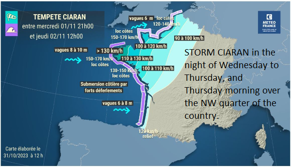
Meteo France and tempête Ciaran winds. Brittany: "Very strong autumn storm, probably of remarkable force for certain departments in the north-west of the country."
It is the wind strength that is causing concerns. Meteo France has warnings for Brittany and Normandy with mention of gusts over 100mph (170km/h). The UK Met Office now has Amber warnings for Wednesday night til Thursday lunchtime over southwest England, the Isles of Scilly, Bristol Channel coasts and Pembrokeshire. There is mention of gusts in excess of 80mph but with uncertainty around the extent of the core of high winds. Huge waves are also expected, creating dangerous conditions. Local people and visitors are warned to stay safe if looking at the waves and wild weather. Paths and promenades could crumble and everywhere is so wet.
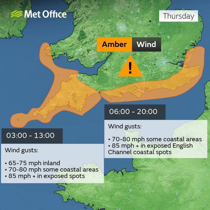
"Very strong northwesterly winds associated with Storm Ciarán could disrupt travel, and utilities and may cause some structural damage." MO
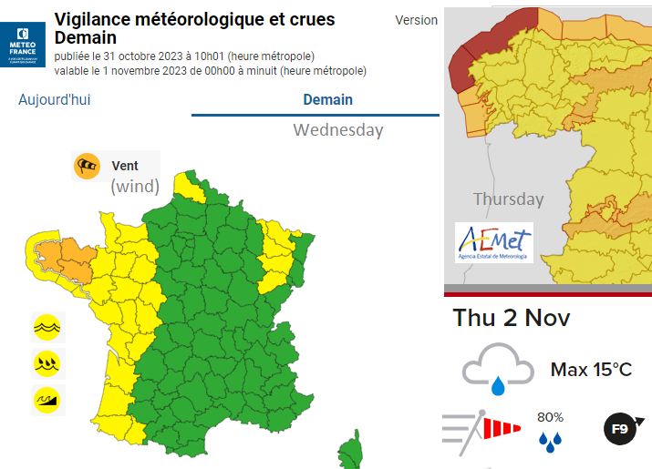
There is still some uncertainty around the exact track of this storm. This will alter where could experience the worst of the winds and high gusts. It is the southern side of the low that will see the worst of the winds with NW France looking particularly prone currently. Also, the Channel Islands, see Jersey Met. Even NW Spain has a red maritime warning for Thursday for the coast of Galicia in the NW flow.
As Storm Ciarán arrives there will be strengthening south to southeast winds for the western Channel and Cornwall/Devon on Wednesday evening. Towards midnight, for the English Channel and the Channel Islands, there could be southerly severe gales, with perhaps storm-force winds out at sea so disruption to ferry services seem likely.
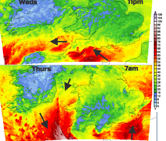
UKV Gusts for Wednesday night and early Thursday mph
As that core of southeasterly gales edges towards the Isle of Wight, the south coasts of Wales could be affected by the east/northeasterly gales around the top of the low centre.
Then around 3/5 a.m., there could be violent winds from the northwest raging over Cornwall and down to the Brest Peninsula, next creeping into Devon as people begin to wake. Around the low, there will be windy weather with a strong southerly for Sussex and Kent, a fresh southeasterly for the Humber and a fresh to strong NE to northerly over Anglesey.
It is this southern side of the low which looks the most dangerous.
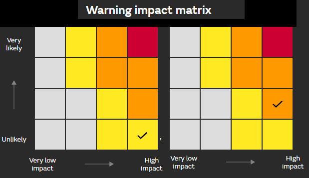
The Met Office warnings are impact-based, so they have moved from High Impacts, low likelihood (yellow) when the warning was first issued on Sunday - like an early heads up - to an increased confidence that the High impacts are likely (Amber), up a step on the Matrix
The latest UKV wind fields are stunning. A raging severe gale from the west through the English Channel on Thursday. A following gale across SW Wales, the Bristol Channel into north coast Somerset.
If the low centre is over East Anglia by lunchtime on Thursday, there will be a push of water towards the eastern End of the English Channel, funnelling effects, a big high tide around 1/2pm and a lot of water on land anyway.
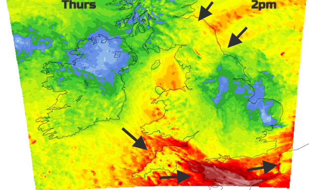
The Amber warning is split into two parts with the area over central southern and southeastern England active during Thursday in the hours when most people will be on the move. So not everyone, but the worst of the weather combined with the possible impacts of people who would usually want to travel to work or school.
Further north there will be a driving northeast wind, again pushing rain off the North Sea to northeast England and eastern Scotland into Thursday night although Northern Ireland looks to miss the worst of the rain on Thursday. This is good news after such a wet start to the week.
"Heavy rain associated with Storm Ciarán could bring some disruption to northeast England and southeast Scotland" (Thursday into early Friday) MO
There still could be a slight shift further south, which would mean that northern France would see the worst of Storm Ciarán and then Britain would have a wet and windy day but not a storm hit. Today is the time to be securing homes, businesses and outdoor spaces. Maybe adapting plans? It’s definitely the time to be keeping up to date with the forecast and signing up for the Environment Agency flood alerts. On Thursday morning, check the local news, it will be better to have a few options, rather than carrying on regardless. Falling trees in the daytime would be a worrying concern and any other flying debris. Never mind the rail, ferry, and road disruption.
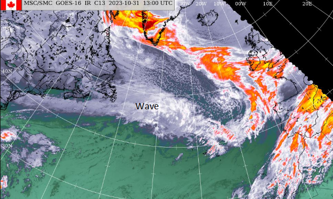
The start of Storm Ciaran, moving east across the Atlantic
We will see how the low develops as it undergoes explosive cyclogenesis on Wednesday and how the forecast models behave. The main areas of concern currently are Cornwall and Devon, also Somerset, south & southwest Wales, southern England into East Anglia but particularly the coastal counties.
More #StormCiaran discussion in the Netweather community forum
Loading recent activity...