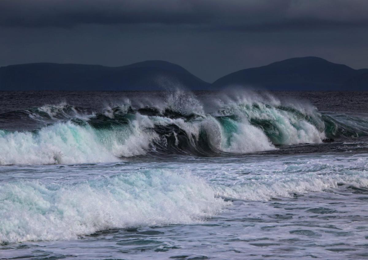
Storm Babet is on the way with the current settled weather soon to be replaced by heavy rain and high winds. Flooding is possible - especially in eastern Scotland.
While all but the far South West are still largely fine and dry, though a little chilly, things are about to change. This is because a vigorous Atlantic depression off Iberia was upgraded to Storm Babet yesterday. By Wednesday, it'll be close to the South West, with its associated frontal systems moving up from the South in the next few days. But today, much of Britain remains under the influence of a ridge that's unfortunately moving away to the East.
There are already first signs of the change, with bursts of locally heavy rain across the Channel Islands and Isles of Scilly moving into the South West, South Wales and parts of Northern Ireland through the day. A freshening East wind will also bring increasing cloud to parts of southern England, but otherwise, it'll be mainly dry.
There'll often be somewhat hazy sunny spells after another frost first thing across the country's northern half, -4C at Tulloch Bridge. Here, where winds will be lighter, we also have mist and fog patches to clear and a few light showers around Humberside, but these should fade. Temperatures for most will end up slightly higher than yesterday, reaching 9 to 12C in the North and 13 to 15C further South.
After dark, mostly Northern Ireland and more western areas see showers, but with bursts of rain, some heavy moving into the South through the night. It should stay dry elsewhere, apart from the odd shower towards the East coast. But a freshening East or South East wind will feel chilly in the North. Another frost is unlikely, though, as milder air begins to move into the South. Lowest temperatures 3 to 5C towards Grampian, 8 to 11C across most other parts, with the thermometer probably not falling below 12 or 13C in the South as the milder air begins to move in.
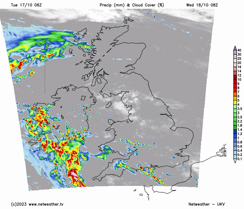
As a series of fronts from storm Babet move slowly North on Wednesday, there'll be some rain or showers heaviest in the West. The South turns wet and windy with heavy rain that a few rumbles of thunder could accompany. Elsewhere, there'll be a lot of cloud and showers, but with drier intervals as well. An East or South Easterly wind will become fresh or strong, with gale-force gusts of wind to 40 or 50mph likely along the South coast for a while. But it'll be milder in most parts, with temperatures reaching 10 to 12C in the North and 15 to 17C in the South.
Storm Babet keeps it very blustery after dark, especially in the North, where an East wind will give gales, perhaps severe along North Sea coasts. Outbreaks of rain moving North will be heavy at times, prompting a yellow Met Office to this effect. But from the Midlands southward, winds should decrease, although it'll remain unsettled with further showers, some heavy and perhaps thundery. On a mild night, temperatures shouldn't fall below 10 to 15C.
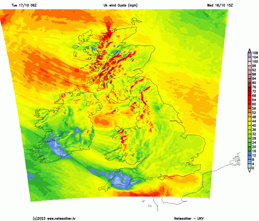
Thursday and Friday will continue to be unsettled, with more rain expected, and some of it may be heavy. There is a risk of flooding in East Scotland since copious amounts of rain are expected to fall. The North will experience further severe gales, especially at first.