
Southern Britain will see rain in the next few days but it will clear for the weekend as colder air from the northwest takes hold throughout the UK. There will be a frost and even snow on the Scottish mountains.
The mid-October weekend will not be like last weekend. For those in Scotland, that will be a relief. Especially for those still battling floodwater or landslide mess. Everywhere will be feeling cooler or even, colder. And if rain has set in midweek, that will clear England and Wales.
Those parts of the UK that have felt almost like summer at 20 to 26C, will be back down into the low to mid-teens. London around 12C by day and only 9C by night for those leaving Madonna at the O2 late at night. Temperatures in Newcastle will be down to 5C at the end of the Octoberfest. There will be a northwest to northerly air flow bringing showers in on the wind. It will be bright or sunny for many parts but the air will feel different, with an autumnal nip in the air first thing. There is talk of frost for inland parts of the UK as the winds fall light, early Sunday and even snow showers over the Scottish mountains, with sleet or hail to lower levels for exposed northern parts of Scotland through the weekend.

The warm air will have retreated to just the southern counties of England by Thursday morning but there are signs of a pulse of warm air reaching up into East Anglia and the Home Counties by Friday lunchtime. Although not to the heights of 25C which were seen earlier this week. The last of any warm air is truly shoved out of the way during Friday night as the colder northwesterly flow reaches right down to Kent.
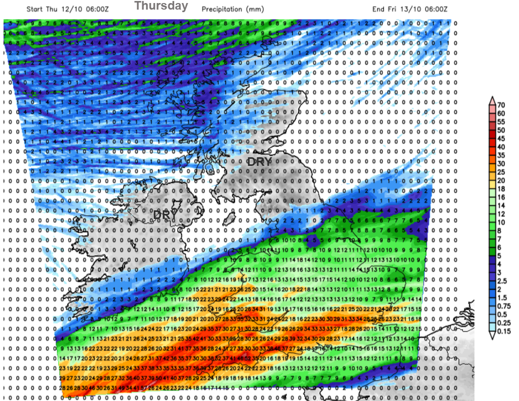
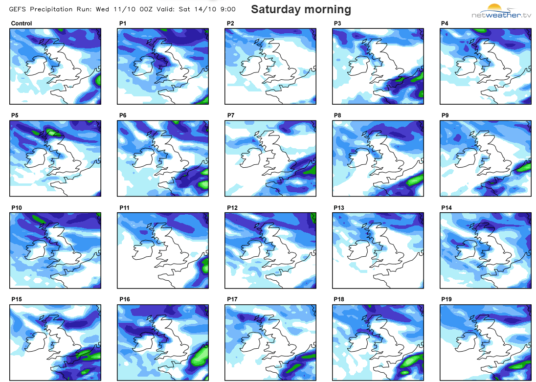
The change in airmass will be accompanied by heavy frontal rain and there are warnings from the UK Met Office. Midweek the rain will hit Wales but by Wednesday evening be in a line from Cornwall across to East Anglia, before waving about over southern Britain tonight. A heavier pulse looks to clear eastwards over London on Thursday morning with a lull through the day. By Thursday evening heavy rain will move up over southwestern England, extending along the M4 to London during the night with areas of intense rainfall moving their way eastwards on Friday with a wet day over the southern half of Britain. The important thing for the weekend forecast is that this frontal rain should be pushed away to the southeast by Saturday. So Friday evening still looks wet for Southeast England and East Anglia but by Saturday morning it should be sunny. The southern rain links to a mid-Atlantic low pressure which will edge along the English Channel during Friday night, so there is a possibility of cloud and rain hanging back over Kent and Sussex early on Saturday.
A more northern low centre will be moving from Shetland towards Norway early on Saturday with gales and 60mph gusts for Orkney and fresh northwesterly winds for northern Britain which will make it feel chilly. Saturday looks windy for Scotland, northern and eastern England and around the Irish Sea.
Through Saturday most places will be fine and bright, even sunny but colder. Areas exposed to the northwesterly wind will see showers.
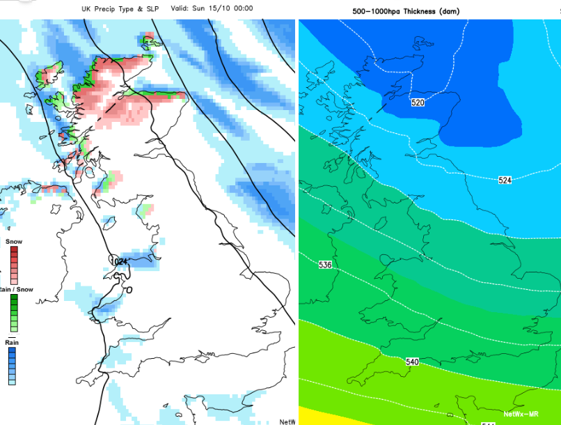
By Saturday afternoon, there will be even colder air over the western Isles and NW Highlands. By Saturday night the 500-1000hPa Thickness chart is showing the 528 thickness line down into northern England (a sign of air which could produce wintry bits) and the 520 line reaching the Moray Firth, even colder air.
High pressure is building in from the west and so there will be light winds overnight and temperatures falling away, down to zero inland for Sunday morning. Many places will have a dry sunny but cold day although there will still be cloud, blustery winds and a showery mix over northern Scotland,. This will again include sleet and hail, mountain snow and a chilly breeze.
It will be a change of wardrobe time. Putting away the summer clothes that saw a late outing last weekend and finding the thicker sweater, maybe a hat and scarf if you are outside for a while. The air is changing, it will feel like autumn.


.jpg?w=350)

