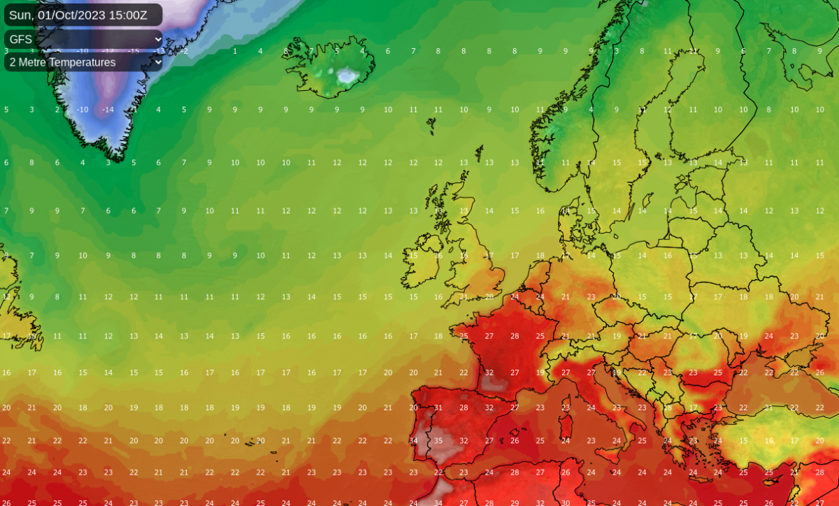
October is set to get underway with some exceptional warmth for the time of year over much of western Europe. Temperatures of up to 35C are forecast in south-western France through Sunday and Monday, with around 32C in many other parts of France. In both Spain and Portugal, temperatures of around 37C are expected in the south. Temperatures will tend to fall closer to normal around midweek before returning to exceptionally high values towards next weekend as another blocking high develops over central Europe.
As well as elevated global temperatures, which have been running at record highs since June, and by a fair distance, this unusual heat for the time of year is linked with high pressure over central Europe, which is producing warm southerlies on its western flank, which are set to especially affect France and Spain. The UK will not get a direct hit from this, although some of that warm air will get into the south-east of Britain, bringing temperatures into the low 20s Celsius - somewhat warmer than average for early October, but not warm enough to threaten any temperature records.
However, there is some potential for more of that unusually warm air to reach the British Isles next weekend (7/8 October). The forecast models are currently divided on this - the GFS model is forecasting lows to come in from the Atlantic next weekend, which will shift the warmest air away to the east, but the ECMWF model is forecasting a direct hit for the British Isles, with southerlies drawing heat all of the way up from Spain.
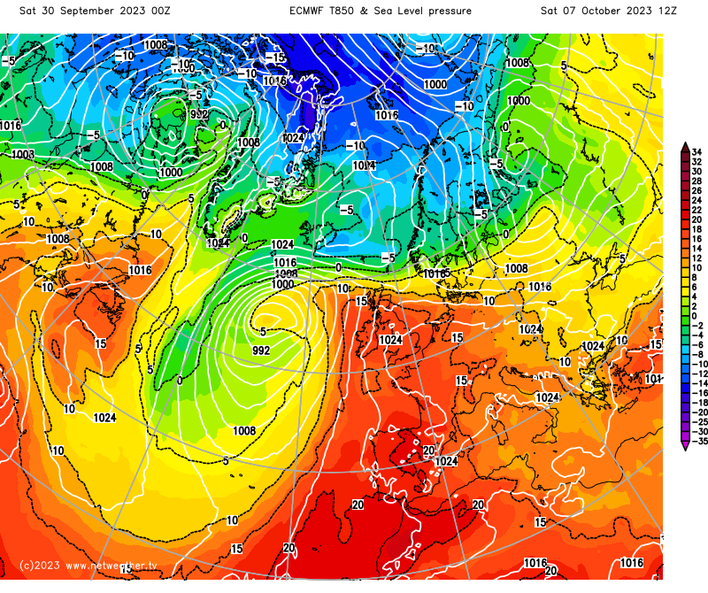
If the ECMWF model is right, we may end up with temperatures in the mid to high 20s Celsius quite widely. The UKMO model also has some unusually warm air heading in from the south into next weekend. It is a long way off and not guaranteed to happen, but it is worth watching.
Today, sunshine in eastern England is unlikely to last for most. Already, most other parts of the country are being affected by a veil of high cloud, and rain over Wales will spread through northern England, parts of the Midlands, and Northern Ireland during the day. The rain will also push into most of Scotland during the evening, but the north of Scotland should stay dry during daylight hours, with plenty of cloud but some weak sunshine coming through at times. East Anglia and southern England will stay dry, apart from some light rain and drizzle over the higher ground of south-west England, and it will stay generally sunny in south-east England.
For most of the country, temperatures will be near average to fairly cool for the time of year, reaching between 14 and 16C, but it will be warm in East Anglia and the south-east, with temperatures in inland parts of south-east England reaching around 20C.
On Sunday, a band of rain will affect much of Wales, northern England and the north and west Midlands but will tend to fizzle out during the afternoon. To the south and east of this, there will be plenty of high cloud but some sunshine, again especially for south-east England, and it will become somewhat warmer than average for the time of year with highs of around 21 to 23C. Dry, sunny weather will establish in Scotland, Northern Ireland and Cumbria, where it will be rather cooler with highs of around 17C for most places.
On Monday, the rain will pep back up again in Wales, northern England and the Midlands, while it will remain warm to the south of this, with temperatures again peaking at around 23C in the far south-east, with some sunshine chiefly for the south-east. Most of Scotland and Northern Ireland will remain sunny and dry but there will be a scattering of showers for western Scotland, particularly to the north of the Lowlands and for the west of Northern Ireland.
Tuesday will be cooler with a mix of sunshine and scattered showers, though as high pressure builds from the south, the showers will become increasingly confined to western Scotland. During Wednesday and Thursday, we will see warmer south-westerlies come in, with high pressure ridging into the south-east, which means that it will generally be warm and sunny for sheltered eastern parts of England, but western areas will often see more cloud, and there will be some light rain in north-west Scotland.
It is from Friday onwards that we see more uncertainty, with the GFS model going for increasingly wet and windy weather as we head into next weekend, while the ECMWF model is suggesting dry and unseasonably warm weather with the potential for many areas to have a fair amount of sunshine and temperatures into the mid to high 20s Celsius.
Loading recent activity...