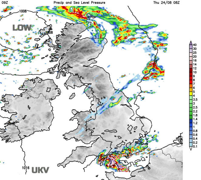
A battle ground between cooler, fresher air from the northwest and French heat reaching across the Channel. There will be showers, maybe even thunderstorms in between.
We've mostly seen the best of the weather in the East and South over the past few days, while the North and West have been cooler and showery. But things are on the change now as cooler weather works its way slowly from the North West reaching all parts by Friday.
In the meantime, higher pressure in the South holds on, although embedded troughs will bring some cloud and patchy rain mainly to central parts. Today brings scattered showers again to Scotland heaviest and most frequent in the North and West, while the East and South see fewer showers with the best of the sunshine towards Fife and Lothian. Northern Ireland also sees a scattering of showers, with parts of Down and Armagh perhaps missing them altogether.
Top temperatures here 14 to 18 or 19C where you see the best of the sunshine in a mostly moderate perhaps fresh in the North, South Westerly breeze.
After a fine start in places towards the East coast much of northern England, Wales mainly the North and the North Midlands see a lot of cloud. There'll also be some rain or drizzle and while a few heavier bursts are likely mainly in the West, much of it will be light and patchy and tend to 'fizzle-out' through the day.
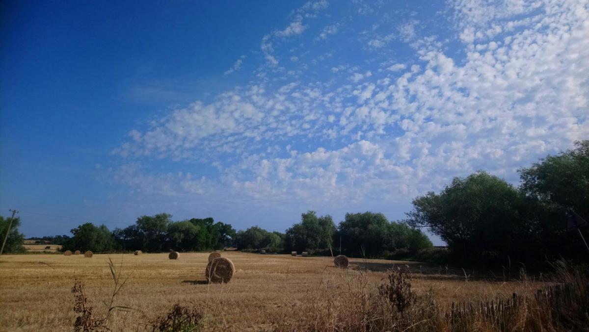
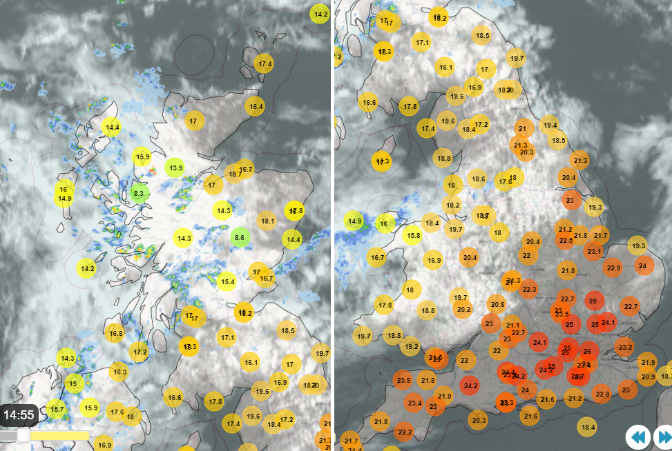
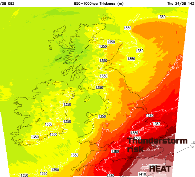
Top temperatures here 18 to 22C in a mostly light South West wind. In the sunny spots, you'll then tap into some of that hot air from Europe and while 25 to 27C will feel humid in mostly light winds, this'll be well down on the stifling 40C plus currently being experienced over parts of southern France and Spain.
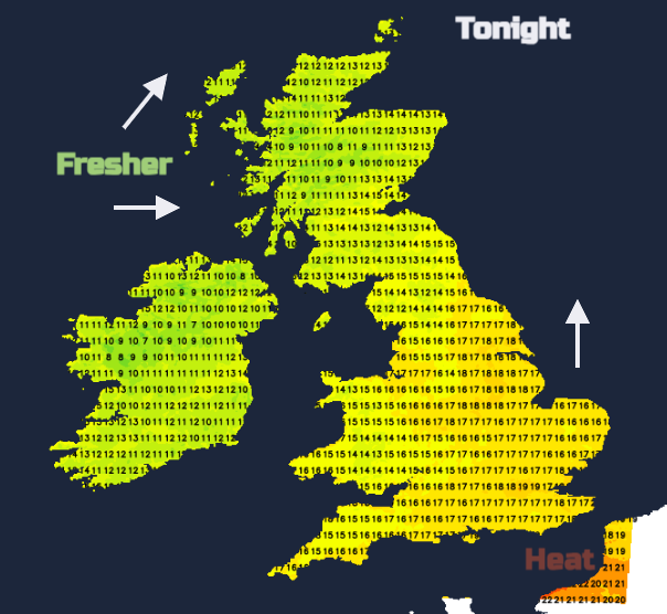
After dark the humid conditions could bring the odd sharp shower to the Channel Islands and later the far South East, while much of the South, East Anglia and most of the Midlands are dry with variable amounts of cloud. It turns misty in light winds with mist and patchy fog forming again in the South later. But temperatures here fall no lower than 14 to 17C in a humid night.
Across northern England and Wales skies will tend to break from the North West. There'll be a few mainly light showers, but the emphasis should be on mostly dry conditions. Northern Ireland continues to see scattered showers, while Scotland sees the showers 'pepping-up', especially in the West where some will be heavy. It'll be cooler here though in a South or South Westerly breeze, with lowest temperatures mostly in the range 8 to 12C.
Somewhat cooler, fresher weather with scattered showers works its way further East and South on Thursday, but across much of the South and East Anglia it may remain bright and warm for a while. Sussex, Kent and Essex could catch a sharp shower, mainly at first. Winds tomorrow remain light in the South, with a mostly light breeze from the West or South West elsewhere. Top temperatures a fresher 15 to 21C, but perhaps as high as 24C in the South East for a while.
After dark the cooler, fresher weather finally reaches all parts, as a mainly light breeze turns into the North West or North. This'll bring a notably chillier night to the South and South East, with minimum temperatures across the country mostly between about 7 and 12C.