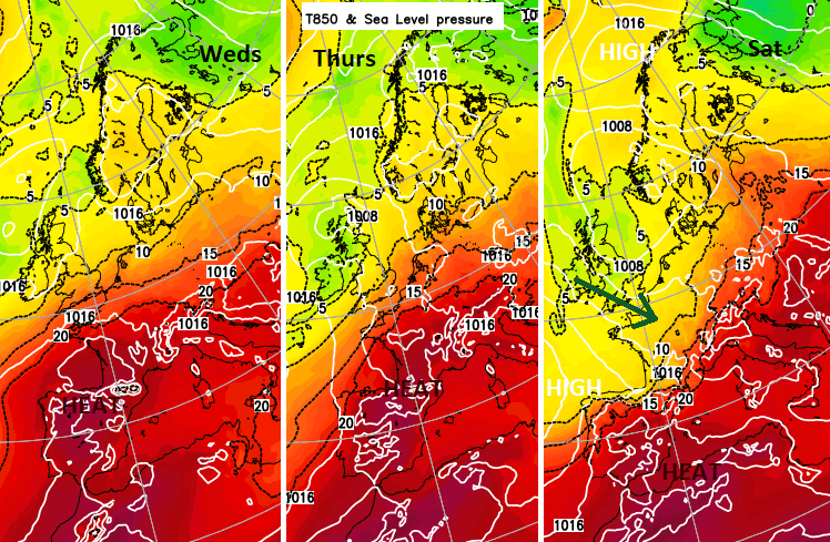
Fresher Atlantic air is edging in, over all of the UK by the weekend. Before that, there is warmth from northern France and the risk of thunderstorms as France and Spain swelter in heatwave conditions
There was a cooler, fresher feel in the air over northern parts of the UK this morning, a nod towards September not being too far away. And yet a different story further south where there will be late August warmth as temperatures rise into the mid to high 20sC. It's not high summer heat and certainly nothing like last year but just a brief midweek taster of the air over France and Spain. London could reach 28C but be back to 20C by Sunday. For Edinburgh in the last days of the Festival, temperatures remain around 16 to 18C.
The very warm air from France will be away by the weekend when temperatures look to be widely in the mid to high teens or low 20sC here in the UK. The weekend looks unsettled with showery outbreaks of rain, mostly from the north and then the west. There will be sunny spells in-between.

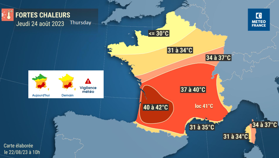
France has seen record-breaking heat and heatwave conditions that are continuing by day and night. It is unusual as it is now late in August. Wednesday and Thursday see more Red and Amber warnings from Meteo France as the risk of thunderstorms appears. Temperatures have passed the 40C mark with many local monthly, even all-time, records being broken.
A lasting and intense heat wave has settled over the southern two-thirds of the country. It is remarkable, even exceptional. Meteo France
This ‘Canicule’ persists through midweek until a frontal band from the UK begins to work its way southwards through France. It will take its time, only reaching southern France on Sunday and there will be severe thunderstorms along the way. Paris will be in the low 30sC midweek but drop to 23C at the weekend.
For Spain with hot air and plenty of sunshine the ‘Ola de Calor’ the heatwave, conditions continue. AEMET has high-temperature warnings over much of the peninsula. There are red warnings in the north, closer to the Basque Country region, inland. Fresher Atlantic air will reach in from the north in the second half of the week, eroding the extreme heat slowly. Barcelona is up in the mid 30sC but will be closer to 26C by the end of the weekend with rain from the cold front.

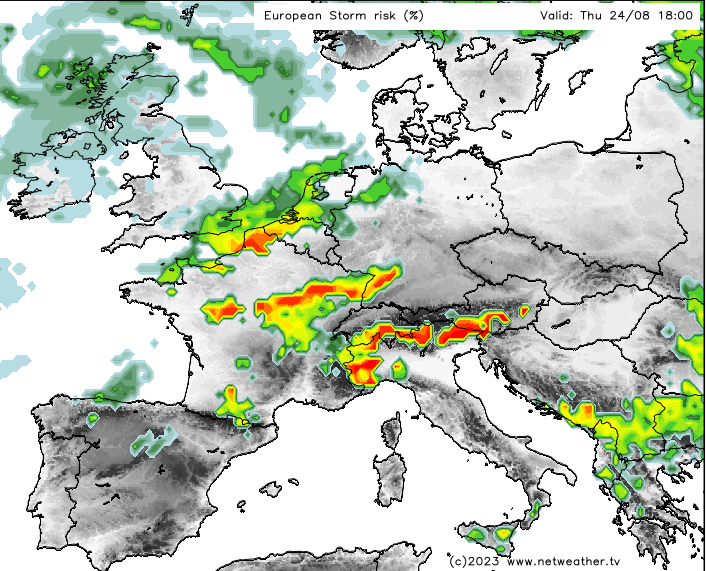
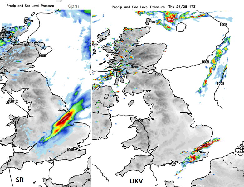
Once more we have this intense heat over western mainland Europe, fresher Atlantic air pushing over the UK and a frontal boundary. The low centre north of Ireland will continue to throw showers over Scotland later today with a heavier band of rain developing for Thursday morning for northern Scotland and Grampian. Further south, the models have been changing around the threat of heavy, thundery showers developing. The UKV shows a push of heavy showers and potentially thunderstorms crossing from France outwards southern and southeastern England on Thursday morning. The very warm air will have been noticeable for the far southeast during the night. The NEtwx SR model shows a different path with heavy showers over SW England and making progress a bit further north into southern Britain on Thursday morning, reaching up into East Anglia.
There are also model differences showing later in the day. Where the threat of heavy, thundery downpours could impact as the atmosphere destabilises around the frontal zone? Any storms being further south and east looks more likely, even staying offshore in the English Channel/southern North Sea. Northern France, Belgium and the Netherlands could see terrific thunderstorms during Thursday night with the action moving into Germany and again for eastern France and the Alps on Friday.