
Storm Betty - lively weather to end the week with a deepening low pressure heading to Ireland later on Friday, gales and high gusts, heavy rain on the cold front and the risk of thunderstorms tonight.
A new low pressure will deepen today and move up through Ireland overnight. Its cold front will come up against warm and humid air, bringing heavy frontal rain but also the risk of thunderstorms. This low pressure has now been named Storm Betty.
There could be impacts from the strong winds and coastal gales around the little low centre with strong gusts developing for western Britain and Northern Ireland later today. The core of strongest winds looks to move into the Western Channel and then up the Irish Sea tonight. Cornwall, Pembrokeshire, southwestern coasts of Ireland and then more of west coast Wales, Anglesey and County Down will become very windy. Then windy through the North Channel, for County Antrim and the Isle of Man early on Saturday.
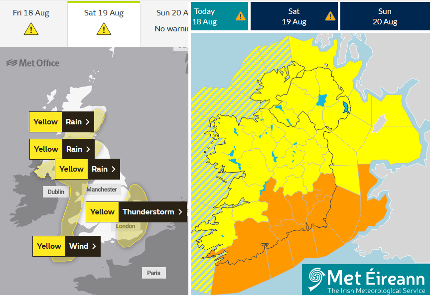
Met Eireann "During this afternoon, heavy and persistent rain will move in across the south and southwest of the country with some flooding. It will extend nationwide during the evening with localised flooding. During the evening, south to SE winds will increase to gale force in the south as Storm Betty approaches from the south. Tonight, Storm Betty will bring very strong south to SW winds up over Ireland. They'll be strongest in Munster and Leinster with severe gusts in places especially in coastal and mountainous areas."
The UK Met Ofice also has yellow warnings for Wind and Rain and Thunderstorms. , and some heavy and thundery downpours to parts of the UK
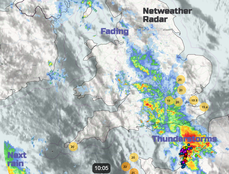
The convective forecast covers the developments along the cold front, after an earlier band of rain linked to thunderstorms over northern France. As is so often the case, the drift of storms across the English Channel heads eastwards.
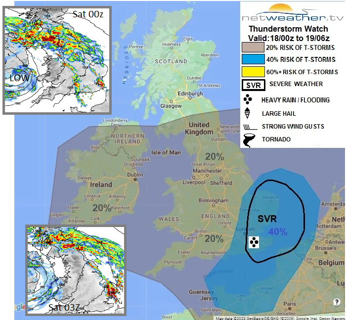
"heavy showers and thunderstorms look to develop and push NE across CS/SE England and E Anglia during late evening and overnight into Saturday – as strongly unstable warm and humid air with steep lapse rates advects NW from France and is forced to ascend by rapidly falling heights ahead of approaching cold front. There is potential for thunderstorms here to perhaps bring isolated severe weather." Convective forecast
The low, its rain bands, downpours and strong winds, will be clearing northwards on Saturday away from Northern Ireland and Scotland to leave a fine weekend.


