The weekend certainly brought a chilly turn. There was a lot of glorious autumn sunshine around, but with cold nights. Braemar saw temperatures down to -4.4C early on Sunday morning at one end of Britain. At the other end, the Isle of Wight saw the top UK temperature of 16C on Sunday after Langdon Bay in Kent reached 16.2C on Saturday. Without the sunshine, the air felt cold, especially for those with a northeasterly flow off the North Sea.
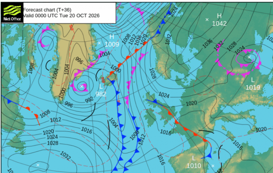
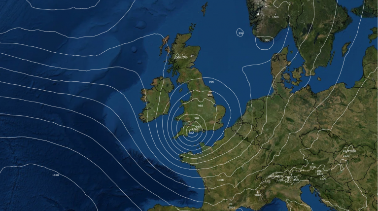
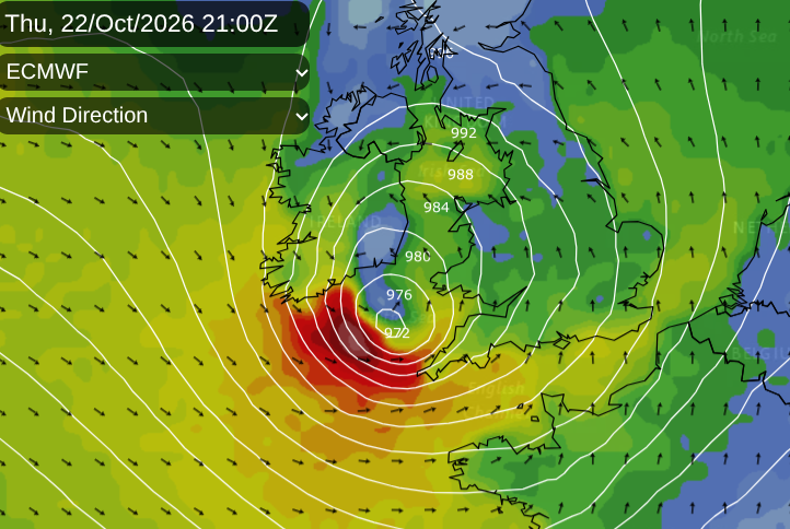
This week will see changes as the weekend high pressure drifts away over the Baltic States and Russia. For England and Wales, frontal bands will move east to west at the start of the week, which is unusual. Soon enough we will return to the prevailing southwesterlies and Atlantic influence. There is also a deepening area of low pressure for Thursday night, which could cause a spell of wet and windy weather with disruption for Friday morning. Something to watch this week.
The frontal boundary shown on the top pressure chart above runs from England down through France to the western end of the Mediterranean.
Storm Names and DANAs
There has been torrential rain for eastern Spain and the Balearic Islands with Ibiza airport having to close twice due to flooding. Here in the UK, our first named storm would be ‘Austen’ as we are in a naming group with Ireland and the Netherlands. Spain is in the southwestern naming group with Portugal, France and others. AEMET, the Spanish meteorological service, has named Adam, but this is a DANA rather than a windstorm.
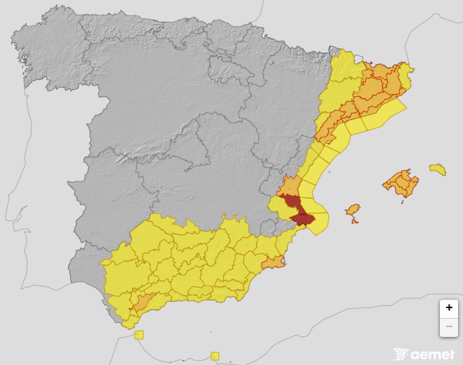
AEMET warnings for Monday 19th October showing heavy rain and thunderstorm risk
DANA is a high-altitude, low-pressure weather system isolated from the jet stream. DANA is Depresión Aislada en Niveles Altos, which translates as an 'Isolated Depression at High Levels'. This cut-off upper low is combined with a very moist flow from the E/NE and has triggered 'an episode of intense and persistent rainfall'.
DANAs can bring huge amounts of rain, often to eastern or southern Spain and can stick around for days adding to flooding events. For the start of this week there will be more wet weather for southern Spain, Sardinia, northern Italy and then the Adriatic, including Croatia for the first part of this week, thinking of holidaymakers on Half-Term holidays from some British schools.
Tuesday
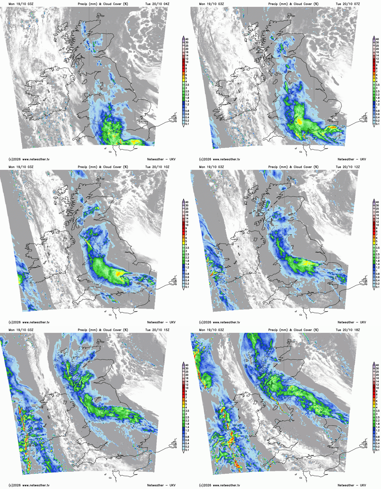
Back at home, England and Wales really need the rain, although timing may not be ideal for those with children off school. A pulse of rain will surge across the English Channel on Tuesday and then heads north. The high pressure away to the east is still exerting enough influence to not let the Atlantic flow in just yet. The UKV model has the frontal rain reaching NE England and southern and western Scotland by Tuesday evening.
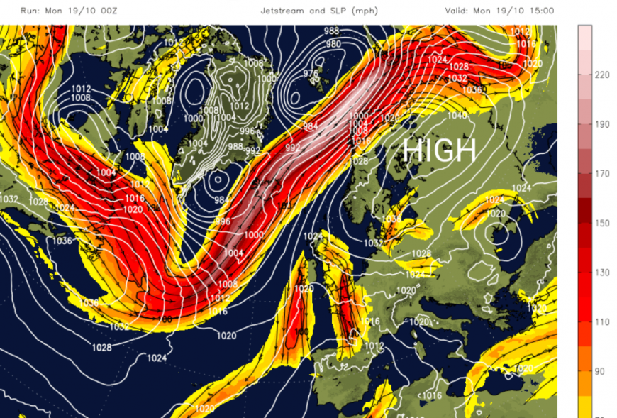
For the start of the week, the jetstream is well away to the north, but it will sink southwards ready to develop Thursday night's low pressure.
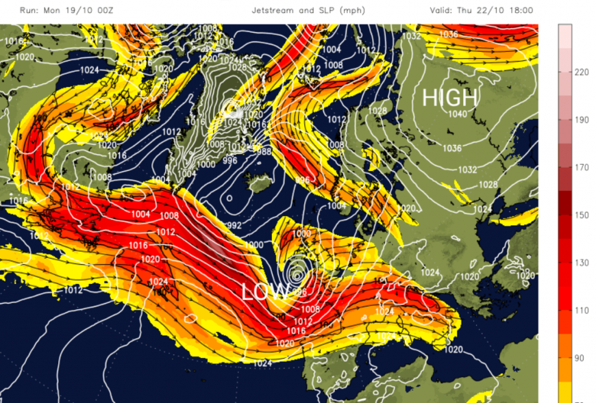
By Tuesday evening, a band of lively downpours will edge into Wales and SW England ready for Wednesday morning. As Tuesday's frontal rain clears away from the far north of Scotland, this new band will move across Wales and England during Wednesday. This rain clears off into the North Sea and Thursday looks fine and sunny but still feeling cool. After this brighter lull, we will then see what the developing low pressure brings for Thursday night and Friday.
The Atlantic low for Thursday night
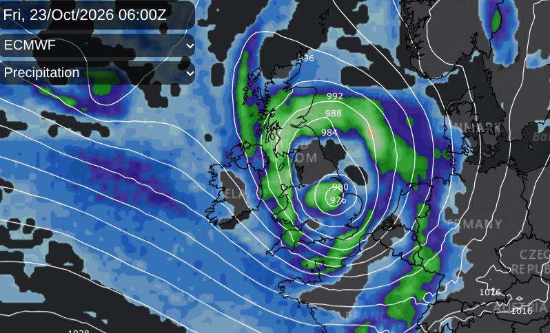
The GFS model is quite different to the European ECM and the Met Office Global.
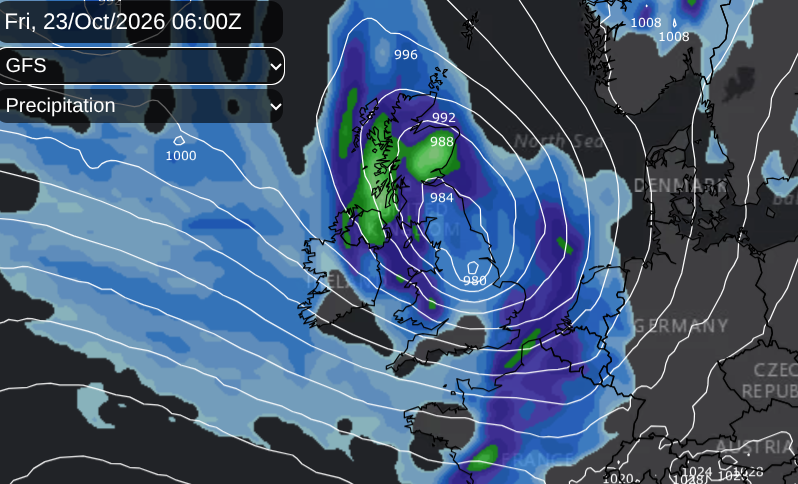
If a deep low does reach southern Britain, the strongest winds would be to the south of the low centre, we would expect heavy rain for a time, but the low pressure does continue moving eastwards. If you have any choice of days for outdoor plans later this week, Thursday looks better than Friday, but there is still low confidence about how this low will develop.
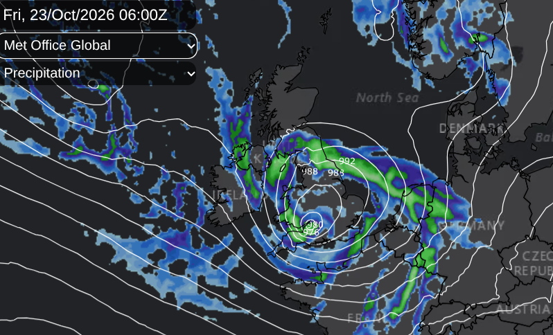
After the hot and dry summer, there are concerns about flooding if heavy rainfall occurs, when the ground is so hard. Any rain will be good for reservoirs and rivers, even just for household water butts, however it will take sustained rains through autumn and winter to alleviate the current drought issues.
More discussion about the potential disruptive low pressure later this week on the Netweather community forum
Loading recent activity...