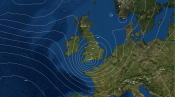
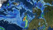
High pressure extends from Scotland to Scandinavia Sunday afternoon -bringing a mostly dry and sunny end to the weekend across northern UK and Ireland. However, an upper low / cold pool drifting west from the Low Countries across northern France and southern UK today. The northern portion of cold pool aloft (500 hPa temperatures between -20 to -25C) crossing the much warmer North Sea is generating heavy thundery showers or longer spells of rain which have been spreading in across SE England and East Anglia through the day, . It’s been quite a wet Sunday across parts of eastern Kent - with 33mm in Deal and 30mm in Folkestone. Showers will spread further west across the Midlands, SW England and Wales this evening and overnight, as the upper cold pool drifts further west.
Cold pool (orange) across southern UK and N France today producing shower clouds (white)
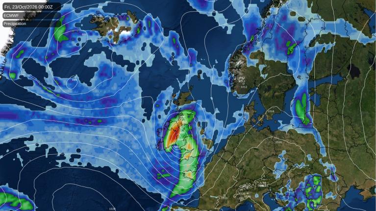
The upper low / cold pool drifting west across southern UK and France will end up over the Bay of Biscay later on Monday - where it will stall and elongate into Tuesday. As this occurs, warm air advection across France will develop in the eastern side of the low to the west, with warm moist air spreading northwest out of France across England and Wales on Tuesday. A north-south frontal boundary which develops along the western edge of the plume of warm moist air is forecast to lie from Scotland right down through western France. Outbreaks of rain are forecast to develop along the boundary across France later on Monday before spreading north across England Monday night and through Tuesday, also reaching up into Scotland. Some uncertainty where highest rainfall totals will be, though central southern, up into the Midlands east Wales and up into NW England seem most favoured for wettest weather. Quite a wet Tuesday looks likely in these areas, but other parts of England, Wales and Scotland may see some showery rain too. Potential for 25-30mm locally.
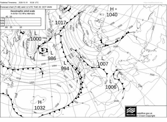
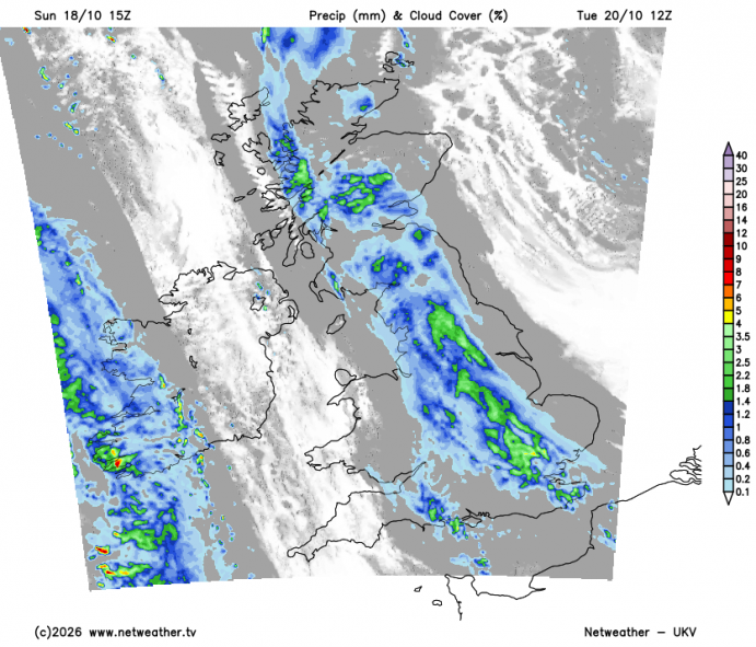
Tuesday's rain pushing north across England and east Wales will then clear northeast across Scotland and eastern England Tuesday night, perhaps pepping up as it reaches the North Sea coast. Then we look toward the southwest for another area of rain and showers, as an upper trough originating over NE Canada crosses the North Atlantic and extends southeast towards western France. This will allow a cut-off low to develop across southwest from a surface low pressure trough and frontal boundary moving east - which will swing northeast across England and Wales during Wednesday - bringing outbreaks of rain or showers with it, the low could deepen as it reaches eastern England and the North Sea, though some uncertainty on track.
More rain on Wednesday, during the day for many areas and overnight in the south
Following on from Wednesday rain moving east, a shortwave trough running across the south may bringing further heavy showers across south Wales and southern England during the evening and overnight, locally some quite intense rain along southern coastal areas, perhaps with hail and thunder too, as cold air aloft spread east over warm seas.
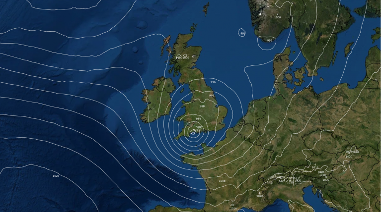
Thursday could see a lull in the rain and showers, at least inland, though showers may continue around some western coasts. However, trouble is brewing for Friday, with most models coming into agreement for a deepening low to move across the southern half of the UK, though the track remains uncertain for now. 12z GFS takes the low northeast through Wales and exiting over the North Sea from North Yorkshire, while the 12z UKMO prefers a southerly track eastwards across southern England and not as deep as GFS.
Friday’s low forms southeast of New Foundland on Wednesday along a baroclinic zone lying over the NW Atlantic. The low tracks east over the N Atlantic under a strong jet stream, then deepens as a sharpening shortwave trough moving out of Canada catches the low up and engages. However, the amount of deepening remains uncertain for now and this will determine the track and how windy it will get. But there is a real risk of gales across south Wales and southern England during the middle of the day. 12z ECMWF shows gusts of over 80mph off the northern and southern coasts of SW England and through the Bristol Channel Friday morning, strong winds transferring east with 70mph+ gusts through the English Channel and later off East Anglian coasts.
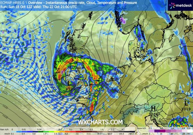
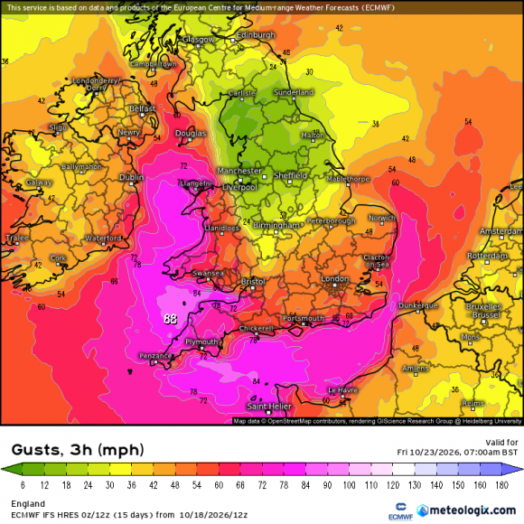
So it is looking increasingly likely that we could have the first named-storm of the 2026-27 storm season, which will be Storm Austen, but we are not going to name it yet. Likely the greatest impacts across southern UK, particularly from strong winds which will be strongest around coasts, but heavy rain is likely too.
Loading recent activity...