After nearly 9000 lightning strikes yesterday, today will be another scorcher with temperatures reaching the low-thirties. However, scattered downpours and thunderstorms are expected once again, which could potentially lead to flash flooding.
The ground is fast becoming parched under the strong June sun, with many places having not seen rain for several weeks now. However, parts of central southern England, the West Midlands, and the North West experienced showers and storms yesterday. The random hit-and-miss nature of these showers both today and tomorrow means that some parts will continue to stay dry. With pressure tending to build again from the North by mid-week, some localities could remain arid well into the third week of June.
The lightning strikes recorded over the last 24 hours.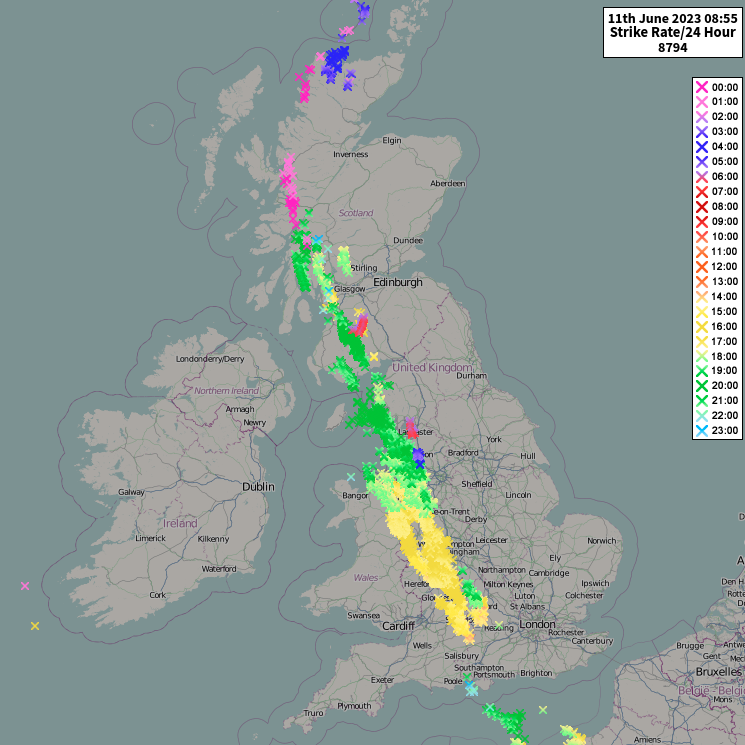
Yesterday's showers are still scattered over Scotland, where more showers will develop later, making it a somewhat cooler day. Not everywhere will see them, however, as there will be spells of warm sunshine as well.
The far North of England also has a few showers and storms, with the odd rogue one elsewhere. After a misty start in some parts, most places will see periods of somewhat hazy sunshine. This will quickly raise temperatures, leading to another very warm or hot, humid afternoon over England and Wales, where showers will break out once more. Some will be lively, giving hail, thunder, local torrential downpours, gusty winds, and flash flooding. All this while another place just a few miles down the road stays completely dry.
A thunderstorm watch has been issued for today: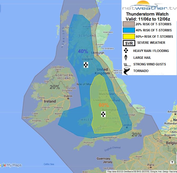
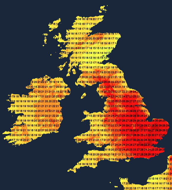
Parts of the South West and Northern Ireland should see more sunshine today. Nevertheless, here too, you won't be immune from the showers, as temperatures reach 23 to 28C fairly generally, with 29-32C likely again across the hottest parts of central southern England. It'll be cooler in the far North and towards the East coast, in a refreshing East or North Easterly breeze.
The showers and storms will rumble on into the evening, with some across South Wales and the South West persisting into the night. The odd storm may also be imported into the South East from the nearby continent. But away from the storms, a fine, warm evening ideal for a barbecue will be followed by clear spells overnight.
Light breezes may cause mist, with a few short-lived fog patches forming towards dawn in rural areas. Low cloud and sea fret may also return to some eastern coastal counties. The South remains humid, where temperatures shouldn't fall below 14 to 16C, but with a somewhat fresher 10 to 12C more likely further North.
The new working week begins in a similar fashion, with any mist and low cloud towards North Sea coasts soon clearing. Most places will then see further spells of hazy sunshine in a primarily light North Easterly breeze. However, remnants of overnight showers will still be around, with additional showers and storms developing in the afternoon, although not everywhere will experience them. Top temperatures between 22 and 28C will be slightly down from Sunday's values, but it'll still feel humid, with the far North and East-facing coasts a little cooler and fresher.
The showers and storms tend to fade after dark, leaving clear spells. It turns misty again but remains mild and slightly humid, especially in the South. Minimum temperatures will be 13 to 15C in the South and 10 to 12C again further North in a light North Easterly breeze.