A small low pressure is moving along the English Channel today bringing rain and blustery winds to southern Britain. Further north there is a mixture of sunny spells and April showers with another more mature low slowly rotating off northern Scotland, throwing out bands of showery rain.
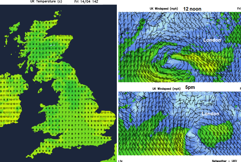
Wind arrows show 10mph for a long 'feather' and 5mph for a short one.
It will be another tricky day to gauge how it feels out there. In the sunny spells with hardly any breeze, it will feel warm. The air temperature values will only rise to 11 or 12C. Where there is more cloud, it will feel cooler and as showers pass or in the gusty winds along the south coast of England it will feel colder.
Cardiff 8C today feeling like 4C in the rain but more like 7C late afternoon as the weather dries up. Birmingham 6 or 7C today with only light winds. Brighton showing 7C on the thermometer but feeling more like 3C at times with the wind and rain. Dundee will fair at 9 or 10C with very light winds.
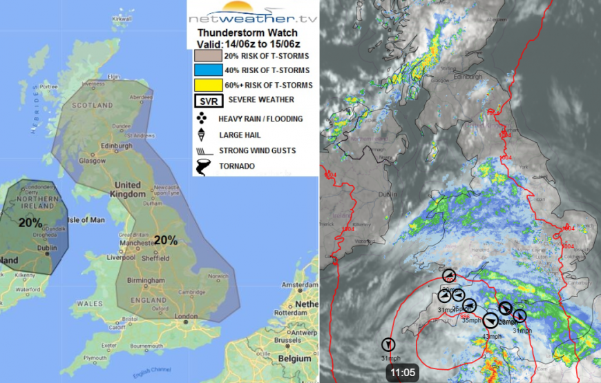
Netweather Radar showing rain and showers at 11am, top ten gusts and model Pressure overlay
Most of these showers will be slow moving and there is the risk of heavier downpours even thunderstorms today. The Convective Forecast includes:
“scattered thunderstorms to develop over S Scotland and NE England this afternoon, aided by local breeze convergence. Elsewhere, scattered showers or more general outbreaks of rain are also likely to develop in places, but cloud cover may limit convection and thus the chance of thunderstorms developing, but the potential is there locally over central and eastern England, with cloud breaks allowing insolation in combination with local breeze convergence.”
The showers over northern Britain could also bring hail and with the sudden heavy downpours there is the risk of surface water issues. Large puddles may develop or local areas that are prone to temporary flooding will be at risk if the showers pass by.
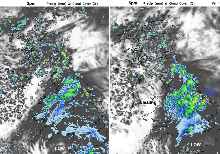
Northern Ireland, Scotland and Cumbria will be peppered with slow moving heavy showers and some thunderstorms by this afternoon. East Anglia will see some home-grown showers bubbling up in the sunshine ahead of the frontal rain wrapped around the southern low. Gradually more cloud and showery rain will spread over more of England, with further outbreaks for Wales especially in the north. There will be an improvement in the weather over Cornwall and Devon this morning with western Wales seeing sunshine this afternoon as the low edges away eastwards.
Overnight the rain becomes confined to eastern Britain, from the Forth down to Sussex still linked to the low pressure over northern France.
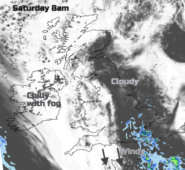
There will be showery rain lingering for Saturday morning over Kent with more cloud and patchy rain for East Sussex, Essex and Greater London. It does fade quickly as the morning progresses but the cloud will take a bit more time. It will be a grey start for much of eastern England early on but as the cloud breaks up and the sun gets to work there will be scattered showers for eastern England and SE Scotland. Northern Ireland will see a nippy start after a clear night with fog patches.
Warming up through the Weekend
Loading recent activity...