Blog looking at the prospects of dry and settled conditions developing from Sunday persisting into Easter Weekend. Warm in the sun by day, but nights could be cold with a risk of frost, easterly wind may make eastern areas chilly. The long weekend may end with rain in the west.
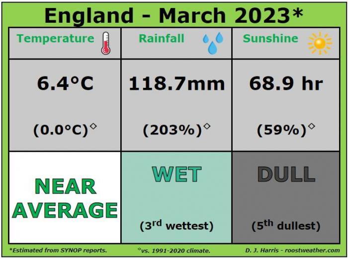
The Met Office on Friday confirmed that for England March had been the wettest since 1981.
According to early provisional Met Office statistics including data up to 30 March, England, Wales and Northern Ireland have all so far had one of their respective top ten wettest Marches on records which go back to 1836.
While it has already been England’s wettest March since 1981, the record figure of 147.2mm in 1947 won’t be troubled this month.
England’s temperature, rainfall and sunshine for March from Starlings Roost Weather:
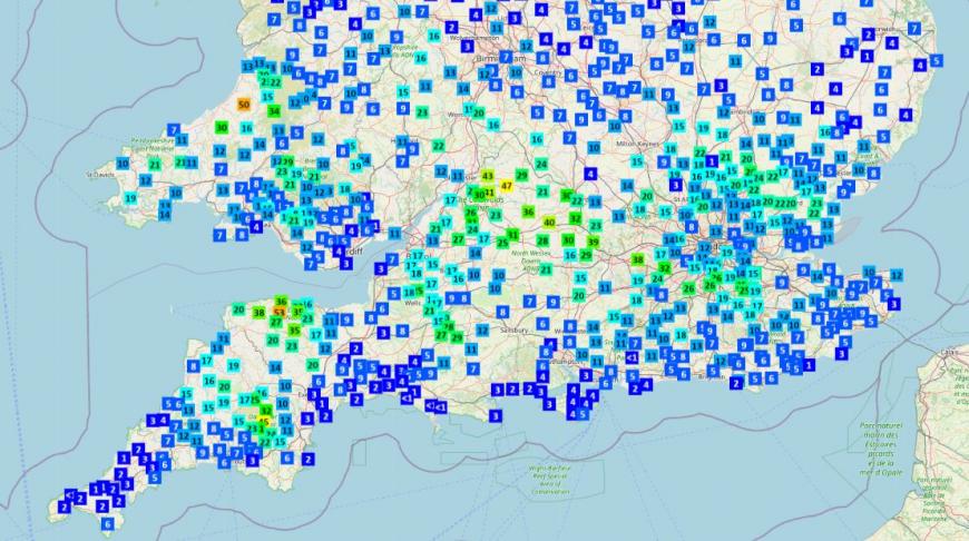
It’s only befitting that the last day of March went out like a Lion, with very wet and windy weather affecting much of southern Britain on Friday, as Storm Mathis, named by Meteo France, tracked east across southern England. 50mm fell in 24 hours over North Devon, with 25-40mm falling across parts of southern England further east too.
Data from Starling Roost Weather
The good news is the recent wet weather looks to be on its way out over the weekend and a drier period with high pressure in control looks to start from Sunday and may last all the way through to and over the Easter weekend too.
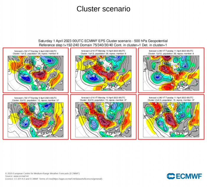
Using the 00z ECMWF clusters, there are 5 clusters in the period covering Good Friday and Saturday, but all show high pressure in control. There are then 2 clusters for the period covering Easter Sunday and Easter Monday, the largest cluster of ensembles has high pressure just about in control still for Easter Sunday, but by Easter Monday low pressure is pushing in from the west, portending more unsettled conditions with cloud and rain spreading in across the west. The smaller cluster of members has high pressure still well in control.

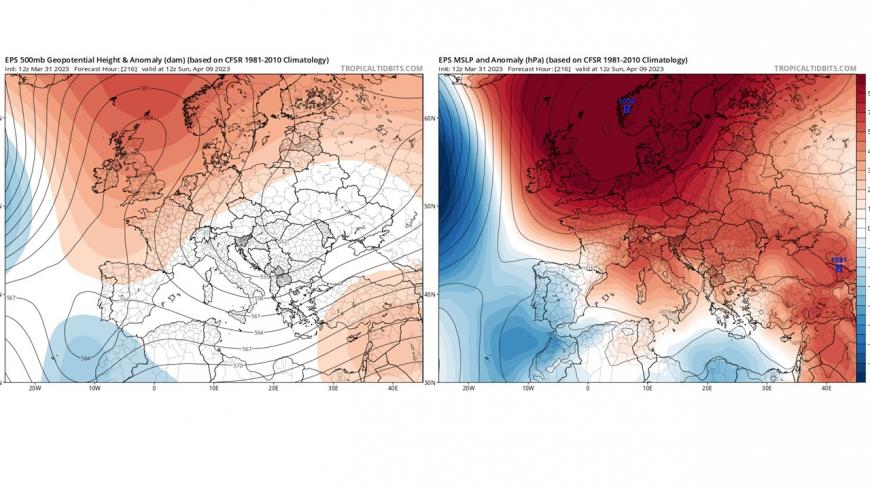
The 00z ECMWF ensemble mean for 500 hPa heights and sea level pressure shows high pressure in charge on Easter Sunday.
So, for now, it looks like dry and settled for many for most of the Easter Weekend, though with the possibility that low pressure over the near continent and a strengthening easterly wind may bring cloud and showers to eastern areas as the weekend progresses, while low pressure edging in to the west may bring cloud and rain in across western areas on Easter Monday.
Temperatures could vary though depending on the positioning of high pressure through the weekend likely to be control and where you are in the country. Subtle differences in position and location in the UK can may all the difference between a warm southerly or a chilly easterly breeze off a cold North Sea. At the moment there looks to be a risk of frost across England and Wales overnight, especially in the first half of the long weekend - with a drier continental flow here, but warming up during the day with sunshine. The far west and northwest could be the warmest areas though by day and night, with a cool easterly flow tempering temperatures further south and east.
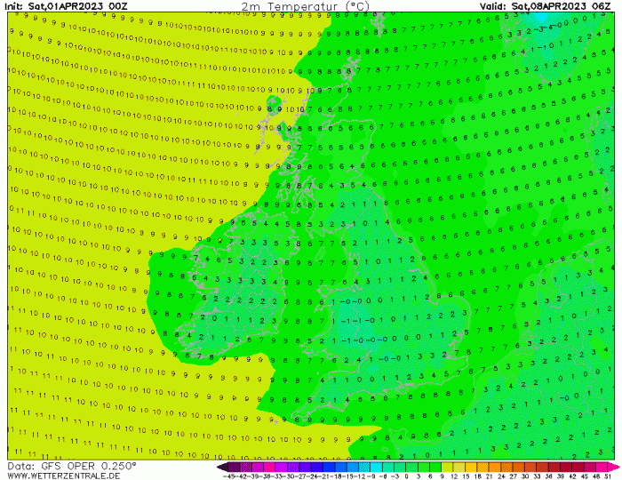
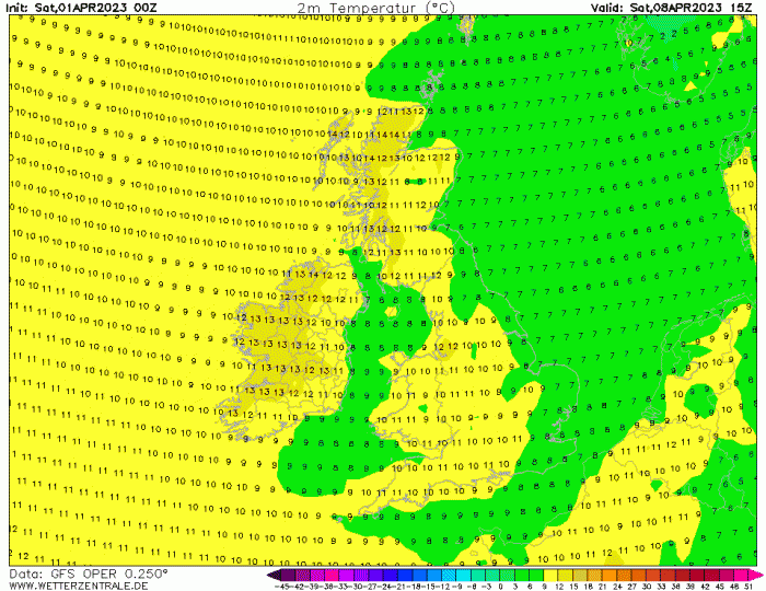
It looks like warming up through next week, so Good Friday and Saturday may be pleasantly warm in sunshine likely, with temperatures reaching the mid-teens. However, we may see a cooling trend towards eastern areas, particularly Easter Sunday onwards, as a chilly and increasingly cloudy easterly wind develops.
Cross-model ensemble consensus does point to a higher likelihood of dry and settled weather lasting through most of the long Easter Weekend. Temperatures warm at first but perhaps a downward trend into Easter Monday.
Loading recent activity...