
A few bouts of snow will move east across south Wales and southern England from tonight and through to Thursday, rain on the coast. Then a risk of disruptive heavy and prolonged snowfall further north on Thursday into Friday morning.
Cold arctic air spread south across all parts overnight, following a cold front that slowly cleared the south coast this afternoon – which brought bands of rain, sleet and hill snow across southern England through the day. Frequent heavy snow showers continue to pile across northern Scotland – which is causing travel problems and forced the closure of dozens of schools this morning.
Any lingering rain, sleet and snow will clear southern England early this evening. Snow showers will continue to pack in across northern Scotland, N. Ireland and NE England – where there are Met Office warnings for snow and ice in place. Most disruption across northern Scotland – where snow showers will be heaviest and most frequent. Elsewhere it's been a sunny afternoon with just the odd snow flurry.

Snow showers continue for northern Scotland, though tending to ease north towards coasts. Otherwise, clear spells across the northern half of Britain will lead to a very cold night with a widespread hard frost, temperatures falling as low as -4 to -6C. In sheltered glens in the Highlands of Scotland, we could see temperatures fall as low as -13C.

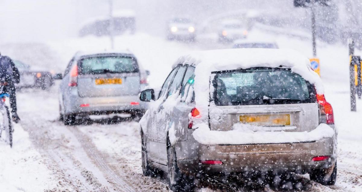
Cloudier picture across the southern half of Britain tonight, the cold front that clears south this afternoon will lift back north as a warm front overnight, introducing outbreaks of rain and sleet northwards into southern England and far south of Wales in the early hours of Wednesday - which will turn to snow inland as it bumps into the cold arctic air firmly established across most areas. There is some uncertainty about how far north the snow inland will spread and how much will accumulate at lower levels too. Based on the most recent model forecast data, the greatest accumulations look to be over south Wales and south of the M4 further east over England. Over higher ground, 5-10cm possible, perhaps 1-5cm over lower elevations inland away from coasts.
One round of rain, sleet and snow that arrives overnight, mostly south Wales and southern England, looks to clear east through Wednesday morning before another round of sleet and snow spreads into SW England in the afternoon before reaching SE England in the evening. This second round could be heavier, especially across the southwest, with significant accumulations of 10-15cm possible over SW Moors, less lower down. Potential for up to 10cm further east along southern England too, more particularly higher ground. So potential for some travel disruption tomorrow, though towards the south coast snow may turn to rain. The second round of snow, sleet and rain clears east across southern England through the evening, then becoming drier with clear spells in the early hours of Thursday.

Further north, a mostly dry, quiet, cold and sunny Wednesday for central Wales and the Midlands northwards, though some scattered snow showers are possible for north-facing coastal areas.
Then attention turns to a low pressure system waiting in the wings over the Atlantic to the southwest of Ireland Wednesday night. The low looks to track east over Britain on Thursday – but some uncertainty over the track of the low. 06z GFS takes the main centre of the low east across North Wales, then the southern half of northern England. 06z ECMWF takes the low further south across southern England. Regardless of track, outbreaks of rain preceded by snow look to spread northeast across Ireland, N. Ireland, England and Wales through the day, the snow turning to rain across southern areas as milder air is pulled in by the low but north Wales and Midlands northwards it looks like to stay as snow – where the cold air remains entrenched north of the low’s track.
However, there is uncertainty about how far north the snow will reach, depending on the track of the low. GFS has snow reaching the Central Belt of Scotland Thursday evening, ECMWF reaches southern Scotland overnight. There is potential, though, for some significant snowfall, given the heaviness and prolonged nature of the snowfall forecast by models. ECMWF forecasts 5-10cm widely over north Wales, North Midlands and large areas of northern England, but over higher ground, such as the Pennines and mountains of north Wales – 15-25cm by breakfast time on Friday morning. GFS extends 10-15cm over the Southern Uplands of Scotland too.
So there is potential for some significant travel disruption from snow and ice for north Wales and North Midlands northwards across northern England and perhaps into southern Scotland later on Thursday and overnight into Friday morning – affecting Thursday evening and Friday morning commutes in these areas.


Rain in the south and snow in the north clearing the east coast Friday morning, then it looks a mostly dry and bright sort of day for central and northern areas, but we may see further rain with hill snow moving across southern areas from the west during the day, but disruption seems unlikely from any snow for now.


.jpg?w=350)

