The quiet high pressure dominated weather will continue across the UK for the foreseeable future while we wait to see the potential impacts of recent stratospheric warming events.
Sudden stratospheric warming events are often followed by an increase in blocking highs at high latitudes, which increases the chances of Britain getting cold northerly and/or easterly winds. At present, we are seeing pressure rising towards Greenland, which in the long run, increases the chances of Britain experiencing cold northerly blasts.
However, we also have a persistent area of high pressure close to Britain. This high pressure is set to dominate for the rest of February and through the first week of March.
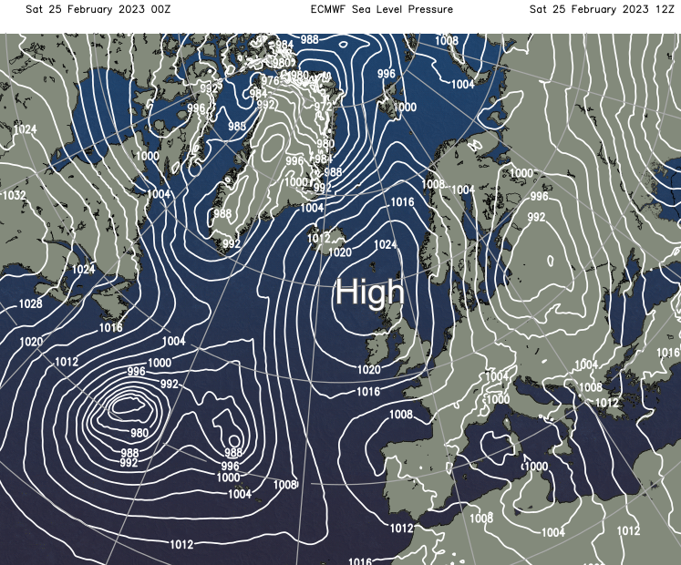
For significant wintry weather to arise after this, it will require this high pressure area to weaken and to get pulled north-westwards towards Iceland and Greenland. Current forecast models suggest that this will probably happen eventually, but it is possible that this change will take until at least the second week of March, so any change is currently a long way off and not certain.
For the foreseeable future, the weather looks set to be predominantly dry, though with high pressure centred over north-western Britain rather than over the south and/or east as we've been seeing recently, which means that temperatures will tend to be close to or a little below the seasonal average.
Most of the UK is currently cloudy with a lot of stratocumulus coming in off the North Sea and some showers (mainly of rain at low levels) for eastern Britain, but we have some sunny spells in some western and southern parts of the country. This pattern is set to continue for the rest of today, although we may see more in the way of sunshine coming through in the cloudy areas as the day progresses. There will continue to be a scattering of light showers in eastern Britain.
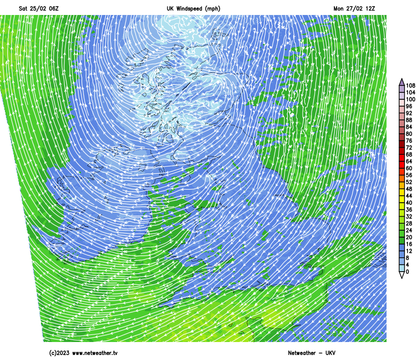
Daytime maximum temperatures are set to be below average for the time of year, thanks to a north to north-easterly wind on the eastern and southern flank of the high pressure area over north-western Britain, reaching between 5 and 8C in most parts of the country.
Under clear skies and light winds, many western parts of the UK will see a frost tonight with temperatures falling close to freezing, but eastern England will be generally frost free with some cloud and showers and temperatures falling no lower than 3 or 4C in eastern coastal areas.
Much of the UK looks set to have a sunnier day on Sunday, with the high pressure covering more of the country, with north-west Scotland and the southern half of England and south Wales most likely seeing the sunniest weather. There will still be a few light showers in eastern counties, mainly near the north-east coast of England. Temperatures will generally be similar to those of today. North-west Scotland and southern England will see a frost on Sunday night, but as we head into Monday, a north-easterly wind will pick up in most areas, bringing cloudier weather in off the North Sea.
For much of next week, we can expect predominantly cloudy weather for most, but it will generally be sunny in the west of Scotland, especially the north-west, where high pressure will often be very close by. Some light showers will spread inland from the North Sea, these especially affecting south-east Scotland, north-east England, Lincolnshire and at times penetrating into East Anglia, but much of the country will stay dry.
Temperatures are forecast to rise by night due to the increased cloud cover, although in the sunny north-west of Scotland, there will continue to be frost at night. During the daytime, we can expect top temperatures between 6 and 9C for most, perhaps reaching around 10C on Wednesday and Thursday as warmer air moves into the circulation around the high pressure area.
So, no significant wintry weather is imminent in the short term, but it is worth watching the long-term impacts of the recent sudden stratospheric warming, as they have the potential to result in significant wintry weather after the first week of March.