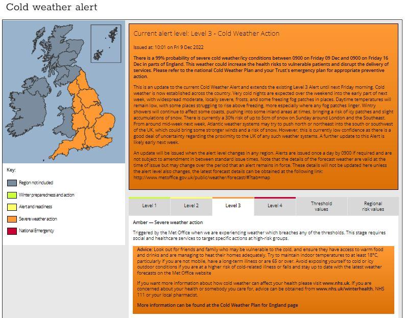
The current cold spell looks set to last through to at least the end of next week, the Met Office has a Level 3 cold weather alert in force until Friday 16th December. The alert levels range from 1-4, with level 4 a national emergency:
There is a 99% probability of severe cold weather/icy conditions between 0900 on Friday 09 Dec and 0900 on Friday 16 Dec in parts of England. This weather could increase the health risks to vulnerable patients and disrupt the delivery of services. Please refer to the national Cold Weather Plan and your Trust's emergency plan for appropriate preventive action.
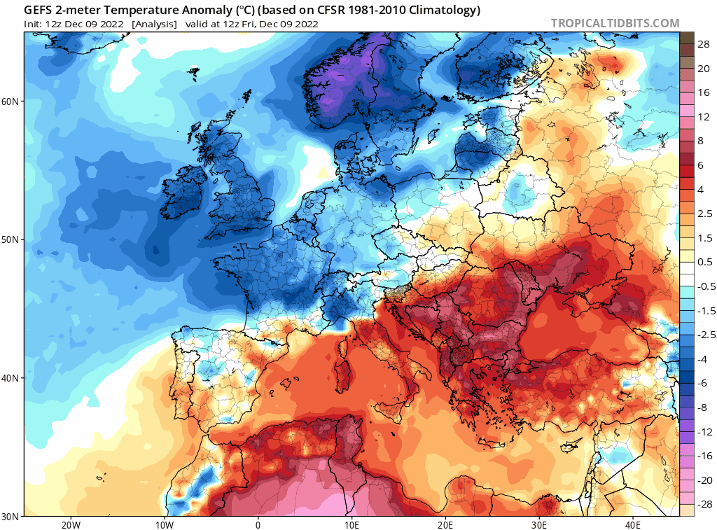
Air direct from the arctic has been seeping down from the north since early in the week and the cold airmass, with temperatures barely getting a degree or two above freezing for many and falling below freezing at night, will linger through next week too.
12z GEFS (Ensemble mean) shows temperatures remaining below average from now until the end of next week at least
Although many places have remained dry and will remain dry through the weekend and much of next week, there is the threat of localised snow events in places, increasing the risk of icy conditions making for hazardous journeys.
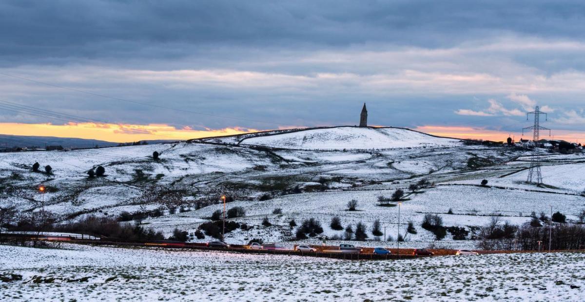
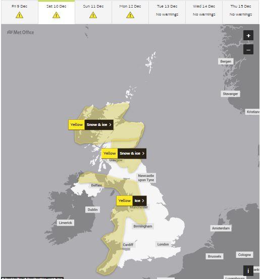
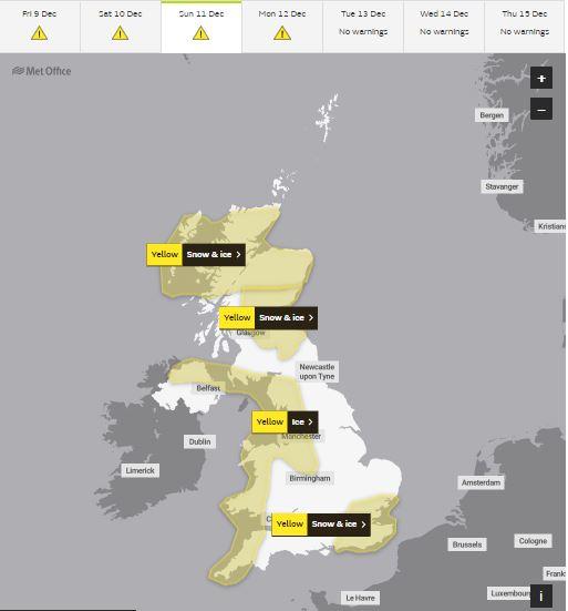
Snow has already fallen in parts of northern and eastern Scotland, NE England, NW England and Wales, with sleet and snow showers expected to continue in these areas over the next few days. Weather models have also started to indicate a risk of snow for London, the South East and East of England on Sunday too. Four Met Office yellow weather warnings for snow and ice are in place for these areas across the UK from now and over the weekend.
Saturday warnings
Sunday warnings
Snow showers forming from the contrast of cold air flowing over the relatively warmer seas around Britain will continue to affect northern, western and some eastern coastal areas wherever there is an onshore breeze over the next few days. However, there will be a few more organised areas of snow showers over the weekend and into early next week, which I will look into more detail below:
Northern and eastern Scotland along with NW England will see more frequent sleet and snow showers over the next 24 hours. Across Scotland, snow showers look to merge into a more organised band of snow moving south mostly across the eastern half of Scotland and perhaps into NE England and Cumbria on Saturday, along an occluded front and upper trough pushing south. A few centimetres of snow possible at lower levels, perhaps several centimetres above 200m.
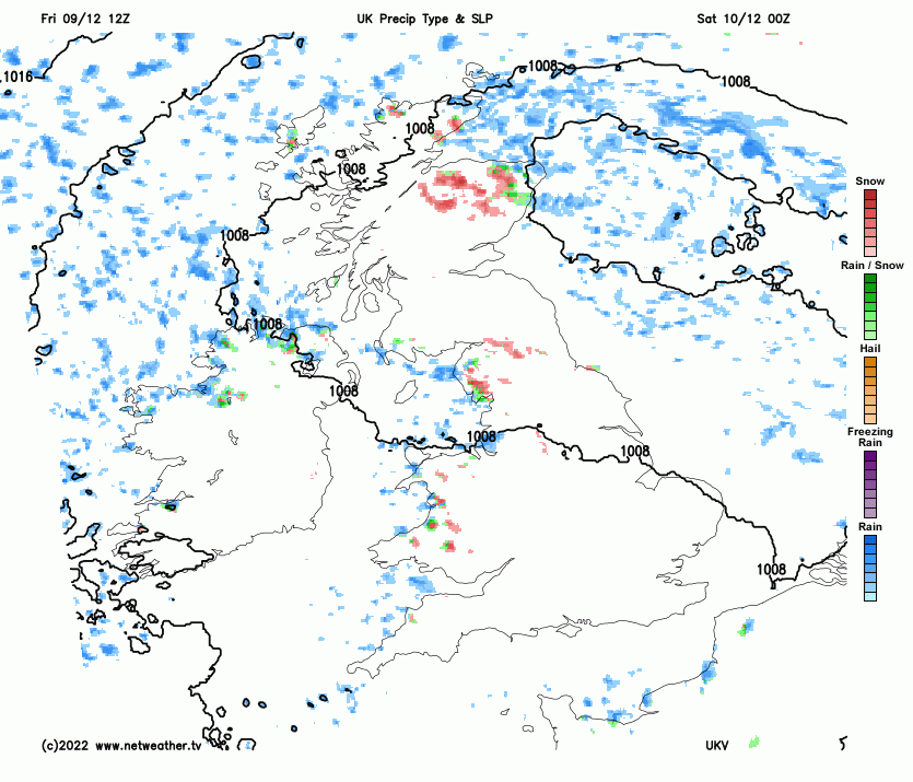
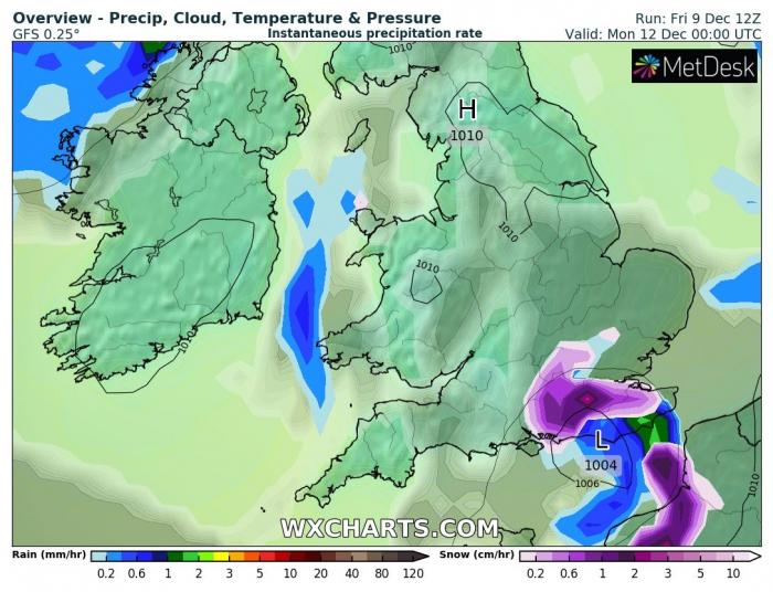
Meanwhile, a shallow low looks to develop across the Irish Sea in response to the same upper trough / cold pool dropping south bringing the snow further northeast. This low looks to move south across west Wales before reaching the far southwest of England early Sunday morning, the low looks to bring an area of enhanced sleet and snow showers down across parts of Wales Saturday PM and Saturday night, perhaps bringing a few centimetres in places, perhaps several centimetres over higher ground of north Wales. Showers also affecting northern coasts and Moors of Devon and Cornwalll.These showers likely to lead to a risk of ice on untreated surfaces as temperatures fall below freezing Saturday night.
Sleet and snow showers probably from the word go across more eastern coastal areas of Scotland and NE England, these tending to ease though through the day. At the other end of Britain, the low dropping south over Wales on Saturday will be across SW England Sunday morning, sleet and snow showers affecting Devon and Cornwall in the morning before easing southeast in the afternoon. Further east, the same shortwave trough on Saturday dropping south will reach the south coast on Sunday – where it will induce cyclogenesis over the eastern English Channel, forming an area of low pressure. This low looks to deepen for a time, this will create lift and pull in moisture from North Sea and English Channel and potentially create a developing area of snowfall around the northern flank of the low for a time later on Sunday and Sunday night. However, there is a great deal of uncertainty over the position of this low, how much snow will develop around it and the extent of any snow across SE England.
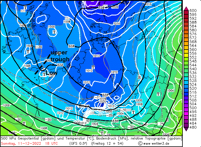
Remaining cold throughout next week. First half of the week sees a blocking area of high pressure to the northwest over Greenland and Iceland, areas of low pressure tracking east to the south of Britain across France and Spain. A strengthening easterly or southeasterly flow across southern Britain, making it feel raw and bringing a few flurries northwest across England and Wales, lighter winds across Scotland, but here may see some sleet and snow showers. From mid-week, a northerly looks to redevelop across northern areas for a time, bringing with it increasing snow showers. But by Friday, high pressure looks set to build in from the northwest across all parts, cutting off the northerly flow, but remaining cold and becoming dry across all parts. Risk of freezing fog overnight where winds become calm. Sub-zero temperatures with frost widespread at night for all parts over the next seven days.
Loading recent activity...