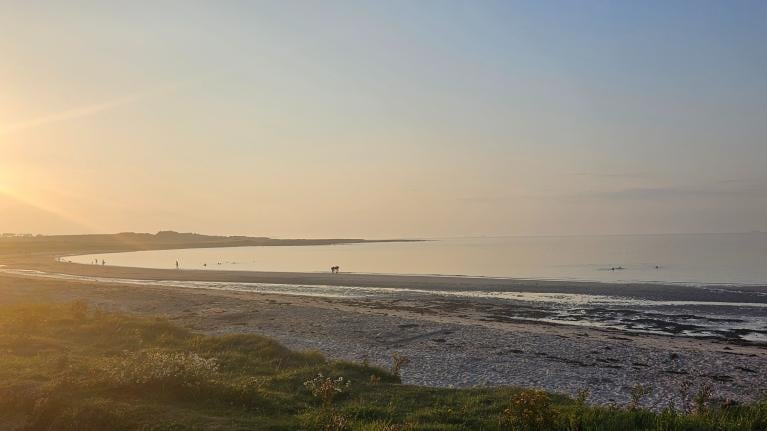
After a chilly end to this week and start to the weekend, it looks to turn warmer into next week, though will also turn unsettled, especially in the west. However, it looks to turn drier and more settled over the Easter Weekend.
The weather in March and April can often be rather fickle. As spring progresses, it is natural to think that the weather progressively gets better, with temperatures rising a few degrees each week. Sure it does feel much warmer in the sun now than it did in early March. However, spring often doesn’t conform to such a concept, with spring warmth arriving in fits and starts – with swings from early spring warmth back to winter chill quite dramatic, but not uncommon, even in April.
Parts of the UK reached 20C over the last weekend of March, but a week ago on the last day of March and first day of April – much of the UK was experienced a cold northeastely wind – bringing cold and dry enough air to bring snow showers even in the south, with temperatures widely not reaching double figures, with widespread frost at night. The same cold arctic outbreak plunged across much of western Europe too, with sub-freezing temperatures at night threatening to damage new growth on vines in French vineyards, spurned by the late March warmth. The second consecutive April in a row where early Spring warmth has been followed by a return of winter cold – causing damage to new growth in vineyards and agriculture in general.
Cold air returns south again to end this week, not quite as potent as the end of last week, with any wintriness confined to high ground mostly in the north, but nonetheless many areas close to or below freezing last night and a widespread overnight frost threatens again tonight, so gardeners be aware.
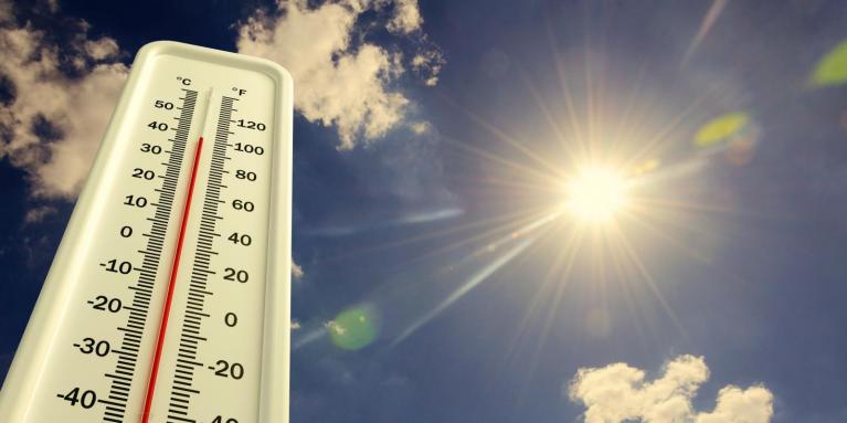
But, the good news is, warmer weather looks like it will arrive next week and may linger through to the Easter Weekend. The warmer air arrives as high pressure building in tomorrow retreats east and low pressure moves into the west of Britain, drawing in a south or southeasterly flow early next week. But, although temperatures look to rise to above average, in the high teens with any sunshine, there will also be a threat of some heavy showers or longer spells of rain, particularly in the west – as low pressure moves close to the west and Atlantic fronts make slow progress eastwards.
After a chilly end to this week and start to the weekend, it will turn warm into next week ...
... but also unsettled, particularly earlier in the week and int the west
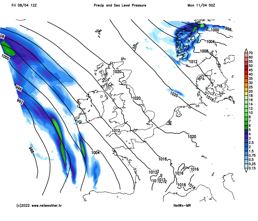
Unsettled but warmer conditions early to mid-week next week, rain more particularly prevalent in the west, but it won’t rain all the time and feeling pleasant in any sunshine between showers or spells of rain. Some uncertainty though for the second half of next week and over the Easter Weekend, as may be expected this far off, especially over the positions of surface highs and lows in proximity of the UK – which has impacts on what weather we'll experience on the ground. The uncertainty is apparent between GFS and ECMWF high resolution runs over recent runs. When there’s disagreements between the high resolution runs forecast look at the ensembles of the models for guidance.
Both 00z EPS (ECMWF ensembles) and GEFS (GFS ensembles) mean indicates upper level ridge (red anomaly) over the Easter Weekend - which would suggest higher likelihood of settled weather:
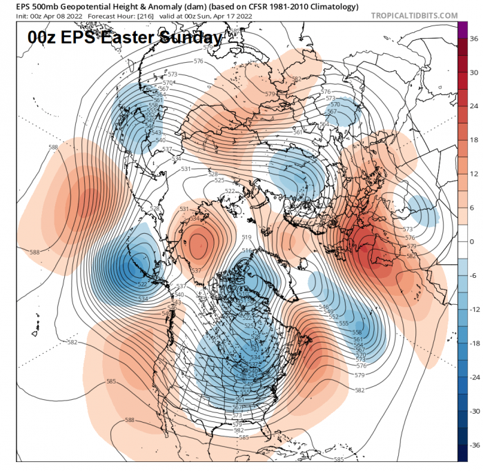
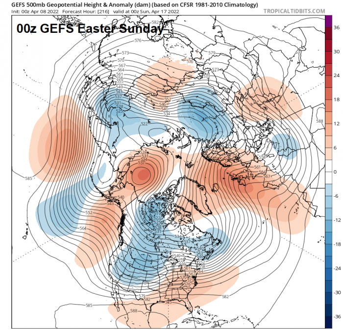
There is some broad agreement between the ensemble means of both ECMWF and GFS for an upper level ridge to build from the south across the UK as we head through the Easter Weekend. This would suggests some confidence for some parts or large parts of the UK to see a drier and more unsettled period from late next week through the Easter Weekend, as upper trough and surface low pressure close to the west earlier next week retreats west and northwest.
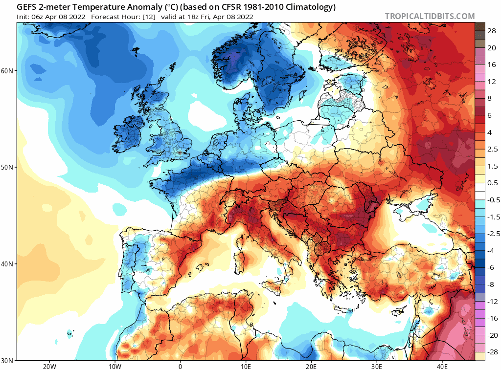
How warm it will get is too far out to have any confidence, GFS has on a few runs, most recently the 06z today, indicated a chilly easterly flow developing across southern Britain, so although it may be dry – it could be chilly, perhaps dull along eastern coastal areas and chilly in the shade where it’s sunny. ECMWF looking warmer.
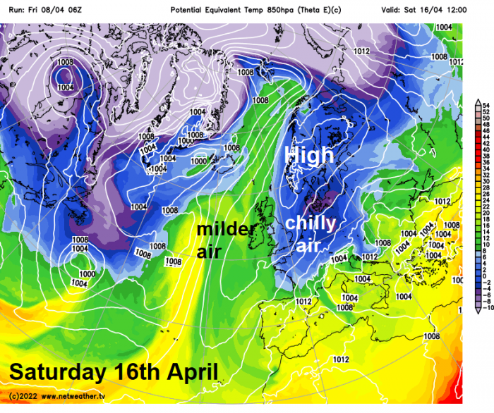
06z GFS suggests chilly air from the east could invade over the Easter Weekend
So in a nutshell, warmer next week, unsettled during the first half looking likely - though more particularly in the west, unsettled conditions perhaps lingering into the second half too. But increasing confidence of some dry and settled weather developing for the Easter Weekend, but some uncertainty how warm it will be.
Loading recent activity...