St David's Day sunshine before rain from the south tonight for Wales. High pressure over the UK brings a lot of fine weather for Tuesday as a rainband fades then reappears in the south.
Pinch punch, that’s meteorological winter over. It’s St David’s Day and spring flowers are beginning to show their joyful blooms. There has been a frost in the north away from a frontal rain band with a chilly start for March. Still quite mild in the far southeast this morning but damp.
Provisional February data shows that the UK was warmer, wetter and duller than average. Winter, defined as the three months of December January and February, looks to have been warmer than average overall. For those who’ve not seen any snow, this won’t come as a surprise. It was more likely than not with climate change.
Thinking back, the Beast from the East had only just set in this time four years ago. if you are despondent about the lack of wintry weather, it does sometimes snow at Easter here in the UK. Nothing much this week, just snow for the tops of the Scottish mountains tonight. High pressure will continue to settle our UK weather down although there will be rain from the south later today and more patchy bits from the west midweek.
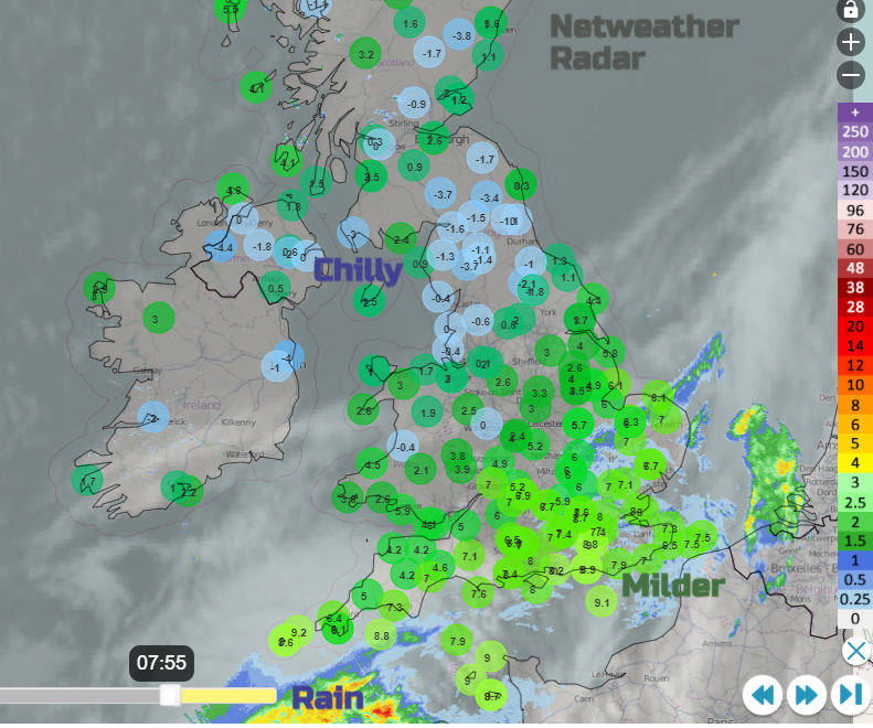
High pressure builds in over the UK today, with a waving weather front lurking over the English Channel. You can see the rain just at the bottom of the Radar image above which extends over SE Britain to start the day. This patchy rain over East Anglia, London and the Home Counties fades by lunchtime but slowly, through the afternoon, the warm front pushes northwards bringing rain. To Cornwall, south Devon and Dorset and then by evening rush hour just reaching Cardiff and along the M4 and M3. So for southern England today there will still be more cloud, patchy rain at times and a light NE flow.
Although high cloud will increase through Wales and the Midlands this afternoon it remains dry and bright with temperatures around 7 to 10C. And blues skies with sunshine for Northern Ireland and northern Britain and hardly any breeze, although a brisk westerly for the Northern Isles at the edge of the high pressure.
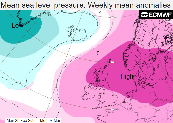
The ECMWF chart for pressure anomaly this week shows a strong signal for high pressure to be centred to the east of the UK and low pressures away to the northwest. This is the overall theme. By next week, the Atlantic is filled with lower pressure anomaly and Europe (north into central regions) with higher pressure, which leads to a southerly flow for the UK and milder than average temperatures, for the week overall.
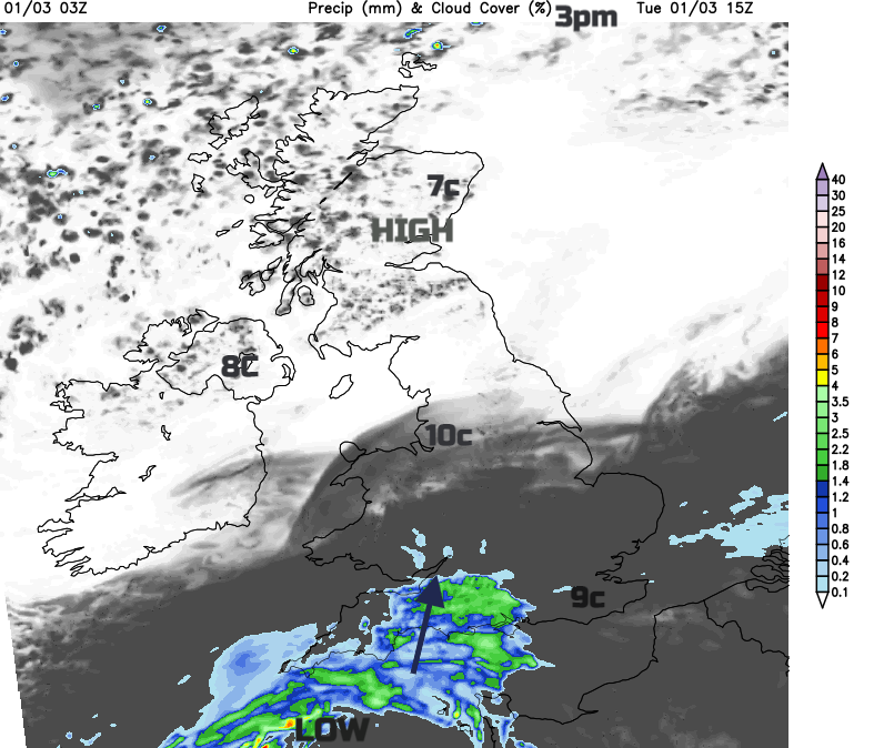
We have a low pressure near to the tip of Greenland by Wednesday, trailing its fronts down towards Ireland. Also, the low pressure from Fitzroy sea area moving closer to SW Britain, the rain in the south later today is from this. Both of these begin to stumble and are blocked by the high over Europe. They grind to a halt and fade over the UK through Wednesday and Thursday.
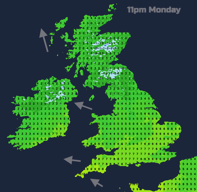
There will be a frost inland tonight for Scotland and the far north of England where winds will be very light, Northern Ireland could see a frost before midnight but then the breeze will pick up from the southeast.
For Wednesday there will be a fine, sunny but nippy start in the north, patchy rain and grey skies for Wales and much of southern England. In between there will be increasing cloud, a light east wind and outbreaks of rain will work their way northwards through the day. SW Britain will be mild, into double figures. Northern Ireland becomes windy with a fresh SE wind and coastal Scotland will be blustery, a change from today but holding onto the sunshine well into Wednesday.