Colder air moves down from the North on Sunday, but in the meantime, the weather remains in much the same, very mild mood.
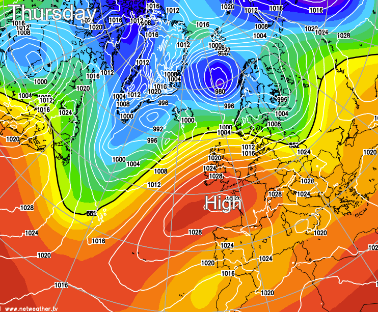
Colder air moves down from the North on Sunday, but in the meantime, the weather remains in much the same mood. An anticyclone to the South keeps southern, eastern and central parts mainly dry and somewhat quieter while further North, Atlantic systems continue to bring windy weather with occasional rain or showers. But it'll be very mild today and tomorrow, exceptionally so for some.
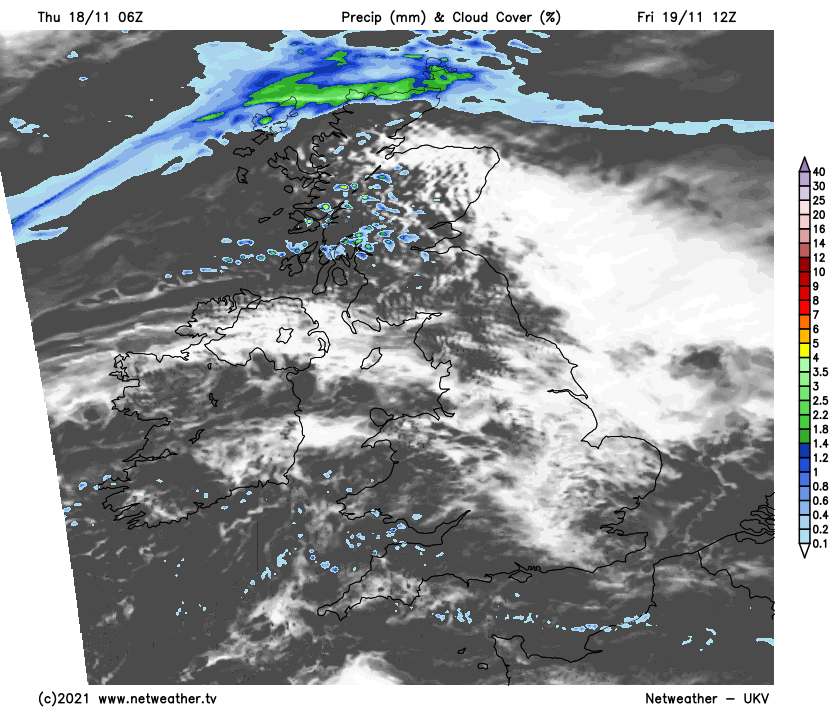
It's a bright but chilly start across the far South East, with a touch of frost in some rural parts of Kent first thing. But for most, there'll be a lot of cloud at times today, with patchy, mostly light rain or drizzle in the North and West. Over the West and particularly North of Scotland, there'll be heavier bursts, especially over West facing slopes and hills where it'll be misty at times, but elsewhere, it'll be mostly dry.
Although not quite so blustery in the South, a stiff South West wind will be up to gale force across the far North and North West. The wind will help break up the cloud over sheltered parts of East Scotland and the East of the Pennines, where it could become exceptionally mild. Here the Fohn effect could lift temperatures to the lee of the Grampian Mountains to 16 or 17C where the sun comes through, with 12 to 14C in most other parts still very mild for mid-November.
After dark, most parts remain in a broad South Westerly flow bringing very mild air from the Azores. The North and North West of Scotland see the heaviest rains, but apart from patchy light rain or drizzle mainly in the West, it'll be mostly dry. There continues to be generally large amounts of cloud, but with some breaks, especially in central, southern and sheltered eastern areas. Winds remain fresh or strong in the North but will be lighter in the South. Here a few mist or fog patches are possible towards morning, but temperatures generally shouldn't fall below a very mild 9 to 12C.
Friday sees the best weather from the Midlands southwards and to the East of the Pennines, although cloud amounts may continue to be quite large at times. It'll feel particularly pleasant where you see some sunshine, bringing what is sometimes referred to at this time of year as 'Saint Martin's' little summer. However, the North of Scotland sees further rain at times giving heavier bursts, with patchy light rain or drizzle continuing to affect mostly windward slopes of hills in the West.
A balmy South West wind continues to import tropical maritime air from the Azores but should be less boisterous and light in the South. Temperatures reach an unusually mild 13 to 15C again fairly generally, with sheltered eastern areas to the lee of hills perhaps reaching the dizzy heights of 16 or maybe 17C once more.
After dark northern Scotland areas see more rain at times, which may begin to creep further South on a cold front. This may allow the Northern Isles to become clearer but much colder in a sign of things to come. Elsewhere it remains much the same, with the East and South, in particular, seeing a few clear spells. Where these last of any length of time and with a lighter South West wind here, a few mist or fog patches may form in sheltered rural valleys towards morning. It'll be another mild night, though, with temperatures generally falling no lower than 9 to 11C except in the far North.