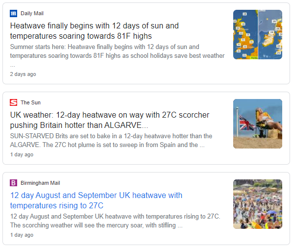
Some UK tabloids ran very similar stories last weekend of a 12-day heatwave starting this Monday, these stories were picked up and run by other media outlets - such as regional papers and radio stations too.
In reality, there’s not a heatwave anywhere in the UK this week, using the technical definition of a heatwave. More likely, as is the norm when a Bank Holiday Weekend approaches, the tabloids are looking for feel-good end of summer ‘clickbait’ weather stories for their readers and stretch the truth with regards to the likely weather. Nothing new there then!
A google search shows a whole host of tabloid newspaper websites and other media outlets running very similar stories.

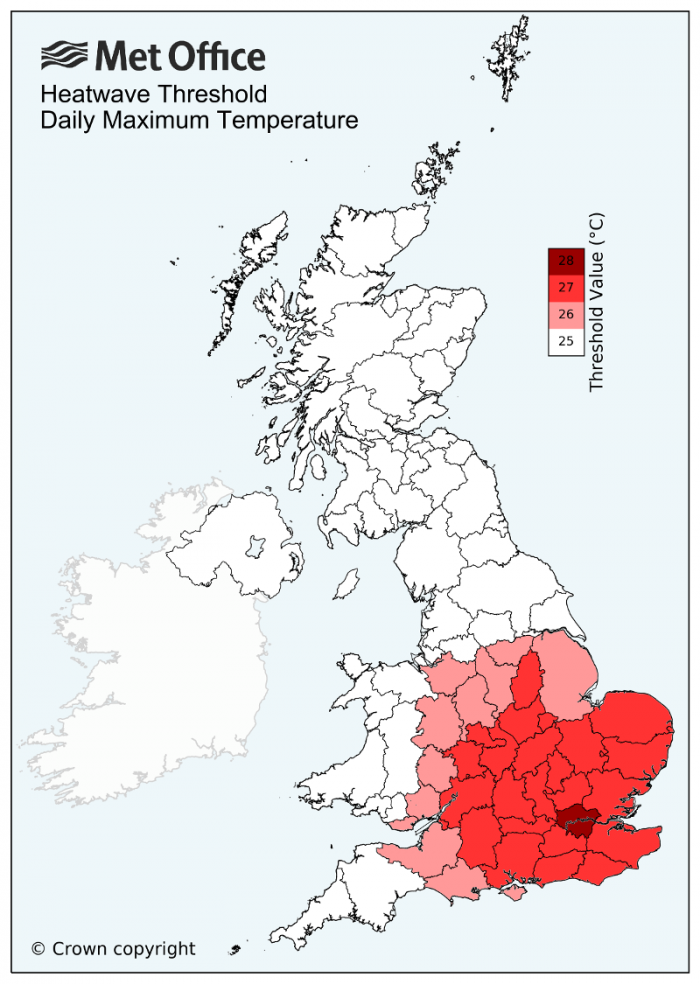
The UK Met Office definition of a heatwave is below:
A UK heatwave threshold is met when a location records a period of at least three consecutive days with daily maximum temperatures meeting or exceeding the heatwave temperature threshold. The threshold varies by UK county, see the UK temperature threshold map below.
The northwest of the UK has seen the highest temperatures this week, particularly central and western Scotland along with Northern Ireland – where winds will be lightest and pressure and air thicknesses will be highest close to the centre of high pressure located to the west of Scotland. We’ve seen highs of 24 to 25C in the south too where the sun came out since the start of the week, the next few days will see the low twenties, but well below heatwave thresholds.
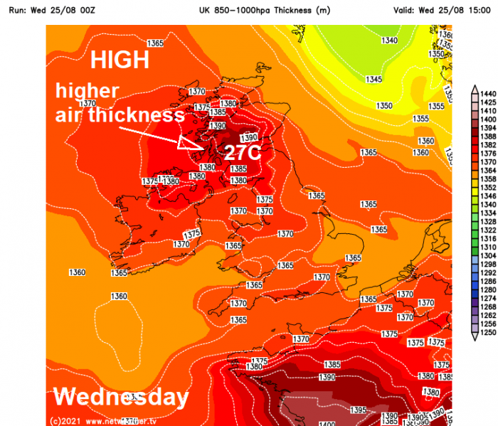
The heatwave temperature threshold for northern parts of the UK, as per Met Office heatwave threshold map above, is 25C. Will there be three days of 25C or more this week in a particular location in the warmer northwest? Likely no. It has been a very warm start to the week in the northwest, Monday’s high was 24.3C at Castlederg in Northern Ireland, Tuesday’s high was 26.1C at Strathallan in central Scotland. Today could see highs of 27 or 28C in western Scotland. However, a weak cold front will sweep west across the UK Thursday morning, introducing cooler air. So we are unlikely to see the very warm or locally hot conditions of early to mid-week in the northwest, with highs reaching 21-23C. Friday seeing 20-21C in the northwest.
.PNG?w=600)
So, it doesn’t look like there will be three consecutive days of 25C plus anywhere in the UK, let alone the northwest, which will see the highest temperatures this week. Though it is more unusual for the northwest to see the highest temperatures in late August and certainly parts of central and western Scotland are enjoying some summer warmth and feeling locally hot today, before it cools down from Thursday.
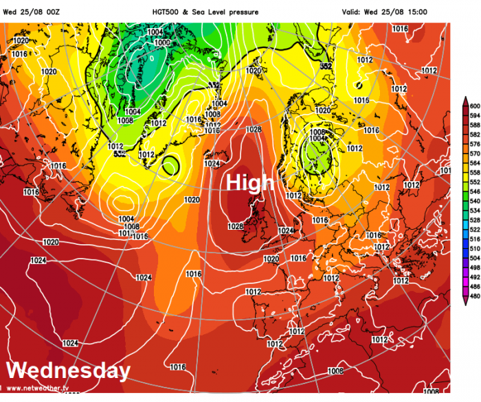
High pressure is firmly in control this week, bringing fine and dry weather for all. However, as often is the case, there will be cloud floating around the periphery of the anticyclone. Where the high positions will determine who see clearer skies, lighter winds, sunshine and warmer temperatures towards the centre and who see breezier and cloudier conditions further away from the centre.
This week, the high has been centred offshore close to the northwest since the start of the week, meaning lighter winds, higher pressure / air thickness have been across the northwest closer to the centre – leading to the highest temperatures here too. Further away from the high centre across central, southern and eastern England – there’s been a keen northeasterly wind, which has fed cloudier skies and cooler conditions off the North Sea at times so far this week.
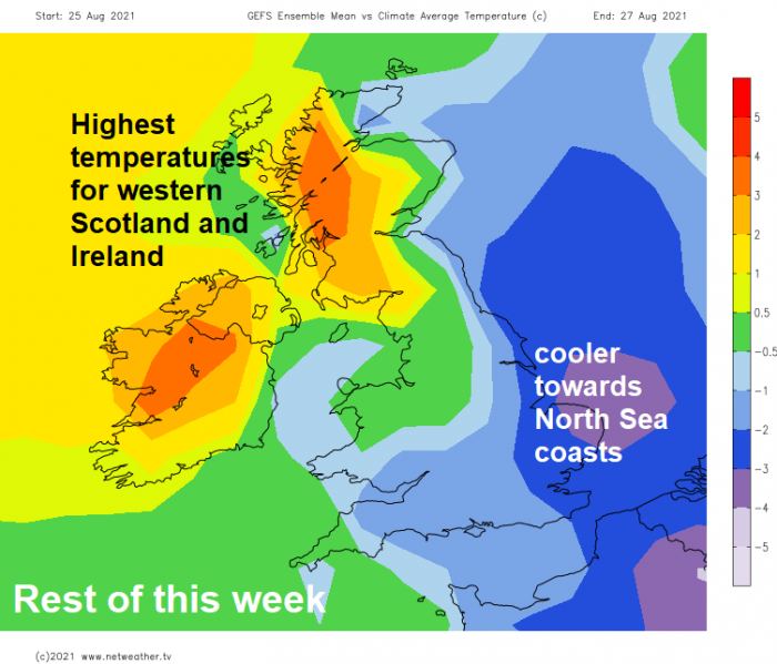
The high centre subtly drifts further east to the north of Scotland on Thursday and Friday, which will allow cooler air from the east to spread across all parts of the UK, including the northwest which has been warmest all week. So, a cooler end to the week for all. The weekend looks to remain settled with the high centre repositioning back to the northwest of Britain again. So, for most it will remain dry with variable amounts of cloud and sunny spells, cloud thick enough in places to bring the odd spot of rain, particularly across the southeast, but no sign of a heatwave! Temperatures reaching the low 20s Celsius at best.
Loading recent activity...