A murky grey, calm start to the week but turning wet and windy later. Fog and mist in this mild air but it will become fresher, more blustery with rain from the west mid-week onwards.
It is a grey, murky but mild and calm start this morning. For those who are out on the roads, do be aware there is fog in places. This week will be milder than last with a southerly flow. There is some rain about, heavy and persistent from the west.
High pressure over Europe brings settled, calm conditions for Monday but Atlantic frontal systems will manage to sway over the UK bringing the rain but also more windy weather as the week progresses. Today there is some showery rain working its way up from the south.
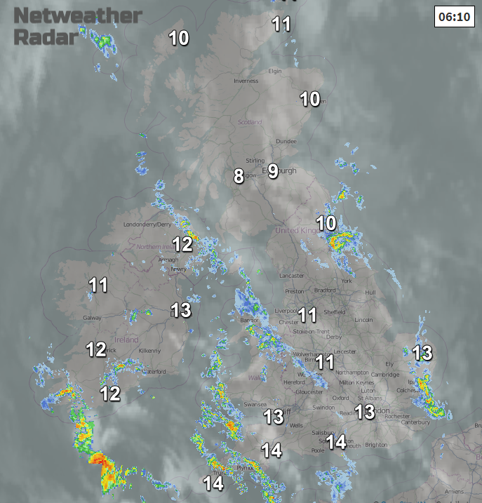
Brighter breaks do appear, to the lee of high ground in the south to SE light winds. North Wales, NW England and parts of Scotland. The rain foes gather itself today down to the SW. There will dampness and patchy rain for NE Britain and western Scotland, also over Northern Ireland but the bands of showery rain just keep on coming for Wales and SW England, and through the afternoon these spread over southern England. There could be some surface water issues from this rain and due to conditions on the ground. Further rain works its way over England this evening, heading NE and the Irish Sea stays murky and damp as does Wales.
UK temperatures during the weekend passed 17C. Today they are still above average around 12-15C, no widespread frost issues expected this week. Thursday morning looks nippy for Northern Ireland and Thursday evening for inland Scotland
Tonight remains cloudy and mild with hardly any wind for most. There will be some clearer spells, mainly for northern Scotland where temperatures will dip. The fading outbreaks of rain edge north-eastwards but in the murky conditions, there will be some mist and fog for Tuesday morning.
Tuesday should become brighter over much of Britain after some early showery outbreaks in the SW. Again, hardly any breeze, a mild start and temperatures in the mid-teens. The southerly breeze will pick up for Northern Ireland and west coast Scotland, the Northern Isles during the afternoon, and freshen in the evening.
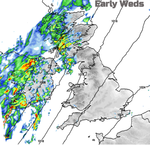
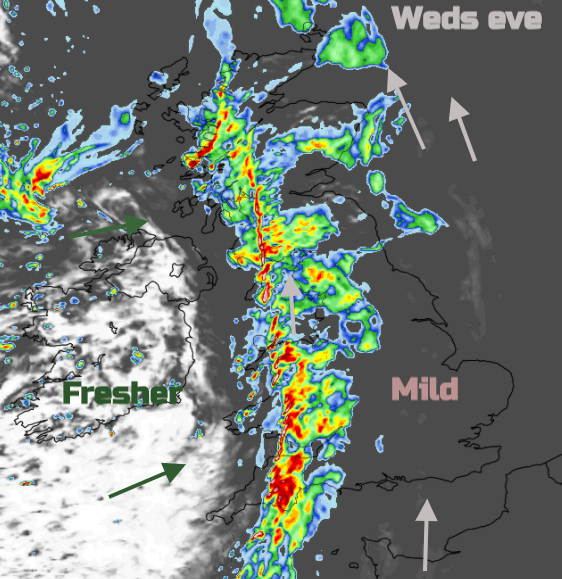
During Tuesday night a frontal band of heavier rain arrives from the west over Ireland. So, Wednesday will start wet and windy for Northern Ireland with fresh to strong southerly winds for coastal western Britain and through the Irish Sea during the morning. This will stir the gloomy murky on the deck at least. This waving frontal band is forecast to move across Northern Ireland and then Britain during the second half of Wednesday as an active cold front. Ahead of this there will be another quiet start again with mist and fog, light winds but some brightness over SE Britain and a cooler start for the E. The progress of this heavy rain has lower confidence for timing and positioning, but it looks to move over western Britain by Wednesday evening with heavy downpours, strong gusty winds and brings the risk of surface water flooding. There are a lot of fallen leaves about.
Colder, fresher clear air spreads across the UK from the Atlantic following the passage of the front with a brief ridge of high pressure. So, Thursday see a fine, sunny start after some blustery wet weather during the night.
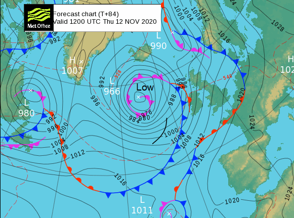
However another low pressure will be getting closer from the Atlantic, this lurks south of Iceland but NW of the UK and will bring further wet and windy weather in from the west as a waving front also introduces rain from the south.
Caribbean - Eta is still going and could be one of the longest-lasting November Atlantic cyclones. During the weekend it moved away from Central America, leaving devastation from flooding in its wake. Over Cuba which is still at risk of further heavy rain and flooding along with Jamaica. TS Eta is now close to southern Florida, having made landfall over the Florida Keys and there are widespread Tropical Storm warnings. It could strengthen to hurricane status once more over the warm waters of the Gulf of Mexico.