If it's back to school in your household today, good luck and pack a jumper, it's cool with those open windows. Rain is moving in from the west as blustery winds pick up later this week.
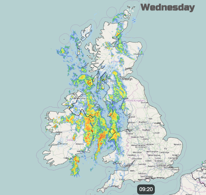
There is a wet start this morning for Northern Ireland and western Scotland. Fine for much of England as more pupils go Back to school today and the band of rain will continue to push into over Wales from the west. By hometime the heavier rain will be over Merseyside and West Midlands, Peak District and Pennines, NW England into SW Scotland
A selection of low pressures move between northern Scotland and Iceland swinging weather fronts over the UK with ongoing wet weather for western Scotland and blustery winds picking up for more northern parts of the UK. Away from areas exposed to the westerly flow and further south, there will be a lot of dry weather for the second half of the week. Midweek, warm air is caught up in the weather fronts, a warm sector moving over Britain by Wednesday night but replaced by cooler air across the UK for the weekend.
Today
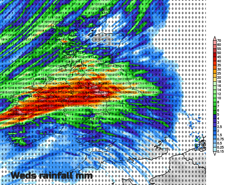
A fine start for much of England and eastern Wales with fine, bright weather and light winds. It is a wet start this morning for Northern Ireland and that band of rain is already over western Britain, quite showery over Cornwall and Devon but already reaching further inland for Scotland. The warm front rain moves over Britain for the second half of today with the cold front over Northern Ireland and Western Scotland later today. This includes the heaviest rain and there is already a yellow rain warning for SW Scotland with concerns being highlight by SEPA. Northern Ireland, the Isle of Man and NW England, particularly Cumbria and the far north of Lancashire will also see high rainfall totals by the end of today.
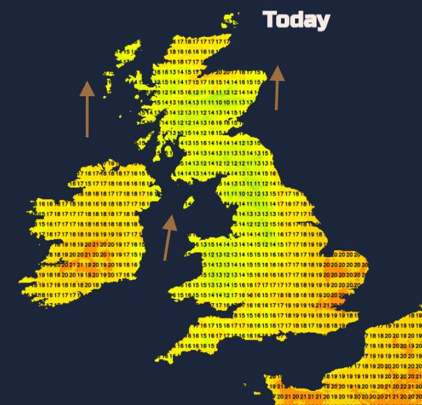
After a cool start today, there will be some warmth for eastern England and the far north of Scotland, to the lee of the mountains in a freshening southerly breeze. Within the warm sector Ireland will also warm up even with the cloud and rain. There will be light winds for much of England but coastal gales around the Irish Sea, Isle of Man, The Minch and Northern Isles by this afternoon and evening.
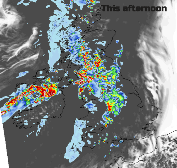
The cold front works its way SE over Britain on Thursday. There will be more cloud about until the cold front digs south tomorrow allowing breaks and brightness. There will be a grey warm morning for southern Britain with a line of patchy rain, although quite murky and wet for the north coast of SW England. This band of damp weather really takes its time on Thursday to reach SE England by later afternoon. A scattering of showers begins to appear for NW UK in the fresher SW then westerly winds.
Later in the week, there will be blustery showers whirling around the low to the north. These mainly affecting exposed north-western areas. Elsewhere feeling fresher but a good deal of fair weather but not that warm. School children should take their jumpers as with all those open classroom windows, it can feel a bit chilly. Advice from those who’ve been back a while.
It is now meteorological autumn and it will feel more like that by the weekend. The new Storm Names list is out for 2020/21. Around the world, there are three named cyclones being watched and TS Omar out in the Atlantic not troubling anyone.
Tropical Storm Nana in the Caribbean Sea is heading west and will affect Belize and Honduras as a hurricane midweek.

Typhoon Mayask is already close to the Korean peninsula heading north. Haishen could hit the main islands of Japan at the weekend, currently developing into a typhoon over very warm ocean waters It will then continue heading north towards Korea.