After fair weather to start this week, heavy, thundery showers return to the UK bringing the risk of surface water flooding.
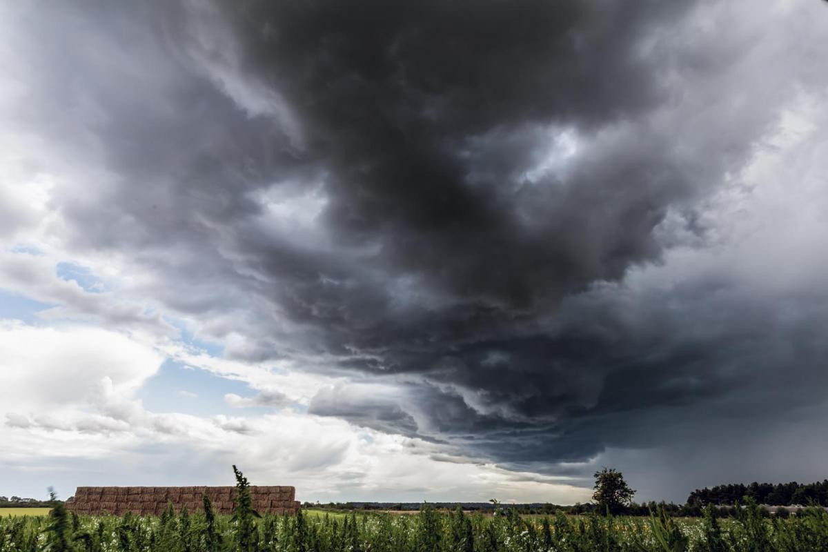
Back in February 2020, it rained a lot. It was the wettest UK February on record. Since then we have had the sunniest UK spring (March, April, May) on record and the driest May on record for England. June 2020 has certainly been different already. The first week was more unsettled, not as warm or sunny and there has been rain. Heavy, thundery showers at the weekend produced some stunning skies and this shelf cloud in Essex.
This week starts off quieter with light winds, ideal for #BikeWeekUK as so many more people have taken to cycling in the past few months under lockdown restrictions.
However low pressure moves in midweek and there will be more heavy and thundery downpours. After an unsettled Wednesday across the UK, the threat will be higher for England and Wales, then southern Britain as the week progresses. These convective showers bring the risk of surface water flooding. The downpours can result in sudden high rainfall totals concentrated in one or two small areas. If they are slow-moving, then the rain continues for tens of minutes occasionally an hour in certain conditions.
After the recent dry weather with baking sunshine the ground has hardened, the grass browned, and rain can struggle to soak in. More of an ongoing modern problem is urban runoff with more concrete, few lawns, and just more housing and infrastructure. The rain has to go somewhere. You may have seen ponds or surface drainage systems in new housing estates, introduced to deal with surface water runoff. Flood warnings from the environment agencies can cover coastal flooding with high tides and wave forecasting, groundwater flooding and river flooding. Surface water flooding is more difficult to pinpoint as the showers themselves are individual cells that could soak your street but a mile down the road remains dry and sunny.
People who live near a river or the coast should have an eye to high tides or rising river levels after ongoing heavy rains. Even then flooding can catch people out. However, surface water flooding can occur anywhere, and urban areas are more prone. It hits transport as roads become waterlogged and underpasses or roads under rail lines flood. A car stalls and then a huge traffic jam occurs, and it takes hours for commuters in a town or city to get home after work.
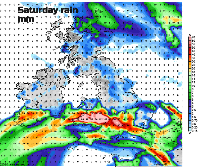
The rainfall total map for Saturday shows totals over 100mm as much more humid and warm air flows in from the east, giving extra energy to the unsettled weather from a low to the south. The positioning of this rain should not be taken at face value. Think of it as a theme with low confidence in any detail but it shows the potential for some very high totals in places. Half these amounts look more likely, in the heavier downpours.
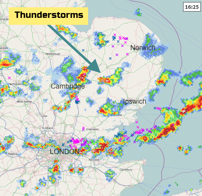
These hefty downpours or thunderstorms are more common in summertime. If you do see a Met Office warning for heavy rain or thunderstorms and a yellow warning area, remember these are individual cells and it’s where all the water heads and flows that can cause the flooding issues.
If you do get a downpour you might be grateful for it watering the garden or refilling the water butt. Farmers and growers will be pleased as long as any storms don’t cause damage. A bit like a small child “helping” with the watering of the garden, having the hose on full blast on an unsuitable setting.