The weather will remain fairly benign but chilly as we close out 2025, but a big change is on the way as we start the New Year, with a potent plunge of cold arctic air from the north on the way next weekend, with an increasing risk of snow for some too.
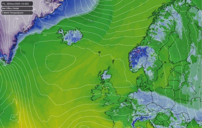
The closing days of 2025, as they have been over Christmas, are looking mostly dry, settled but on the chilly side, thanks to high pressure in control. Temperatures have risen a little over the weekend, as high pressure that has been over Scandinavia shifts westwards to be centred to the northwest of the UK over the weekend. This means the dry and cold continental flow from the east is cut-off to be replaced by a cloudier and less cold maritime airmass from the north looping around the top of the high migrating west.
After a chilly start, especially where skies cleared overnight, Sunday will be another dry and settled day, though many areas will see cloudy skies spilling down from the north and northeast, temperatures reaching 6-9C across England and Wales, but perhaps only 4-6C across Scotland. The far west should enjoy some winter sunshine.
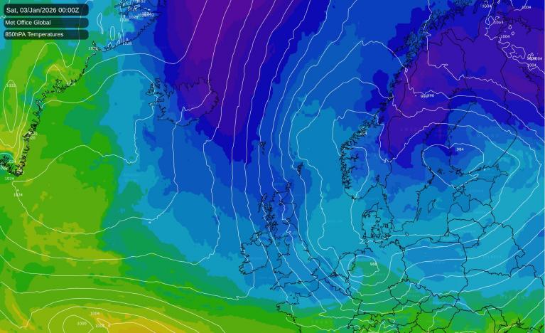
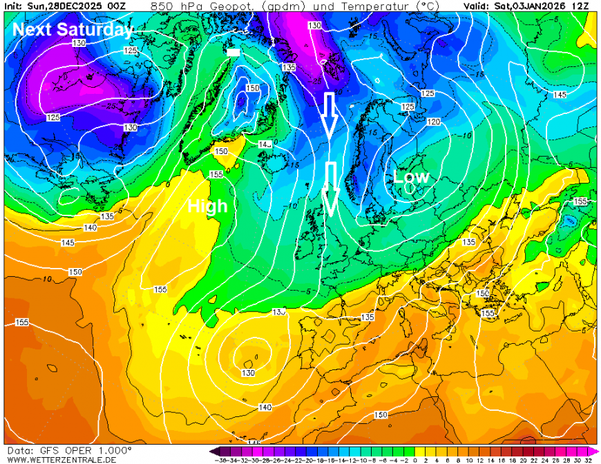
Some changes to the north next week, as the upper flow amplifies upstream over North America and allows an upper level ridge to punch north over Greenland. This will shut off less cold maritime air sourced from the northwest Atlantic looping around the top of the high to the northwest and dropping south towards the UK. Instead, it will allow deeper cold arctic air to spread south across the UK and Ireland at the end of the week, with an increasing risk of snow with the colder air moving down across all parts next weekend.
Upper flow amplifying upstream will allow an upper level ridge to punch north over Greenland while cold arctic air is pushed south over UK and Europe from late next week
Early next week is looking to remain mostly dry and settled across many areas. Monday & Tuesday will stay chilly, and cloudy for most, though some sunny spells may develop over the north-west and far west. New Year's Eve will see sunshine return in the south, but cloudier and windier further north with a few showers arriving later in far northern Scotland.
New Year’s Day a brisk northwesterly wind will develop across all areas, further showers for northern Scotland and coastal areas of the north further south, these showers perhaps turning increasingly wintry across northern Scotland by the end of the day, as winds turn more northerly and colder air from the arctic arrives.
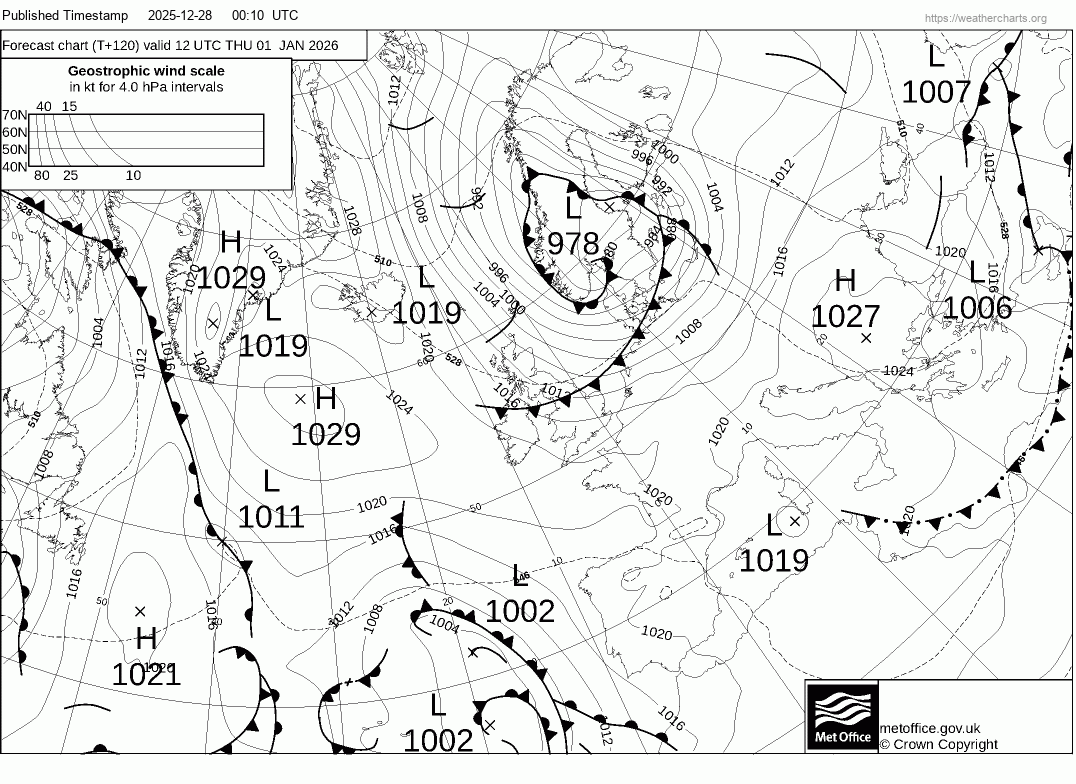
T+120 fax chart for noon New Year's Day shows cold front clearing south introducing cold arctic northerly flow, 528 dam line showing airmass cold enough for snow arriving from the north.
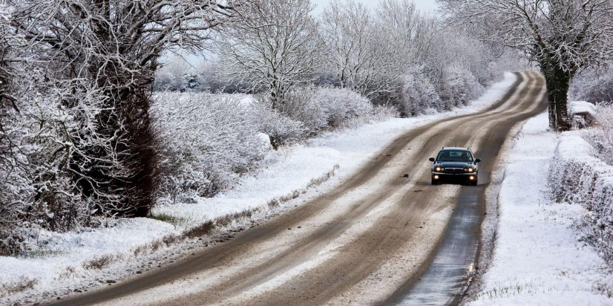
There is now good confidence from models that colder arctic air spreads south to all parts by the weekend on brisk northerly winds, with a risk of wintry showers falling as snow, even at lower levels in the south, spreading south next weekend, giving local accumulations, especially higher ground, but perhaps lower levels too.. Showers most frequent across northern Scotland and towards coasts exposed to the northerly wind, often referred to as the ‘wishbone effect’. Wintry showers may penetrate inland too with any troughs in the northerly flow, though these can’t be forecast until nearer the time. Widespread overnight frost likely where skies clear, but uncertainty over the depth of cold and how long the northerly flow will last.
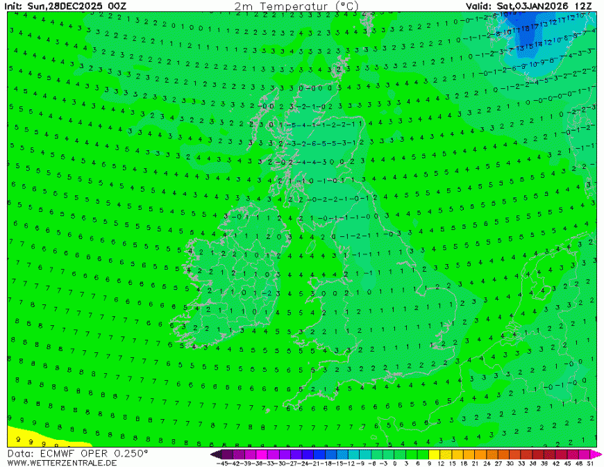
It is looking very cold next weekend, temperatures forecast by ECMWF struggling to get above freezing during the day, particularly Sunday. So there will be a risk of ice where sleet, hail and snow showers fall. Some hard frosts likely overnight where skies clear and especially if winds fall light.
The very cold conditions look to continue into the following week too, though uncertainty how long. If the cold arctic air lingers, then potential lows may move off the Atlantic to bring some snow too, but that’s a long way off.
Loading recent activity...