The weather this week will become milder as winds swing round into the south but despite that change and a couple of drier interludes the overall theme is still an unsettled one.
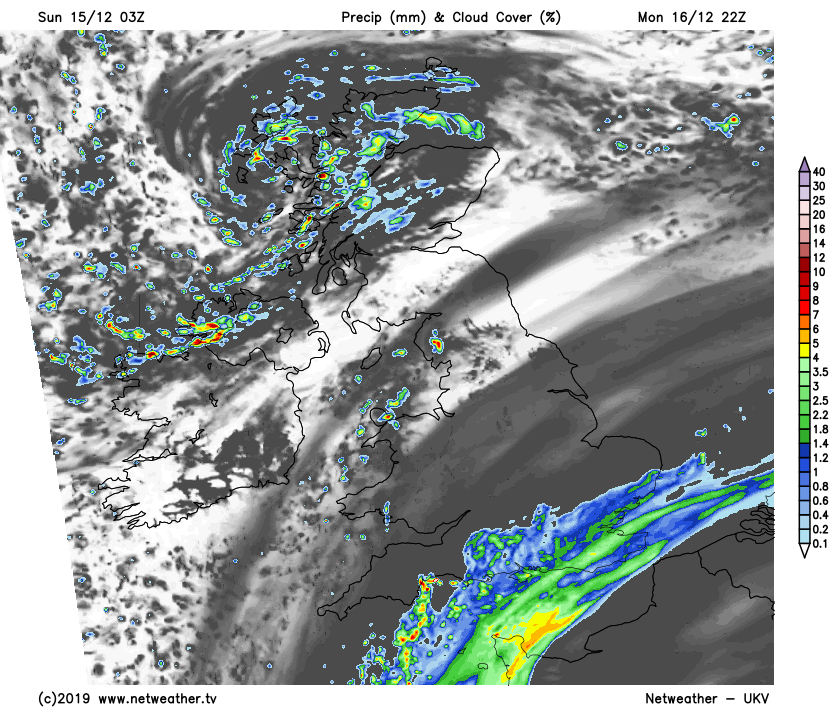
Today (Sunday) won't see the weather changing much from yesterday, with another day of sunny spells and blustery showers. The showers will again be most frequent in the west, with sleet and snow up over the hills - especially in the north.
Into next week, the showers will become mostly confined to the northwest on Monday, with some rain also moving up into the southeast later. Other parts stay drier and brighter with lighter winds, and that will continue into Tuesday as well. But milder and wetter conditions will return from the southwest from midweek, with the unsettled weather then sticking around right through to the end of the week.
Looking in more detail at today, there'll be some quite hefty showers blowing through at times, especially in the west and south. Central and eastern Scotland will be in with the best shot of staying dry again though, with eastern regions generally seeing the best of the sunny spells. It'll be another cold feeling day, with temperatures tempered by the wind. So, the thermometer may show 4-9c, but it'll feel a good few degrees colder than that.
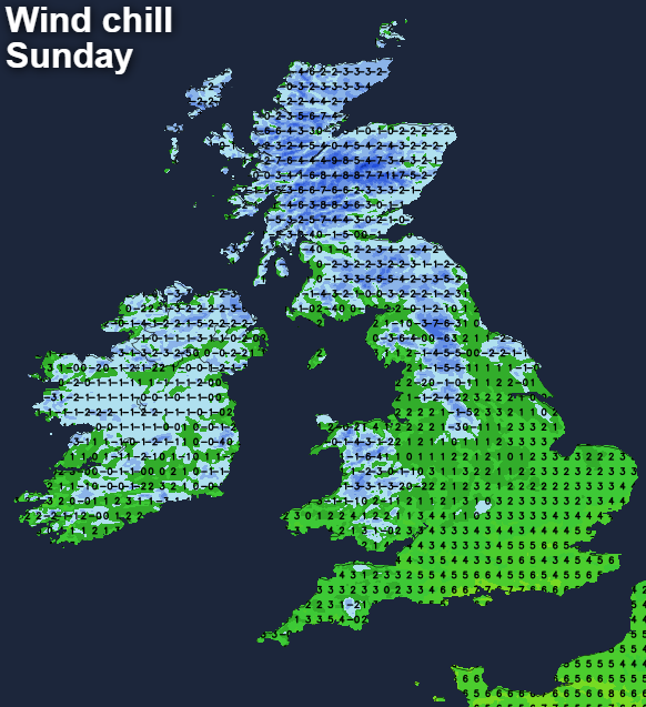
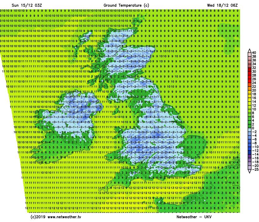
Overnight tonight, the showers will continue in the west especially, but with clear spells in the north, there will be a frost and some icy patches. Further south, with more cloud, temperatures will stay above freezing.
Monday will see low pressure still closeby to the northwest of Scotland, and it'll be here where the focus of the showers will be, with just a few running into other western regions. Much of the rest of the country will see a dry day, with some sunny spells. Cloud will thicken from the southeast during the day, with rain arriving during the afternoon and into the evening.
It'll be another cold day away from the milder far south, but with lighter winds across the southern half of Britain, it won't feel quite as cold here. Overnight, the rain in the southeast will move a little further north into the East Midlands, and East Anglia, the showers in the northwest will continue as well. In between though, it'll be dry with varying amounts of cloud and a patchy frost.
Then, into Tuesday we'll see a couple of things happening. The rain in the southeast will start to move away, and the low pressure close to the northwest of Scotland will finally begin to move east as well. That should mean the showers in the northwest start to become fewer and further between, initially transferring the bulk of them east across the north of Scotland. But by the evening, much of the country will be dry with just a scattering of showers. That'll leave a window of clearer weather overnight, which is likely to mean a quite widespread frost, with the risk of some fog patches - some of which may be freezing.
Many parts look set to stay dry into Wednesday, but a change to milder, wetter weather will be on the way. It's likely to be the far southwest of England and much of Ireland seeing it first, but by the end of the day, a band of rain will move through to other parts. Then, with winds blowing from a southerly direction for the remainder of the week, temperatures will be up on where they've been of late, but rain will still be a frequent visitor.