More rain on the cards this week, as an ex tropical storm pays a visit by mid-week, could bring further flooding issues. Turning colder from Friday, leading to a cold but drier start to December
For much of this week it will be on the mild side thanks to south to southwesterly winds, particularly across the south, with temperatures reaching low to mid double figures. But colder air arriving from the arctic and moving down across Scotland on Thursday looks to spread to all parts on Friday and this colder airmass looks like lingering through the weekend and into the start of next week. So a cold start to December likely, with the prospect of some wintry showers in the north, falling as snow, particularly over higher ground.
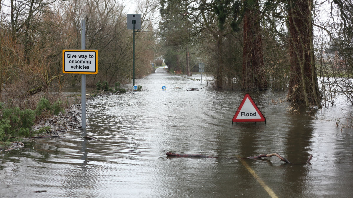
For the next few days weather prospects, we look to the southwest, to an ex-tropical system that will bring wind and rain to many parts from tomorrow, gales across the south and southwest and also mild tropical maritime air. The rain from this system will be heaviest and most persistent in the southwest on Tuesday and in the northeast on Wednesday, falling on already saturated ground it brings a risk of further flooding.
Post tropical cyclone Sebastien, which formed over the tropical North Atlantic to the east of the Leeward Islands of the Caribbean last week, is expected to take aim at the British Isles this week. Over the last few days Sebastien was a tropical storm and tracked northeast from the mid-Atlantic passing close to the Azores this morning. For a time, Sebastien was expected to strengthen into a category one hurricane, which is rare over the Atlantic for this late in November, but in the end didn’t quite strengthen enough.

Sebastien is bringing heavy rain and gusty winds to the parts of the Azores this morning, before it then continues to track northeast towards southern Ireland for tomorrow. It is now an ex tropical cyclone, having lost its tropical storm characteristics, as it continues northeast over progressively colder waters and merges with the upper westerlies / polar front jet stream and develops characteristics typical of a mid-latitude depression moving across the north Atlantic.

Sebastien will still have some remnant tropical warmth and moisture wrapped up in it, so it will continue to deepen as this airmass collides with colder air to the north of the polar front jet. The fairly deep low will bring gales to the southwest on Tuesday while bringing some heavy rain to the southwest (see Met Office yellow warning for rain below) and a spell of rain moving northeast elsewhere followed by heavy showers in the south. The low arrives close to SW Ireland by middle of Tuesday, before it tracks east somewhere across southern Britain on Wednesday.
As the low tracks across the south on Wednesday it looks like bringing gales through the English Channel, so probably likely to be some disruption to cross-channel ferry crossings. Showers are likely across many parts on Wednesday circulating around the low as it moves across the south. But late in the day and overnight into Thursday there is the potential for longer spells of rain to feed off the North Sea and affect NE England and Scotland, which falling on already saturated ground across NE England and east of Scotland could increase the risk of flooding here.
Low pressure clears northeast across the Low countries on Thursday, before heading towards the Baltic on Friday, bringing quite a bit of snow to Sweden as cold air wraps into the low from the arctic. The low will also pull down colder air from the arctic across Scotland on Thursday, before this colder air filters down across all parts on Friday. Both days should be mostly dry and fine though, as high pressure topples in from the northwest.

A widespread frost likely Friday night, so a cold start to the weekend. The cold air looks to hang around through the weekend, though some uncertainty over how far north a low pressure system moving in from the Atlantic gets as it arrives across western Europe on Saturday. ECMWF model bring the low centre across Britanny before it dives southeast, this would bring rain across the south and perhaps some hill snow across Wales. GFS model, on the other hand, takes the low further south, so much of the UK dry and cold on Saturday, though wintry showers across northern Scotland. A cold day on Sunday, 1st day of December, with a northerly flow bringing wintry showers to Scotland and down eastern and western coasts, but elsewhere a bright but chilly winters day.
It looks like high pressure over the Atlantic will topple across the UK early next week, though uncertainty between the models over how quickly. But it looks to continue on the cold side early next week, with widespread frost overnight, perhaps still some wintry showers on Monday towards coasts, but turning drier thereafter as high pressure moves over. Signs are that later in the week it will turn unsettled, milder and windy off the Atlantic as upper level ridging that has persisted over Greenland over recent days is replaced by upper troughing and low pressure to the northwest of Britain