SW England has a lot of rain on the way for the rest of November. It's already been wet and there is rain forecast for more of the UK this weekend as areas have barely recovered from this month's flooding.
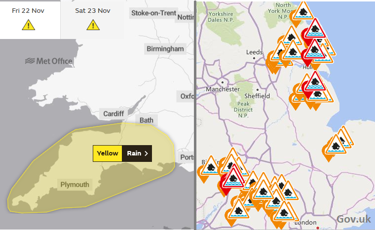
There are three types of flooding being warned about today. Groundwater flooding on Humberside, River flooding risk still for the Severn, Lincolnshire and in East Riding of Yorkshire, these as flood warnings from the Environment Agency. There is also a Yellow warning for rain from the UK Met Office due to Surface Water flooding. From noon today until Saturday evening “Persistent rain leading to some flooding and disruption.”
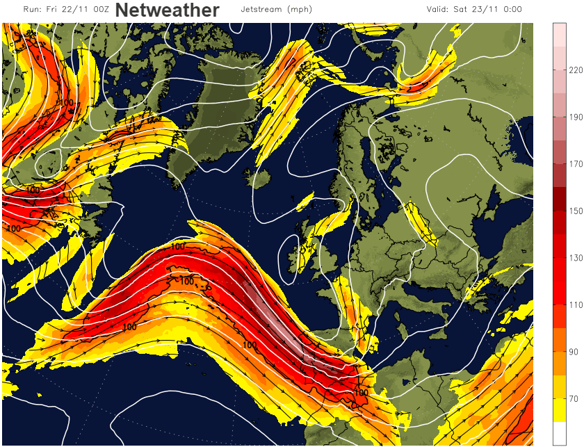
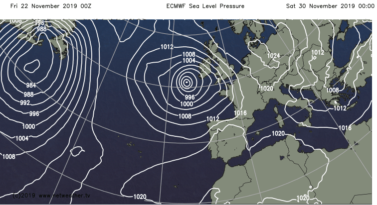
A low pressure has eased over the Bay of Biscay and will move up through France on Saturday and fades as it heads north over Scotland on Sunday, being over run by the next Atlantic low. Yet again surface low pressures are just getting stuck near to the UK as great meanders in the jet stream buckle overhead nearby. The jet dips further south next week and there will be more unsettled weather and so more rain for southern Britain, especially SW England.
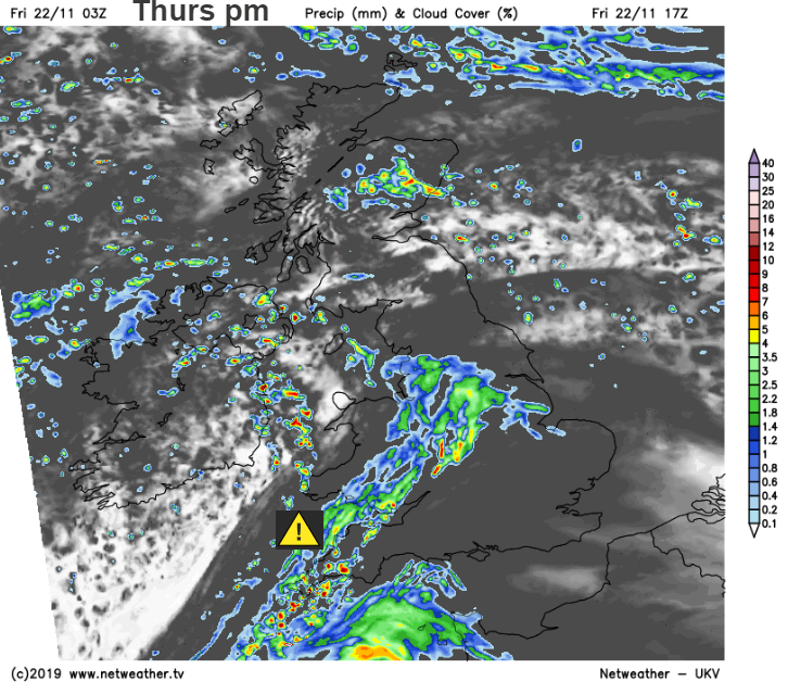
There are bands of rain rotating around this low pressure and ahead of it bringing more cloud to the UK today. It is a mild start with an east to south breeze. There are scattered bits of rain but one more distinct band over Northern Ireland and northern England which will move up into southern then eastern Scotland today. Over southern Britain, particularly SW Wales and SW England there are heavier pulses of rain which gather themselves by lunchtime, hence the yellow warning. This includes some thundery showers and by Saturday “20 to 30 mm is likely to fall quite widely, and 40 to 50 mm may accumulate in a few places, most likely across the higher ground of south Devon.” Northern Ireland will also have some sharp showers today, it has been pretty wet here this week.
The SW rain will push towards the Midlands over the Severn catchment area. Other parts of England and Wales will have a grey cloudy day, with temperatures around 7 to 9C. For Scotland, away from the rain area, there will be brighter spells, even some sunshine with temperatures of 5 to 8C in an east wind.
Further bands of rain rotate up from the low with mild enough air, plenty of cloud and more rain for SW Britain but also NE England and eastern Scotland. By Saturday night the main rain is over Scotland and then there is a cloudy lull on Sunday for the UK. It’s a brief lull, with temperatures in the brighter SE up to 12 or 13C and later on Sunday, the next area of heavy rain arrives for Wales and SW England.
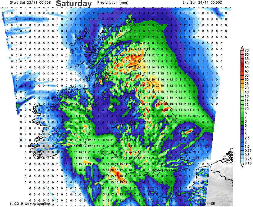
“Local surface water and river flooding is possible more widely across parts of England and Wales on Saturday and into Sunday. Also possible across parts of the south of England and possible but not expected more widely across England and Wales on Monday” EA
So, more rain from the SW on Sunday night with blustery winds, still over Northern Ireland on Monday morning and moving north through Britain. Then potentially another low pressure and more rain for SW Tuesday. Southwest Britain looks rather wet next week, there could be flooding issues and windy along the Channel coasts.
After that some milder air now showing for the start of December but with the European model throwing up a deep low for the end of November but GFS not so keen. A fair way off but We’ve still not had a named storm yet this season.