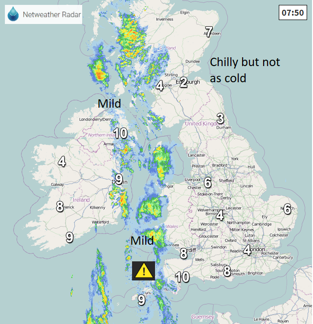
It's not as cold today with rain out west. More rain appears for SW England and south Wales as low pressures swirl around the UK for the next few days.
It’s not as cold this morning, there is more cloud about and still some mist and murk. A low pressure is stuck to the west of Ireland and the frontal bands from this are barely moving, bringing rain to western Scotland, eastern counties of Northern Ireland, through the Irish Sea into western Wales, the Isle of Man and Devon & Cornwall. There is a Met Office yellow warning for Rain this morning over Cornwall highlighting the risk of travel disruption.
Today for western parts of Britain there will be this early rain, but it fades. It is also more breezy with a fresh SE wind for Wales, SW England through the Irish Sea and the North Channel. Although it stays damp and blustery for Dumfries & Galloway, the Inner Hebrides, Co. Antrim and Co. Down much of Britain will have a fair day with bright spells interrupting the grey skies. There will also be a brighter slot for Co Fermanagh and Co Tyrone before the next band of rain rotates in around the low.
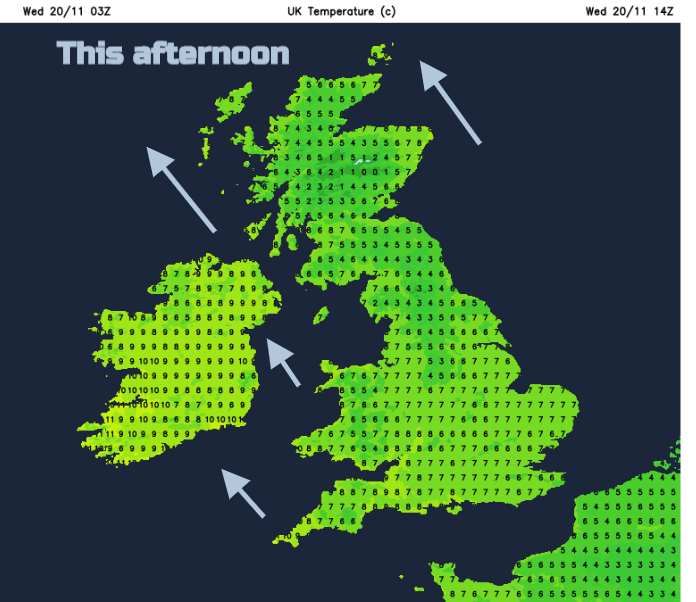
Temperatures will be around 6 to 9C today but feeling cooler where the breeze is brisk. More rain moves over Cornwall tonight where it stays mild, but for much of Britain it will be a cool night with temperatures around or just above freezing. Northern Ireland stays milder with more cloud.
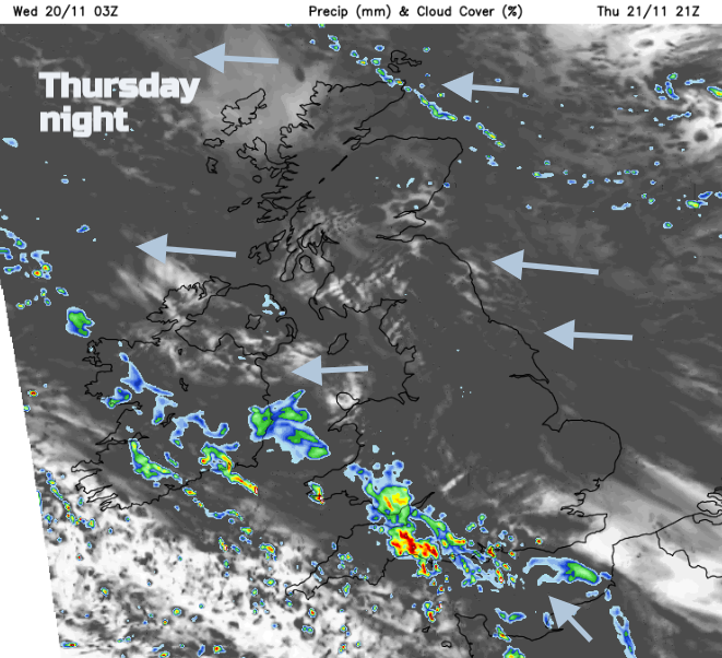
Through Thursday there will be more rain for Cornwall and Devon, later Somerset as much of the UK has another quiet, fair day. The winds back more to an easterly and the rain keeps coming for SW England, spreading towards Cardiff later in the evening. There is still a scattering of Flood warnings and alerts over England so any incoming rain will be viewed with concern.
"Local river flooding is possible in eastern parts of Yorkshire Wednesday. Local flooding from groundwater is possible in North Lincolnshire for the next five days. Local surface water and river flooding is also possible in south-west England and the south of Wales on Thursday and Friday and more widely across parts of Wales and south and central England on Saturday." Environment Agency
By the Weekend a new low pressure spins up over France and looks to bring a spell of rain up through Britain Satu5rday into Sunday. Then on Monday, a new Atlantic low moves our way, bringing rain from the west. Nothing like what we saw earlier in November but with the saturated ground and already high river levels the risk of flooding remains. Any snow?