
With an Amber warning for Thunderstorms issued for Monday evening rush hour and then more rain from the west, a look at the UK forecast for the week ahead. Video with Jo Farrow
With a wet, blustery not too cold theme looking to more likely than not to continue in the coming months we might have to get used to soggy ground and dodging puddles. There has already been plenty fo rain this October and before a large Atlantic low pressure churns its way over the UK for the rest of this week we have trouble from the south.
Thunderstorms are marching north. There already was a yellow warning for heavy rain over SE Britain but the UK Met Office has now issued an Amber warning as there is an area of thunderstorms and heavy rain which may bring travel disruption. Moderate impact and likely risk of occurring on the impact matrix.
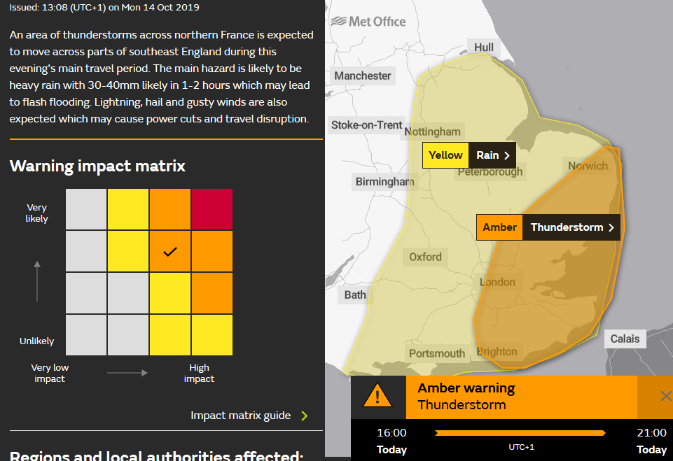
"An area of thunderstorms across northern France is expected to move across parts of southeast England during this evening's main travel period. The main hazard is likely to be heavy rain with 30-40mm likely in 1-2 hours which may lead to flash flooding. Lightning, hail and gusty winds are also expected which may cause power cuts and travel disruption."
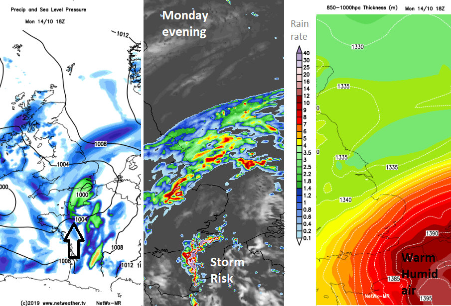
There is warm and humid air over France. Two small low pressures are affecting the UK on Monday, one bringing rain to Ireland and the other causing the rain over SE Britain. Caught up in this one is the feed of heavy showers and the risk of the thunderstorms clipping SE England during rush hour.
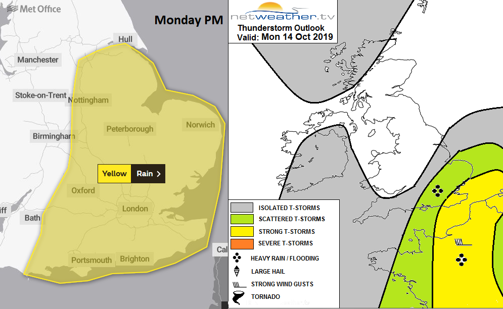
Nick has issued a Convective forecast for the thunderstorm risk on Monday.
"This will support areas of deep convection to develop and move NE, bringing some locally intense downpours accompanied by thunder and lightning in places. Strong deep layer shear (40-50 knots) is forecast, so convection will likely organise into multicell segments, perhaps even an isolated supercell, capable of producing locally intense rainfall leading to flash flooding, given forecast high precipitable water (PWAT) values of 30-33mm across SE England. Isolated strong wind gusts are also possible with stronger cells – particularly across far SE of England."
There are still several Flood alerts and just a few flood warnings out. The Environment Agency does have a low risk of flooding today and on Tuesday morning.
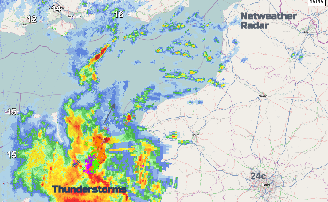
Keep an eye on the Netweather radar to see progress of thunderstorms on Monday and use animation button ON for motion, lightning to see sferics.


