Strong winds come and go over the next week with more rain from the Atlantic. There is a risk of localised flooding too.
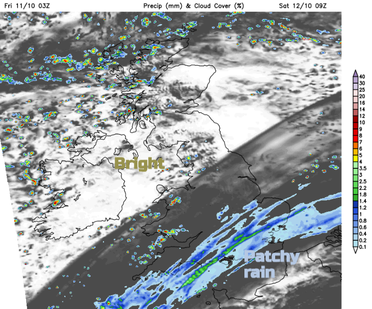
No let-up in the mobile Atlantic flow for the weekend. More rain today as flood warnings reappear and there are three areas covered by yellow warnings for rain from the Met Office. And it will be windy at times too.

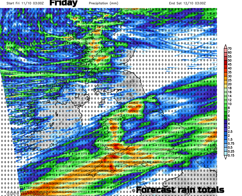
Somerset – “There has been an intense period of rainfall overnight on Friday 11th. Rivers are responding rapidly... It is possible flooding of low-lying properties and land may occur. Further bands of intense rain are forecast throughout Friday. “ Environment Agency
Western Scotland has had a yellow warning since Thursday with plenty of rain already and plenty more showers today as a low pressure centre grazes the far north. There are fresh and gusty SW winds which will veer to the NW later today when it will feel cooler.
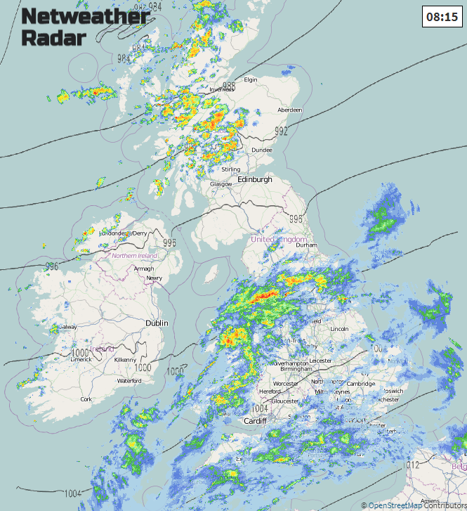
Much of Wales has a rain warning for today as does part of northern England into the north Midlands including the Pennines and Peak District. Here there is a waving front which will continue to feed rain in from the west, as it is forced up over the Welsh mountains or other hills further inland, it cools, and the air gives up its moisture. It rains more. The ground is already sodden in places after recent wet weather.
“Heavy rainfall may bring some localised flooding across parts of Wales, central and northern England on Friday.” MO
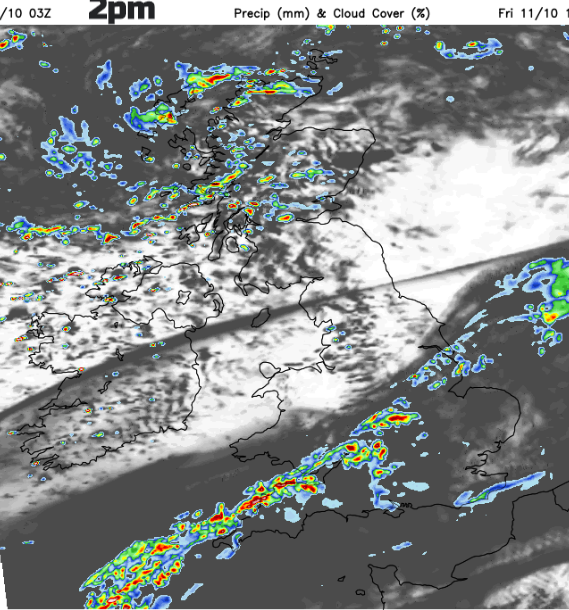
The frontal band does gradually sink south-eastwards during Friday. The air to the north is cooler with temperatures of 12 to 15 even though there will be sunny spells along with the showers. Ahead of the rain for southern England, particularly the SE temperatures could reach 17 or 18C away from the band of cloud and rain. It is windy this morning for southern Britain with a fresh SW wind. This continues for SE Britain into the afternoon as the winds veer to the west and ease off slowly for Wales and northern England. Kent will be windy this afternoon with gusty winds in the eastern Channel. Northern Ireland and much of Scotland continue with brisk winds all day with gusty winds channel through the Central Lowlands for a time which may cause some travel disruption for Friday evening including the A1 into NE England.
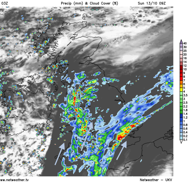
Tonight, the winds do ease off as the heavy showers in the north fade. The main rain clears from the SE as the next wave along the same front rears up for SW England. It looks nippy for inland Scotland.
Weekend
“Local flooding from rivers and surface water is possible across Wales and many parts of England and Wales on Saturday and Sunday. Land, roads and some properties could flood and there could be travel disruption.” Gov.uk
Saturday will be cooler, less windy for most although still blustery for NE Britain. There will be cloud and patchy rain over southern Britain from the front, but Ireland and northern Britain will have sunshine with just the odd shower. Some heavier pulses of rain feed up along the band over central southern England and East Anglia by Saturday evening.
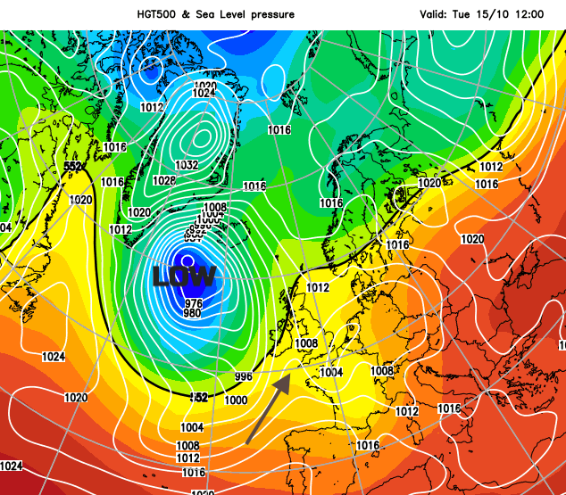
For the start of the new week there will be two pulses of heavy rain or showers from the SW. One early on Sunday moving up through Wales and England and then another during Monday. All adding to the soggy ground and river levels. Even after that there is a large deep area of low pressure which looks to sit nearer to Iceland for while next week and could bring more windy weather. More rain from the west looks likely too
Typhoon Hagibis is still heading for southern Japan with warnings for large waves and heavy rain already issued. Forecast to hit later on Saturday local time there are already cancellations in the Rugby World cup for two matches and plenty of controversy at the implications of that ruling. The possibility that Sunday’s matches could be played behind closed doors if there are concerns for the stadium area and travel after Hagibis moves away. Also, all of the events on Saturday for the F1 Japanese GP have been cancelled.