Staying unsettled and often windy for the rest of the week and through the weekend, with showers or longer spells of rain. No signs of a let up for now.
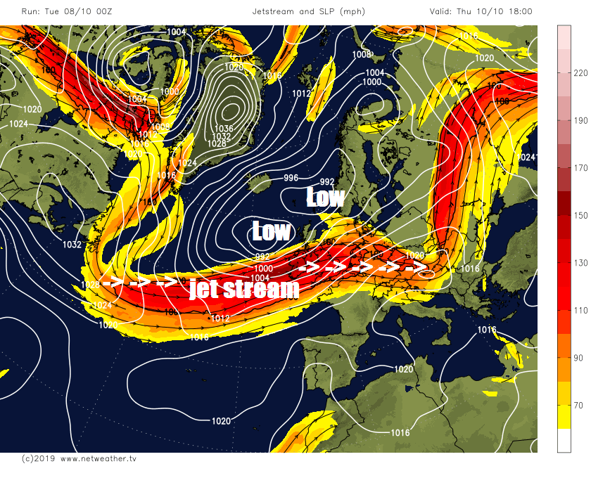
Monday was a rather cloudy day and many of us saw some rain, however, Tuesday should see more in the way of sunshine for most, but there will be scattered showers and it will windy too, especially in the north and west. Low pressure and a strong westerly jet stream over the UK will remain in charge for the rest of the week, low pressure on Wednesday centred close to NW Scotland, this low moves away to be replaced by another low close to the northwest on Thursday and Friday. So, a continuation of windy conditions with sunshine and blustery showers, or perhaps longer spells of rain in places. The weekend looks like continuing the unsettled theme too, with a mixture of spells of rain or sunshine and showers.
Low pressure close to the north and a strong jet stream will ensure unsettled conditions rest of this week and through the weekend.
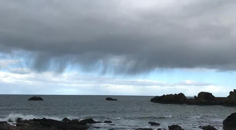
For now, it’s a blustery morning rush hour with showers already affecting many northern and western areas. However, across many southern, central and eastern parts of England it’s dry with plenty of sunshine, but this won’t last, as the showers in the north and west become more widespread across many areas. Showers will tend to be most frequent in the west, but blowing increasingly further east across the Midlands and southern England towards East Anglia through the afternoon too. Showers will be locally heavy, with a risk of thunder too - especially across southern England and along western coasts. Though parts of eastern England may escape showers and have a dry day. A windy day, particularly in the west, with some strong squally gusts as showers pass over, perhaps gusting to 30-40 mph.
Temperatures ranging from 13-15C across Scotland and Northern Ireland to 14-17C across England and Wales.
Showers continuing overnight, particularly towards western areas but also feeding further east at times, though there will be some clear spells – lengthy in the east. Windy, especially in the north and west.
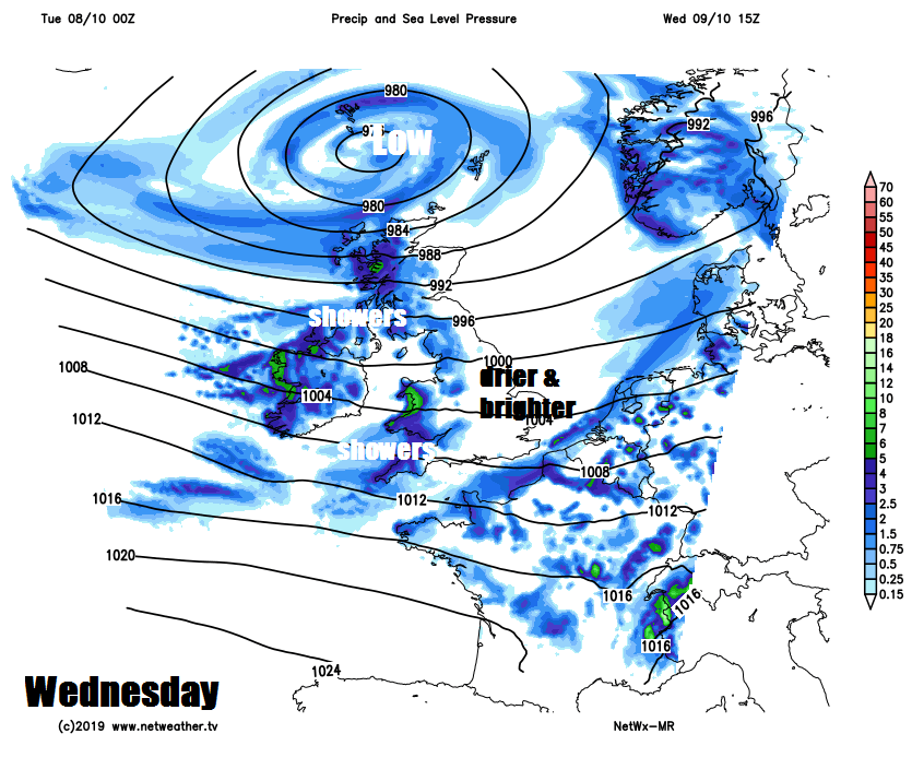
With low pressure close to the northwest, another day of sunshine and showers on Wednesday, band of showers moving through many areas on a brisk or strong westerly wind, perhaps longer spells of rain in the west. The longest of the drier and sunnier spells in the east. Feeling a little cooler than today in the strong westerly wind, temperatures reaching 13-15C.
The windy and unsettled theme persisting to the end of the week, Thursday perhaps seeing fewer showers across southern and eastern England, with many places staying dry with sunny spells. Further north and west showers merging into longer spells of rain spreading in from the west. Friday could see a band of rain shift southeast across England and Wales, reaching SE England by the evening, Scotland and N. Ireland seeing sunny spells and blustery showers. Windy everywhere.
Saturday perhaps wet across southern areas for much of the day, thanks to a slow-moving weather front, breezy with sunshine and showers further north. Sunday seeing rain clearing SE Britain first thing, then becoming drier and sunnier away from northern and western areas, where further showers are likely.