Hurricane Lorenzo has changed, it is now a significant low pressure which is forecast to impact Ireland on Thursday with wet and very windy weather. It will be known as Storm Lorenzo and also affect the UK
Storm Lorenzo has been named by Met Éireann on Wednesday 2nd October as they issue an orange wind warning for parts of Ireland. This will be the first named storm of the 2019/2020 season named but will keep the name Lorenzo after the hurricane it was linked to.
Often forecasters talk about remnants of tropical storms or ex-hurricanes but because this cyclone will have impacts for Ireland (and to a lesser extent the UK) it will take the name Storm Lorenzo.
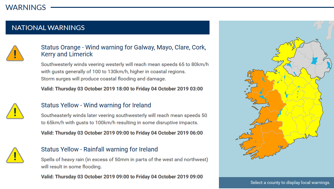
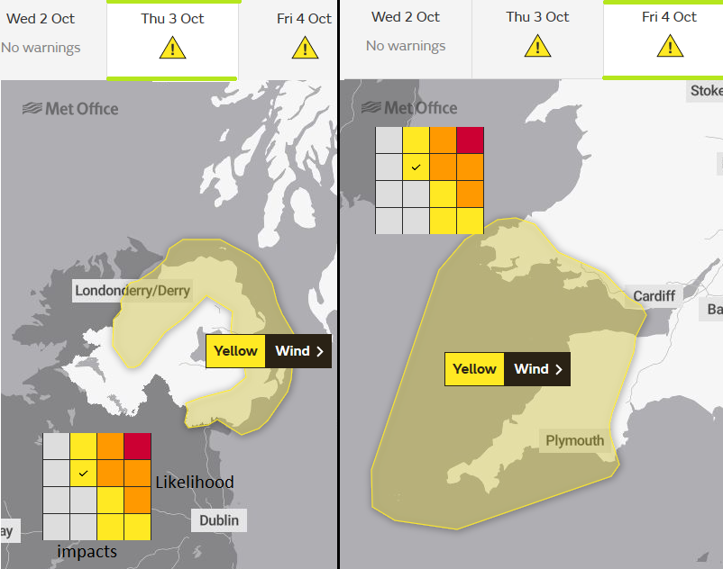
Currently, there is an orange wind warning for western counties in the Republic of Ireland, a widespread yellow wind and yellow warning for rain over Ireland on Thursday. Also a yellow wind warning for Northern Ireland on Thursday and SW Britain on Friday from the UK Met Office. More warnings are likely.
'The effects of Storm Lorenzo will begin to be felt across Ireland from Thursday morning, easing on Friday morning. The main impacts will include disruptive winds, falling trees and flooding. Coastal: Lorenzo is already producing significant swell, high waves and sizeable storm surges. This will lead to wave overtopping, some coastal flooding and damage, especially along western and southern coasts of Ireland. Saturated soils and the expected heavy/thundery rainfall may lead to surface flooding. River levels are currently elevated across the country and the rainfall may lead to river flooding.' Gusts up to 80mph are forecast.
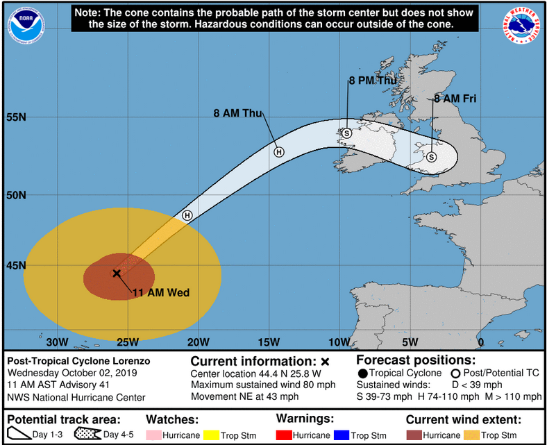
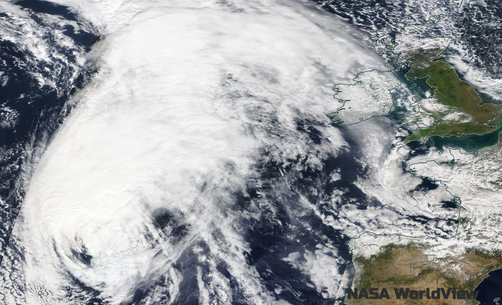
Hurricane Lorenzo moved passed the western Azores during Tuesday night , wrecking the only commercial port of the remote island of Flores which will hamper recovery efforts. The north Atlantic is being affected by a wide large swell from Lorenzo with huge waves and high seas. The cyclone has now undergone its transition to a post-tropical system, an extratropical low pressure which will look more like a familiar autumn low with weather fronts but will still be a significant storm.
The Republic of Ireland is expected to bear the brunt of this storm but there will still be strong winds and coastal gales for the UK, Irish Sea coasts, Wales, SW England and along the English Channel. There has already been flooding events this week, high tides and an extra heavy rain will cause issues even as the low pressure weakens across the UK.
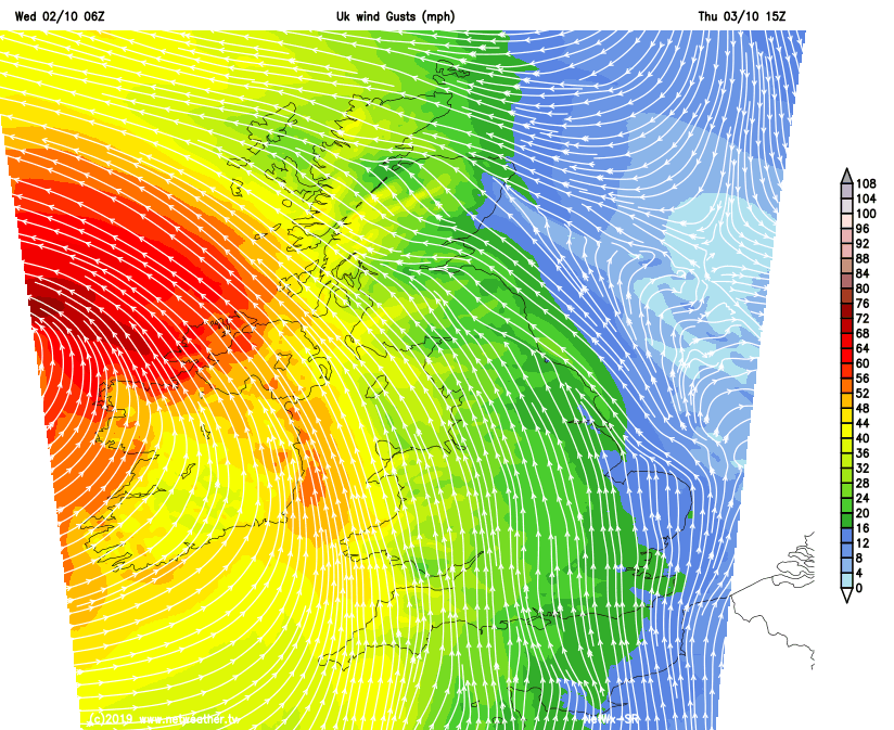
There is still some uncertainty about the path of the low, and so the main rain areas and strongest winds, as the storm is forecast to turn across southern Britain. It will be worth keeping an eye on the forecast and not just looking at an hourly output from a weather app. Looking at a broader picture such as the Netweather Radar will help. Also updating/signing up for the national weather warnings and local flood warnings.


.jpg?w=350)


.jpg?w=175)