


Lot's happening this week, with two main periods to keep an eye on. The first one, today and tomorrow will see yet more rain affecting England, the island of Ireland, Wales and southern Scotland. Then after a brief lull, we have the potential arrival of ex-hurricane Lorenzo.
Lot's happening this week, with two main periods to keep an eye on. The first one, today and tomorrow will see yet more rain affecting England, the island of Ireland, Wales and southern Scotland. Then after a brief lull, we have the potential arrival of ex-hurricane Lorenzo.
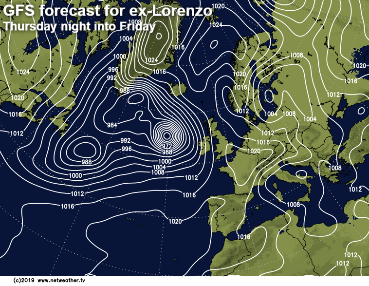
Ex-Lorenzo is a real headache to forecast at the moment, so forecasts for Thursday and Friday really are subject to a lot of change. The reason is that the models are struggling to pin down a track for it. At the moment, some stop it out to the west of the UK and Ireland, swinging it north towards Iceland before it gets sucked into another low. This scenario would keep the strongest winds away from our shores, bringing just a couple of bands of rain across from the Atlantic. This from the GFS.
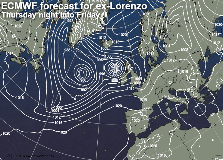
Others take it a bit further east, with Northern Ireland and western Scotland, in particular, bearing the brunt of some very strong winds. Other parts of the country would be blustery with rain bands moving down from the northwest. This is from the ECMWF model.
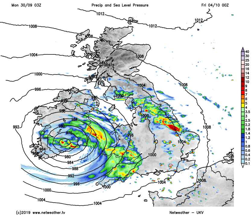
And others weaken it a bit more but swing it south across the southern half of Ireland and into Wales and southern England, bringing some very wet and windy weather. The UKV model shows this currently.
It's certainly one to watch, and it could bring some nasty weather conditions with it, but it's far from certain at this stage. So, if you see doomsday type stories in parts of the media, it's best to take them with a pinch of salt and look for forecasts from established weather forecasters for the latest picture.
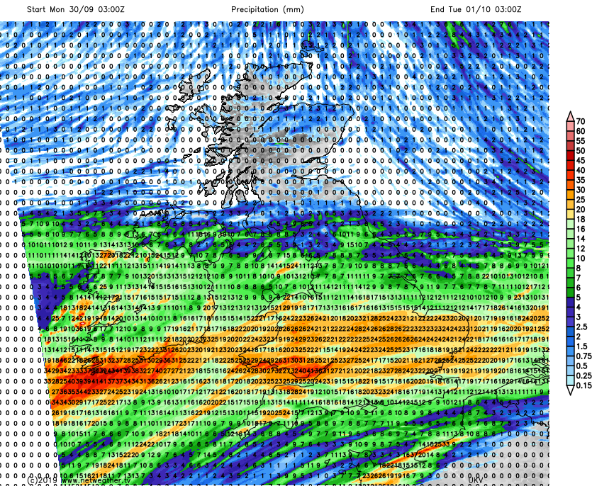
Back to today, and with numerous flood alerts and warnings across England and Wales, more rain is about the last thing that's needed, but that's precisely what we're getting. The wet weather has already crossed into the southern half of Ireland, with some patchy outbreaks into the southwest of England and South Wales. It'll head northeast relatively speedily through the day, with a good part of southern, central the south of northern England and Wales having a wet drive home from work this evening. The rain will just about scrape into southern Scotland later, but much of Scotland will stay dry with only a scattering of showers today.
The rainfall total forecast for today tells the story, with another 25-40mm plus in the wettest regions.
As the rain moves in, winds will increase too, becoming blustery just about everywhere, but particularly in the south. Gusts of 50-55mph or so are likely near channel coasts during the second half of the day before easing a bit overnight. Temperatures won't be anything to write home about today, as you may expect. They'll peak at 13-16c in most places, although some warmer air will arrive behind the rain, which could lift them to 17-19c in parts of the southwest of England and south of Ireland.
Overnight, the bulk of the rain will move away into the North Sea, although the north of England is likely to keep it going a while. Then into tomorrow, as the low responsible for this batch of wet weather crosses the south of the country, we'll have a north-south split. That'll bring some heavy, perhaps thundery showers for the southern half of the UK. Head north, and it'll be drier, brighter and fresher, albeit with some showers affecting the north of Scotland.
By Tuesday night, the showers will have eased and skies cleared. Cooler air from the north will also push south, which'll mean a quite chilly night for most, there'll even be a touch of ground frost in places.
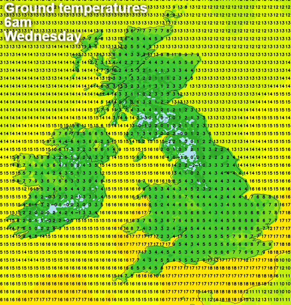
Wednesday will then see plenty of sunshine, but it'll feel quite cool in the north to northwest breeze. Temperatures will generally range from 11-15c. Then we move into the period where ex-Lorenzo will show it's hand, with cloud likely to increase from the west overnight and into Thursday. Rain is expected to arrive during Thursday and winds may start to become a factor at this point too. But we'll have to wait at least a day or two before getting into the detail.


