Heavy thundery rain is moving NE today across Wales and England, later into Scotland. Very wet at times with lightning. Strong winds in the SW this evening. Take your brolly.
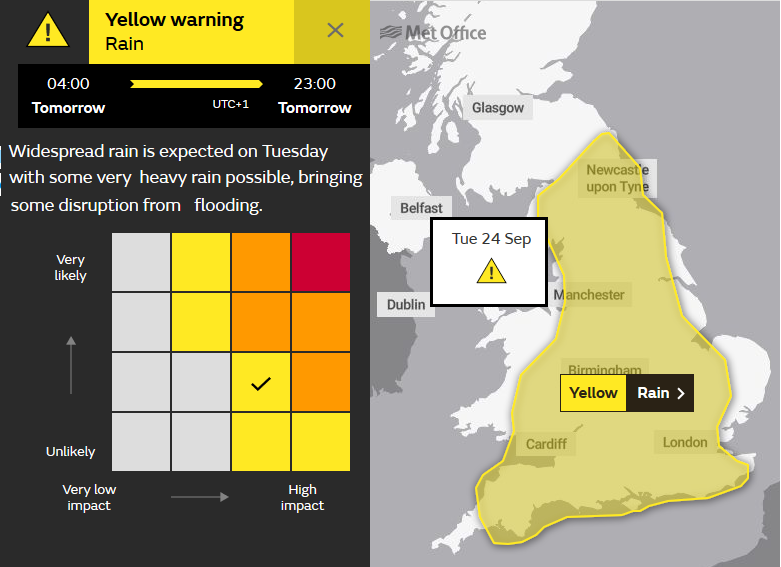
There will be more heavy and thundery rain about today. The UK Met Office has a yellow heavy rain warning over England and part of Wales and the morning commute has been soggy and tricky in places. Already there has been surface water and spray with reduced visibility. There is the risk of flooding today, some areas haven’t seen rain in while, for SW Britain over 70mm of rain is forecast, falling in a short space of time.
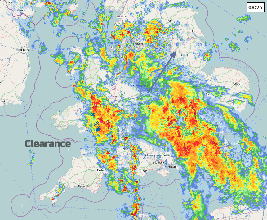
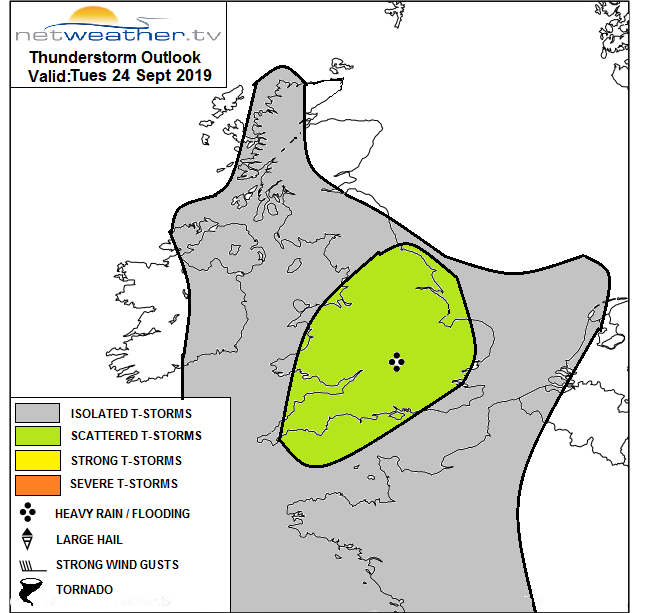
Embedded in this frontal band are thunderstorms, the lightning strikes have been showing up over Wales and SW England, and there will be gusty winds in the heavier downpours.
Quite a change from the fine weather of last week. This week stays unsettled with further rain from the west and blustery winds but today will bring the heaviest rain, even if it is moving fairly quickly north-eastwards.
Northern Ireland will fare well today with bright spells and will miss the heavy rain. Temperatures will reach 17 to 19C with a light southerly wind. There will be the odd shower but overall a fine day. Wales will see the heaviest rain during this morning as the light winds veer to the SW and become moderate. The main area of wet weather clears away NE and things improve. For a time, inland in the sunshine temperatures could reach 18 or 19C. As the low centre moves over the south of Ireland, the occluding fronts bring a cluster of heavy showers into Wales from the west, so more heavy rain.
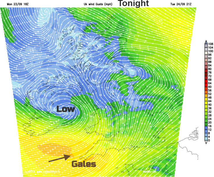
SW England and southern counties improve after the early heavy rain, the sun comes out and temperatures lift into the high teens. As the showery occlusion approaches this evening, the winds will strengthen and there will be coastal gales from the SW
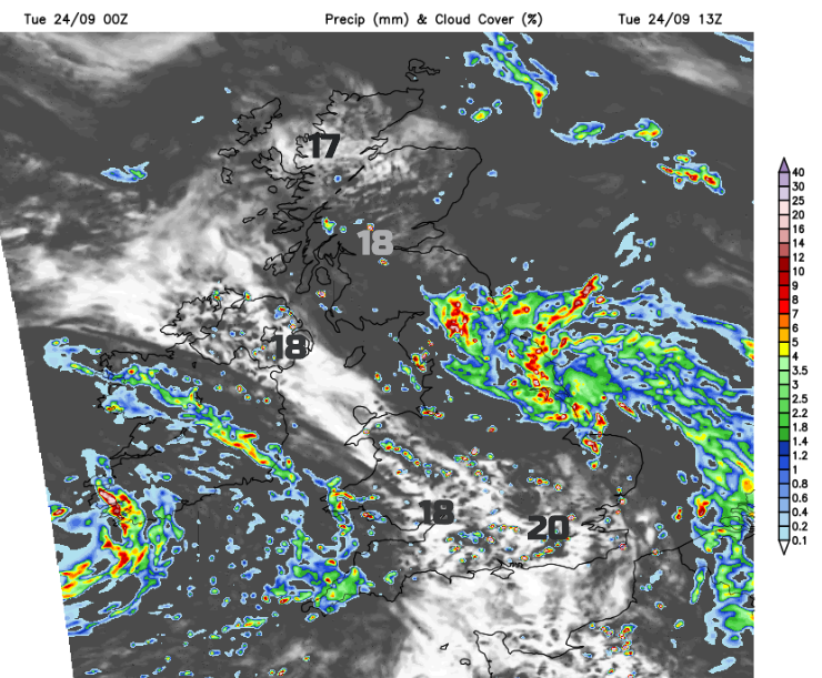
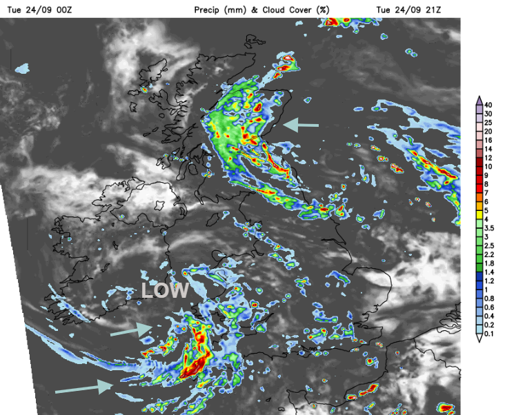
For the rest of England today, this area of heavy, thundery rain moves north-eastwards by lunchtime, bringing the welcome rain to SE England and East Anglia. With downpours for the Midlands and then northern England, it will be eastern and NE England seeing the wettest weather this afternoon, including the Pennines and then moving up into SE Scotland. There is some uncertainty even still for Cumbria and the southern Uplands as to how this rain will swing around. Under the rain it will feel cool at 13 or 14C but in drier brighter areas temperatures will reach the high teens. There will mostly be light winds for northern Britain today but just a moderate SE wind catching the east coast. The rain will feed further north over Scotland, but the models vary from heavy rain covering the east coast to pockets of hefty showers making their way right across the mainland.
Tonight
As the low centre moves across Wales, it will be windy for southern Britain as the heavy showers spread in from the west. Further north the rain pivots westwards over Scotland.
On Wednesday the rain slowly eases through the morning, after more hefty showers in the SE first thing but it stays blustery in the far south all day. Temperatures peak at 18C with sunny spells.
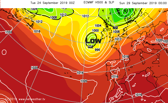
By Wednesday night another Atlantic low will be heading towards the UK bringing further rain from the west and blustery winds. Not as heavy as today's rain but still adding to this week’s totals. Blustery showers continue to whizz in from the west with the unsettled weather lasting through the weekend.,