Warming up into the mid 20sC by the weekend but the settled sunny weather will fade from the SW. Fine and dry for today's Climate strikes. Windy and unsettled for next week.
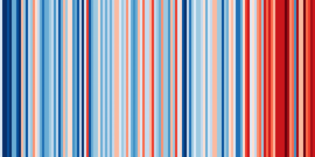
Annual average temperatures for UK from 1884-2018 using data from UK Met Office. #ShowyourStripes Graphics and lead scientist: Ed Hawkins.
Today many pupils and others will take part in the next #Fridays4Future climate strike. This time part of global #StrikeWeek, a people’s movement following the call from Greta Thunberg to school strike. It is to highlight climate change and make governments move the issue to the top of their policy making agenda. For those joining the #ClimateStrike today, the UK has fine, settled and dry weather with sunshine and mainly light winds. Just SW Britain and Northern Ireland have a blustery day, so take care with the banners. The UK Climate predictions released this week showed how much seasonal temperature values were expected to rise here in the UK, also the number of hot spells and hot summer days. The stripes above are a visual representation of the UK or global mean temperature change over past decades.
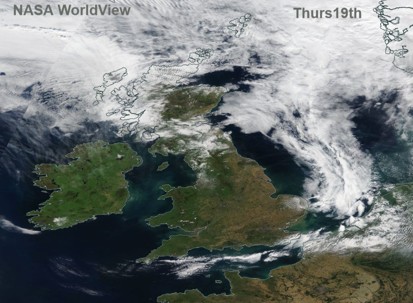
High pressure is still over the UK, it has resulted in a lot of settled sunny weather. It’s another cool start with a little mist and fog about but the same fine weather continues today. The high is beginning to slip to the east hence the brisk winds for western areas and along the English Channel. For Cornwall ad south Devon there will be coastal gales later today. Temperatures will be in the high teens and low 20sC again today. North of the Grampian mountains will do well today, as will the Lake District with a bit of shelter from the S or SE winds.
Saturday
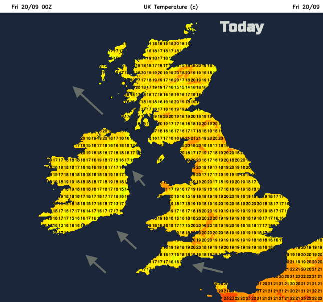
Another fine start, there have been some beautiful sunsets and morning skies over recent days. It will be warmer for England and Wales up to the mid 20sC inland and for London. Western Scotland and western Wales also warming up in the SE winds. The winds pick up during the day, quite noticeable for the east coast of Britain
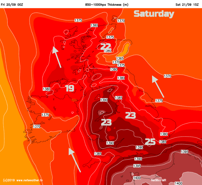
Many places will have a lovely day with warm sunshine, quite a breeze from the SE but staying dry. However, a weather front will bring cloud from the west and outbreaks of rain. The risk starts in the afternoon but looks more likely by Saturday evening. So, clusters of showers with even thundery downpours for SW England, into Wales and Northern Ireland.
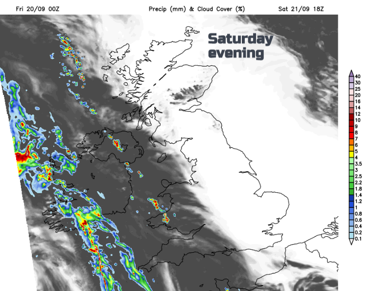
This change continues steadily as more cloud and further outbreaks of rain move over Britain during Saturday night. The winds do ease down as the warmer air from Saturday begins to seep away eastwards. Coming up against this from the SW will be bands of rain and further thundery bursts on Sunday.
The timings of the rain bands keep changing so don’t put too much store by your weather apps detail. Eastern England could heat up again if the sunshine remains, up to the mid 20sC and Scotland into the low 20sC, particularly for the NW Highlands. SW winds edge into Wales and the West country with more cloud and patchy rain, so it will be fresher here. Northern Ireland keeps a fresh SE wind with the risk of rain on and off, a blustery Belfast marathon with temperatures in the mid-teens.
Next week
Low pressure takes over for next week bringing windy weather to the UK and a much more unsettled picture. Bands of rain spin up from the SW, welcome rain for parts of the south and there is a cooling trend. Quite a change from today's’ weather and there is some tropical energy in the mix too, from the other side of the Atlantic. How Hurricane Humberto could influence our UK weather.