Tropical systems from the other side of the Atlantic add some uncertainty and extra energy into the forecast for the northern Atlantic and our UK weather. Hurricane Humberto is heading NE.
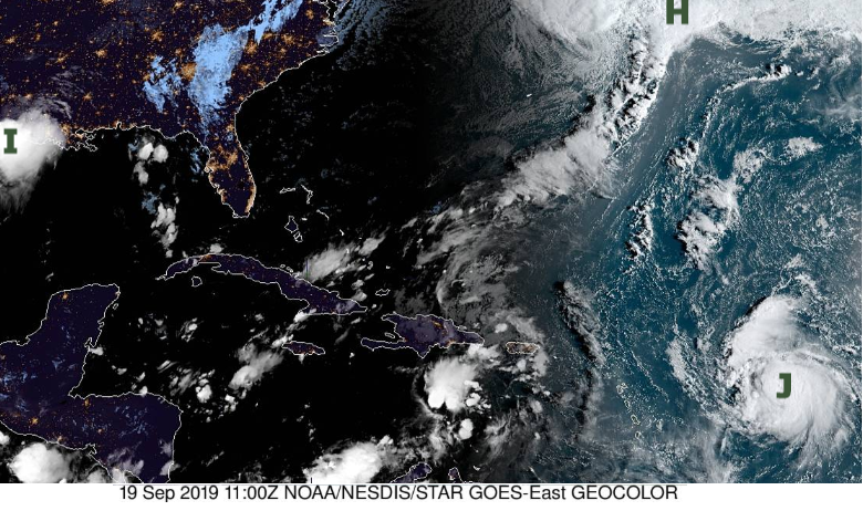
The tropical storm season watched by the NHC (National Hurricane Centre) has certainly stepped up a gear. They are monitoring Imelda, Humberto and Jerry on one side and Kiko, Mario and Lorena on the other.
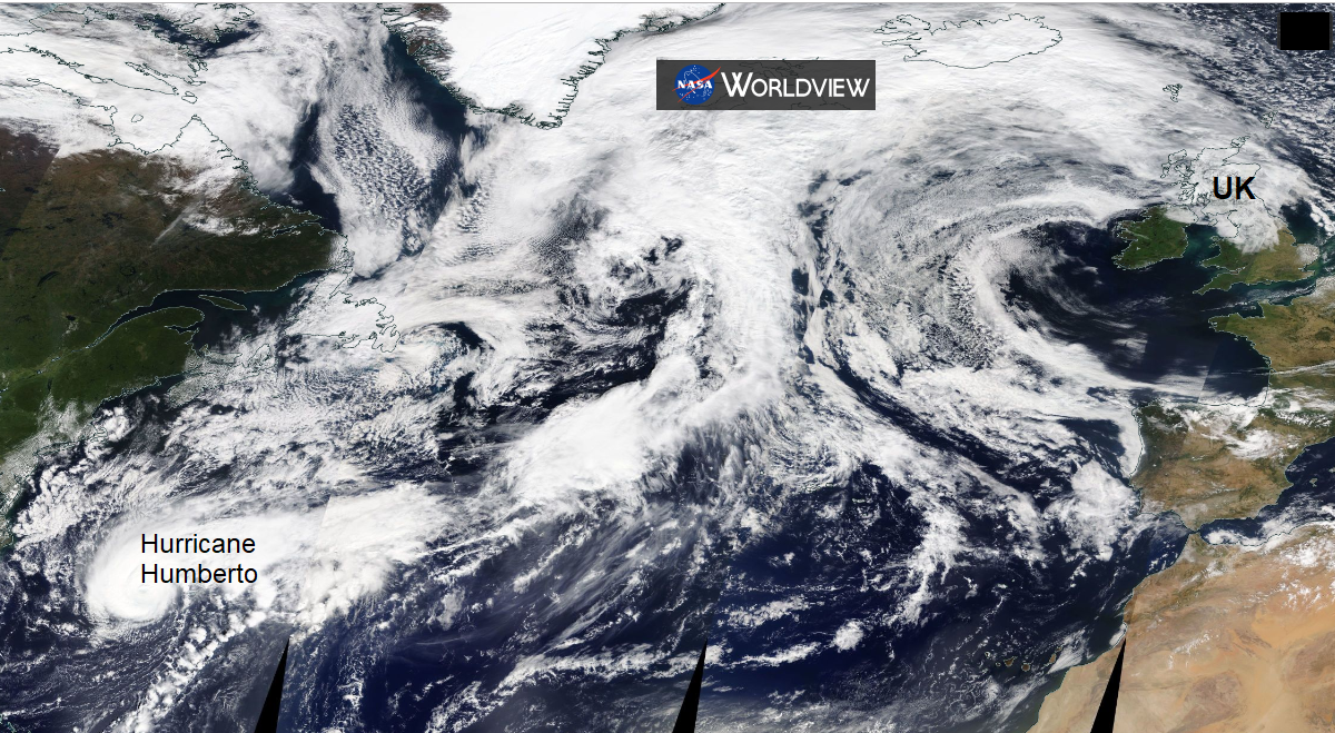
Of more interest to the UK is Hurricane Humberto which came close enough to Bermuda to cause widespread power outages midweek. It is still heading NE across the Atlantic as it begins to change form. Over the colder seas, it changes from tropical cyclone into an extratropical low pressure.
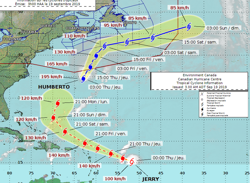
"Humberto's extratropical transition continues… the process will be completed in less than 36 hours. Afterwards, gradual weakening is expected until the extratropical low is absorbed by another larger low pressure system, moving out of Atlantic Canada, by the end of the forecast period." NHC 19/09
There is uncertainty about where the low pressure will end up in relation to the UK, west or NW. However, it does look like next week will feel fresher as the pull of warm southerly air that is around this week will have ceased. There will be bands of rain and showers moving in from the west or SW, so not as dry as under the current anticyclone and it will be blustery for everyone next week.
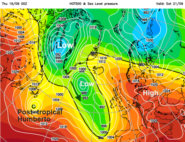
After ex-Humberto’s interactions with the other lows in the north Atlantic, a low pressure containing the remnants of Humberto will head our way.
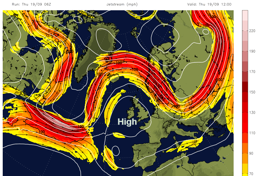
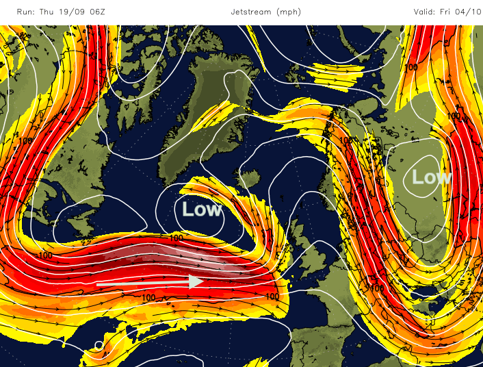
Currently, the high pressure over the UK is bringing a lot of settled, fine, sunny and then warm weather. The jet stream, high above the surface has an amplified pattern, lots of bends in it. It isn’t as fast-moving nor powerful and is being displaced north and south. By the end of next week, a more zonal flow will be in place, powering straight across the Atlantic, and helping to deepen low pressures that arrive near to the UK. The change is not straightforward, there are plenty of wriggles and dives over the weekend and earlier next week, but the shift is clear in the end.
Confidence in the forecast further ahead is usually low at this time of year due to the addition, into the forecasting pot, of Atlantic tropical storms and hurricanes. They have a powerful influence up through the atmosphere, with their extra energy and warmth but are relatively small features with big variation in possible paths. Following Humberto will be Jerry, no sign of Tom.
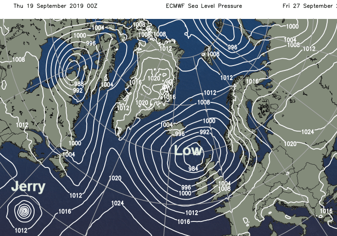
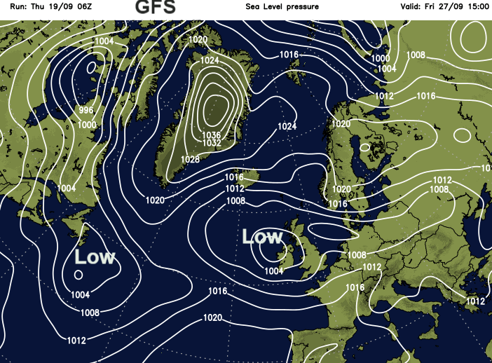
Same time a week Friday but different depths for the two key lows.
What we will see here in the UK is a shift from quiet anticyclonic conditions to more lively, windy weather with some rain and a more blustery autumnal look to the weather for the end of September thanks to an extra push from what was Hurricane Humberto.
Loading recent activity...