Mid to high 20sC later this week as the flow turns around to the south. High pressure brings a lot of settled and sunny weather to the UK, away from the far north.
You can see and feel the change now away from summer. A nip in the air first thing, the nights creeping in and that the real heat of the year is fading, maybe just remembering winter cold and snow. Autumn can be beautiful, settled, sunny and still. Fog and frosts begin to reappear, soon enough the Atlantic storms will rattle in but this week we are under a steady high pressure. This keeps most of the UK dry with light winds and sunshine. Things change through the weekend.
Today
With a cold front clearing to the south and a northerly flow this morning this is a chill in the air. Low cloud over SW England will break up. Temperatures have dipped down to +2 or +3C. With a light northerly wind today, it stays cool, especially along North Sea coasts where there will be more of a breeze. South Wales should reach 18C, London 20C.
There have been a few showers over the far north of mainland Scotland, these continue. There is a warm front coming into the Western Isles later today. Otherwise it is a fine, dry day with sunshine.
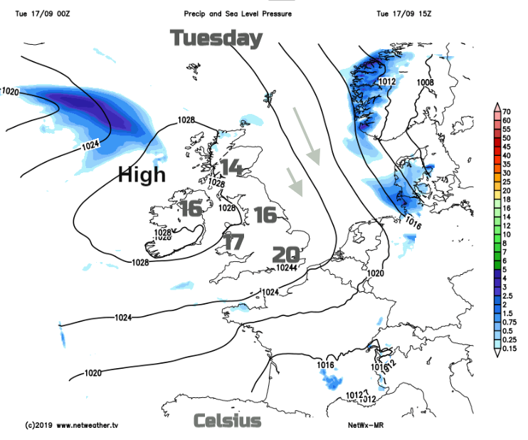
Tonight, will be clear and cool, with light winds, a few fog patches and even a touch of frost. By Wednesday morning the warm front cloud will be across northern Scotland and the islands with outbreaks of rain.
Wednesday
A similar day with plenty of fine, dry and sunny weather. Winds will be lighter for most but there will be enough of a NE breeze over Kent and the Thames estuary to make it feel cooler, also for the north Norfolk coast. Temperatures of 14 to 19C. The cloud cover remains for northern Scotland with patchy rain at times.
Though the week the high slips to the east and more unsettled weather around a large low pressure nudges our way. It takes a while, but Ireland becomes blustery on Friday and the UK windy by Saturday. This flow from the south will also draw up warmer air. Temperatures rise on Thursday, into the low to mid 20sC by Friday
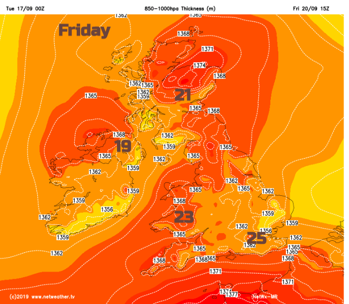
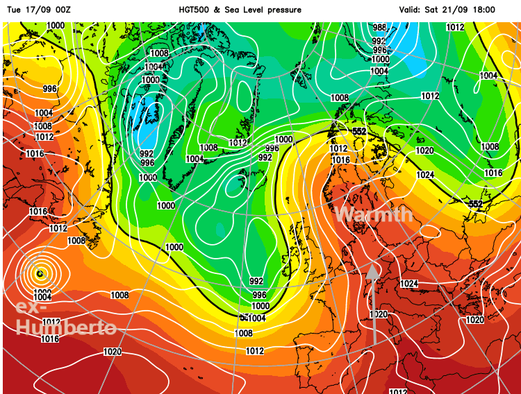
It could be even warmer by Saturday. The unsettled weather begins to move over Ireland during the day and into Wales and SW England later on Saturday with the risk of some thundery bursts. The warmth will try to cling on in the east on Sunday as the outbreaks of rain and cloud spread on the veering flow.
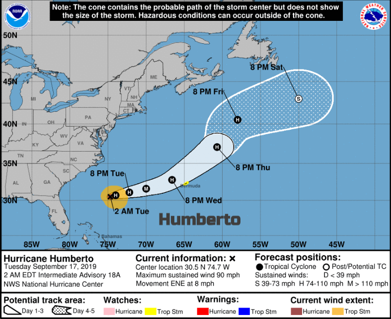
Well out in the Atlantic, the other side, is Hurricane Humberto, which Bermuda is keeping an eye on. This will head north but have quite a wander about before it’s remnants could get caught up in the flow towards NW Europe. The GFS shows a small low head towards the UK later next week, a fair way off.
Watch out for hype. Top temperatures this week look to be 28C 82F, that is above average, it’s only mid-September so doesn’t need to be labelled “an Indian Summer” and there are no UK worries from (ex-)Humberto at this time.