Hottest late August Bank Holiday day ever Sunday and August Bank Holiday Monday today too. But will the heat last much longer?

A month ago the UK recorded its hottest official temperature ever recorded, when 38.7C was recorded at Cambridge Botanical Gardens on the 25th July, beating the previous record set in 2003 at Faversham, Kent, by 0.2C. Yesterday and today, we see yet two more records broken, yeserday saw 33.3C at Heathrow in west London, which beats the previous record of 31.5C (88.7F), set in 2001 and makes it the warmest late August Bank Holiday weekend on record. Today we saw 33.2C, again at Heathrow, making it the hottest late August Bank Holiday Monday ever.
On Saturday, a new late August Bank Holiday record for Wales was set at Gogerdann - where 28.8C (83.8F) was recorded.
August until this weekend has been rather mixed, wet and often on the cool side, with temperatures slightly below average at times. This was thanks to a rather active jet stream moving across or to the south of the UK, bringing the flow off the Atlantic and a succession of low pressure systems that brought above average rainfall across large parts of the UK.
A week ago, the jet stream was south of the UK, so UK on the cool side of the jet and under influence of low pressure
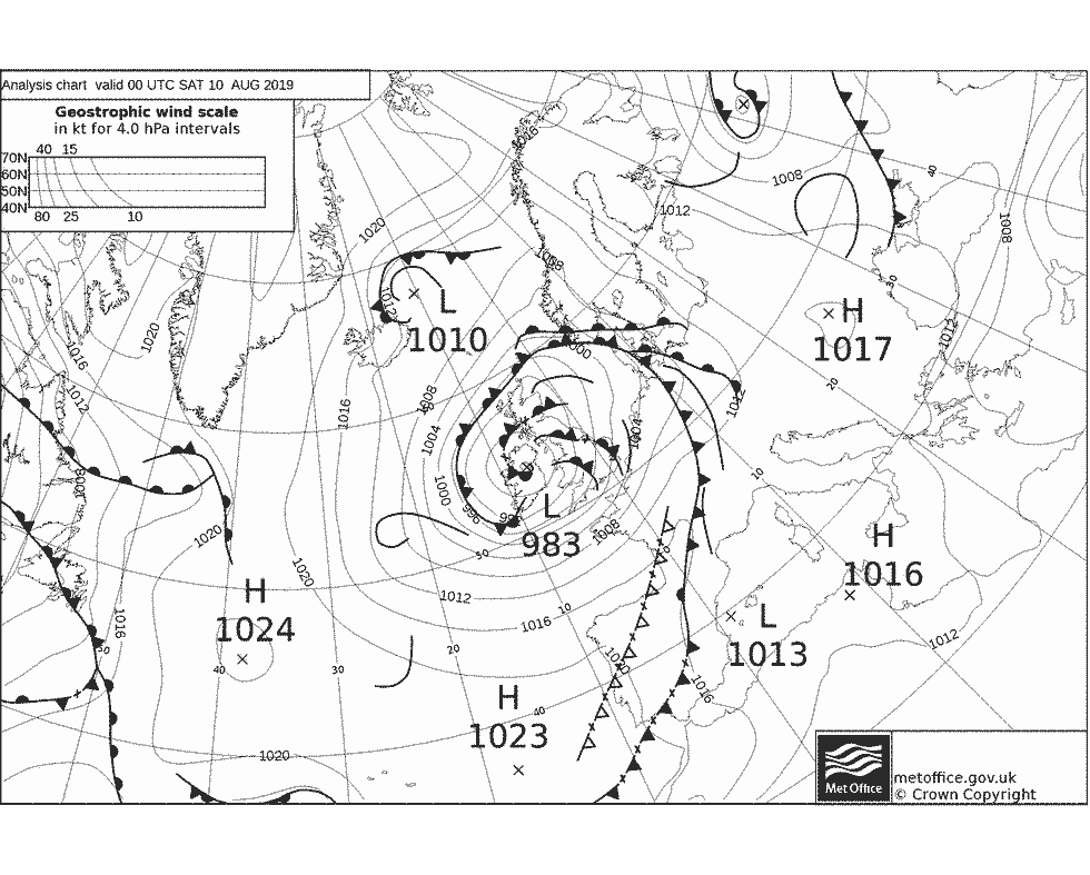
Back in early August, around 1,500 people were evacuated from Whaley Bridge in Derbyshire, during emergency work to repair the Toddbrook Reservoir dam after it was damaged by heavy rain. On Saturday 10th of August, an unseasonably deep low raced off the Atlantic across Britain, bringing more heavy rain in the north and very windy weather in the south - triggering yellow weather warnings from the Met Office across much of the UK.
Remember this deep low on Saturday 10th August?
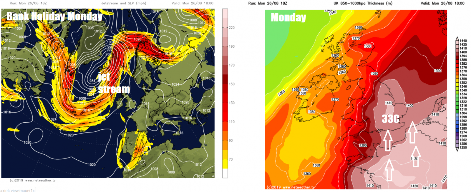
But, as was the case a month ago, though not as extreme heat-wise, the jet stream buckled towards the weekend to allow a deep trough to stall out west and a strong ridge of high pressure to build on the near continent to the east, pulling hot air northwards from France across the UK.
Jet stream well to the north of the UK last few days, hot air being drawn north off France
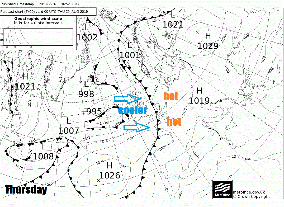
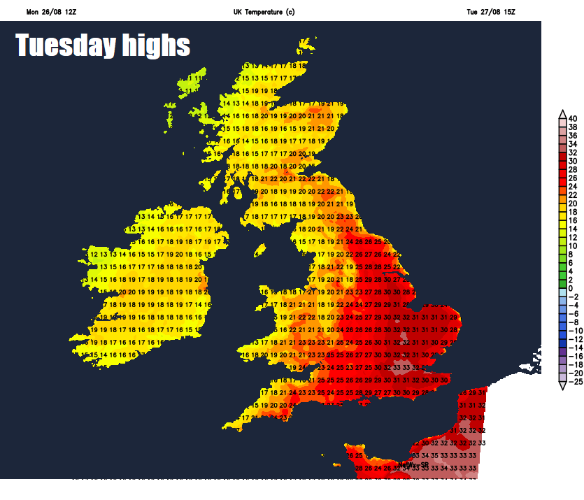
The heat looks to hang on across SE England and East Anglia on Tuesday, reaching the low 30s again, while a breakdown further west will see thunderstorms across SW Britain spread northeast across the Midlands, northern England and eastern Scotland through the day and acommpanied cooler conditions.
Wednesday seeing further thundery downpours spread northeast across northern and western areas, still very warm, dry and sunny in the southeast. Thursday will see a cold front clear eastern England, with all parts seeing cooler conditions with a blustery westerly wind, which will bring showery rain to the north, but the south staying dry.