


A depression to the North West of Scotland will work it's way slowly eastward through the weekend, bringing sunshine and blustery showers.
A depression to the North West of Scotland will work it's way slowly eastward through the weekend. This will bring blustery showers mostly to North and West, although there are signs of some drier, warmer weather moving in particularly for the South from Wednesday or Thursday of next week.
With yesterdays rain now out of the way, most places are waking to much brighter conditions today. There'll be sunny spells especially over England, Wales, East Scotland and towards Down and Armagh. But with a few mainly light showers moving East over England at first this morning soon clearing into the North Sea.
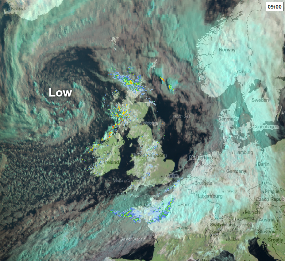 Radar and satellite image at 0900 this morning.
Some build-up of cloud will lead to a scattering of blustery showers by the afternoon mainly over Northern Ireland and in the West, but most places will miss them and stay dry. There'll be an occasionally fresh and blustery South-West wind, that should decrease towards evening in the South. Top temperatures between 18 and 22C however, will be a little disappointing for mid-August.
Across the North and West of Scotland, there'll be more in the way of blustery showers some heavy, with the chance of local hail and thunder later. A fresh or strong South or South-West wind will give gusts in excess of gale force in exposed areas and the more substantial more squally showers, with temperatures here getting no higher than a rather cool 14 to 17C.
The North and West of both Northern Ireland and Scotland see further blustery showers into the evening and overnight. There'll also be some in the West, while more sheltered southern and eastern areas, in particular, are mainly dry with clear spells developing after dark. Later in the night though, a meandering front over northern France could bring cloud and some showers to parts of Sussex and Kent, but this is a threat rather than a promise. A South West wind will remain fresh and blustery over Northern Ireland, much of Scotland and North West England, but with a lighter breeze in the South. Although perhaps feeling a little chilly in the wind, temperatures shouldn't fall below 10 to 15C.
Sunday in many ways will be a repeat performance of Saturday in another day of sunny spells and blustery showers, these mostly in the North and West. Some of the showers over West Scotland and Northern Ireland will be heavy and lengthy, with a risk of local hail and thunder again. Sheltered parts of East Scotland and much of England and Wales see fewer showers with many central and eastern areas likely to stay dry. Nowhere will be immune from catching a shower, however, but if you do catch one it'll quickly move on in quite blustery conditions.
A mostly fresh South West to West wind will give further gusts over gale force in exposed parts of Northern Ireland and across the North and West of Scotland. Here, temperatures will get no higher than 14 to 16C. Elsewhere though, the thermometer should reach 18 to 22C again.
Blustery showers continue into the evening and overnight in the North and West, while more sheltered parts of East Scotland, England and Wales become mainly dry with clear spells developing. A South West or Westerly wind should decrease a little but will continue to give fresh or strong gusts across the North and West of both Scotland and Northern Ireland. It may also feel chilly in the wind, but temperatures are not expected to fall below 9 to 14C.


