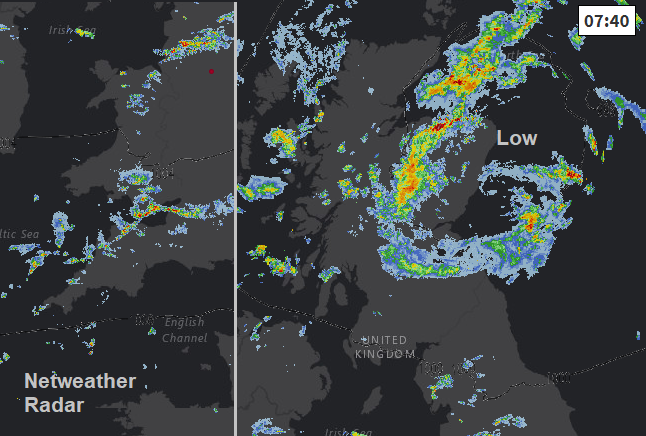
Wet and windy weather for the end of the working week as a new low heads up from the SW. Thunderstorm warnings over Scotland today, but a bit of a lull on Thursday. Be quick it won't last.
A tale of two low pressures for the rest of this week. Today’s low is moving from over the North Sea but still producing more heavy and thundery showers, mainly over Scotland. Thursday brings a brief lull before a new deep low heads up from the SW bringing wet and windy weather later Thursday and into the weekend. This is ready causing impacts with Boardmasters music and surf festival in Newquay being cancelled.
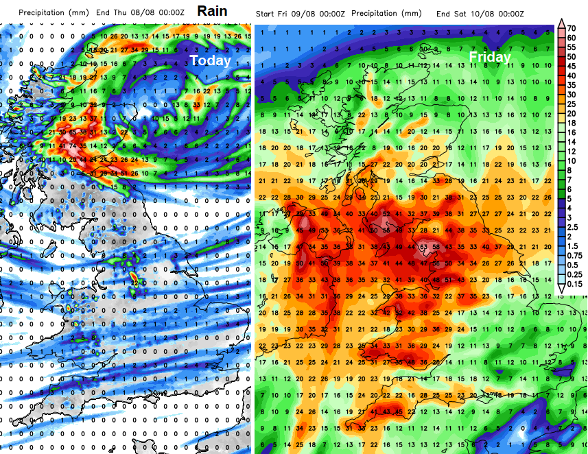
There are already yellow warnings from the Met Office for Friday. Rain for much of England and Wales on Friday and wind for the southern half of the UK on Saturday. Expect some adjustments nearer the time
Today there are thunderstorm warnings for Scotland with heavy showers already over northern Scotland, and more expected through the Central Belt from lunchtime onwards. There has been some glorious sunshine for the start of the Edinburgh Festival but also downpours to contend with for the Fringe crowds. There is also a cluster of heavy showers over NW England and feeding up the Bristol Channel.
Across the UK there will be a light to moderate west wind with temperatures ranging from mid to high teens, into the low 20sC. SE Britain could see 24C in the sunshine. It’s another day of bright or sunny spells with a scattering of showers for the rest of the UK. In sheltered spots, it still can feel very warm but out in the breeze or if the sun disappears behind a cloud, the temperature will fall suddenly.
Thursday
Most of mainland UK will have a fine start tomorrow. The Channel Islands will have heavy and thundery showers, the first signs of the incoming low. With lighter winds, it will feel warmer and temperatures will be from the high teens to mid 20sC. Many parts will have a lovely day, enjoy it if you can. Showery rain and more cloud will begin to show itself over Cornwall and Devon around teatime with the main frontal rain moving in on Thursday evening.
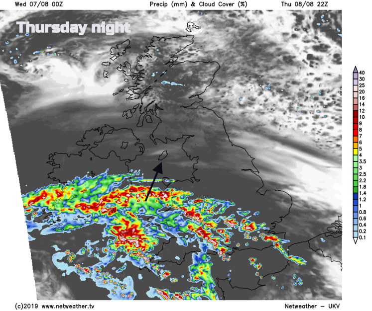
Friday. The frontal bands will move slowly northwards during Thursday night and Friday. The water levels in the Toddbrook reservoir have been reduced but the Environment agency team will continue to monitor the situation and the Severe flood warnings and evacuations continue.
There will be some warm air drawn up with this low, you may notice that early on Friday, particularly for SE England. Temperatures in SE England or East Anglia could reach 27 or 28C. The main rain will start over Northern Ireland, northern England, southern Scotland and East Anglia. Wales, the Midlands and southern England will have seen decent rain overnight. It will be a blustery morning with S to SE to E winds and a lively start for the North Channel, the Inner Hebrides to the Isle of Man
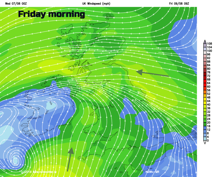
The rain shifts over more of Scotland by lunchtime and in the afternoon, leaving showers for Northern Ireland, NW England and Wales. By lunchtime an easterly wind will be whistling through the Central Belt and buffeting NE England, then strong NE Winds for the Western Isles later. During the afternoon strong S to SW winds pickup for SW Britain with gusts around 50mph for coasts and moors.
Fresh SW winds blow across England and Wales during Friday night with strong winds along the English Channel coasts. A pulse of gusts (50-60mph) will move along the south coast with Kent, looking particularly windy by Saturday lunchtime.
As the second low clears away on Sunday it leaves a cooler northerly flow, so no return to the extreme heat of July. A quieter and cooler end to the weekend.