A drier lull today and Saturday for High Peak, Derbyshire and other sodden areas. Not completely dry but just a few showers within a lot of fine, warm weather and sunny spells.
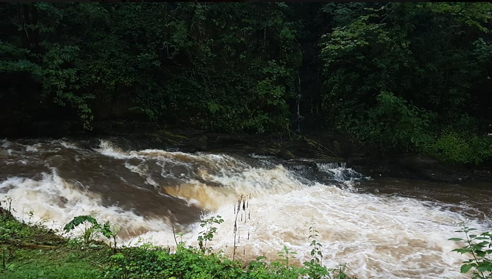
Photo Ashleigh Parker FB - NewMills
Thinking back to last week when the UK saw the hottest day on record, this week has been plagued with flooding and heavy rain for some parts. People in the Whaley Bridge area, High Peak, Derbyshire and other villages have spent the night away from their homes, evacuated due to the threat of flooding from a damaged dam, looming high over the valley. The water in the Toddbrook reservoir has been swelling dangerously at the top of the dented dam with local bridges and roads closed.
"I live in the red zone under the dam hoping the pumps don't flood our houses but know they need to do this work. Les "
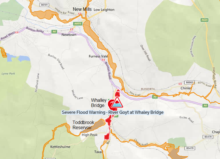
Severe flooding - danger to life Environment Agency. River levels in the River Goyt could still rise rapidly as a result of persistent rain and water coming from Toddbrook Reservoir on 01/08/2019. Evacuation plans are currently underway for the area of Whaley Bridge. last updated at 9:43pm Thursday 1 August 2019
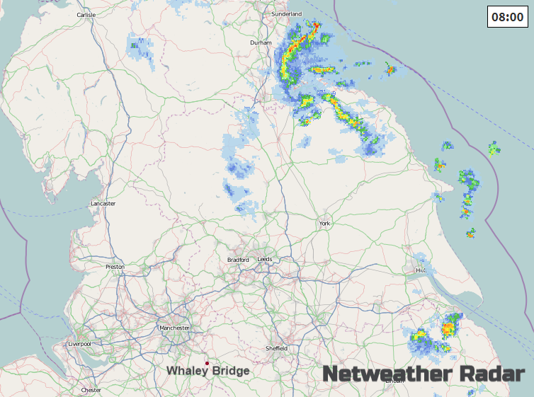
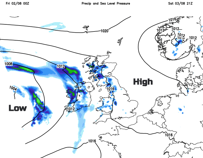
Today does look drier and tomorrow. With flow from the north or east, there have been a few showery outbreaks for eastern England off the North Sea. Some of these will make their way inland, encountering the Pennines first. Bits could reach the Peak District with one or two other showers breaking out but they should be lighter than on Thursday and still well scattered. Other parts of Britain will see a few showers, not many but there could be some heavier bursts of southern Wales and SW England this afternoon.
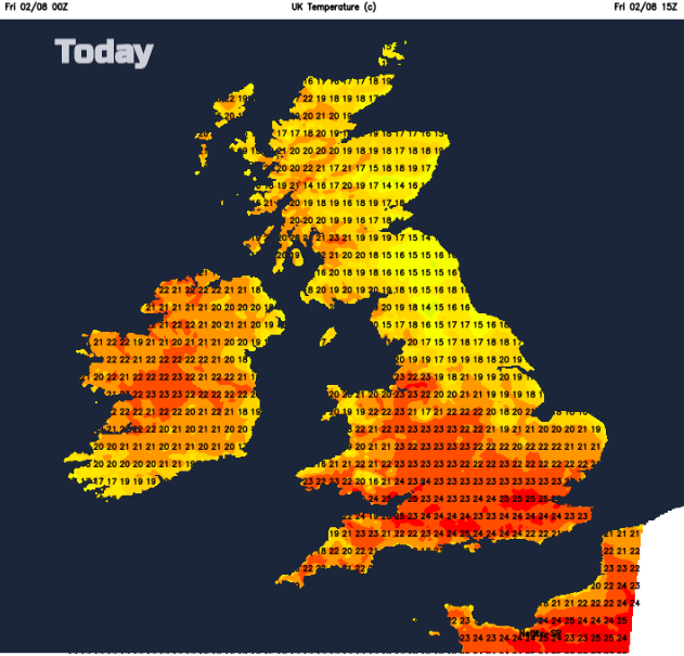
Northern Ireland will have a fine day, bright or sunny with a light SE breeze. There could be the odd light shower but overall it’s a dry picture with temperatures around 21C. Britain will see high teens in the north and low to mid 20sC in the south, all with very light winds and sunny spells. A warm feeling Friday but not the extreme heat of last week. 38.7C from last Thursday has now been confirmed (after Quality Management of the Cambridge data) as the highest UK temperature on record.
Friday evening looks fine and dry, just feeling a bit cooler along North Sea coasts with a light easterly flow
Saturday
High pressure over Britain will bring calm and more settled weather. To start the weekend there will be some low cloud or fog about in the east. Winds remain very light from the east or southeast. Temperatures will be 19 to 25C. For much of Britain, Saturday will be a fine, bright day with sunny spells. Showers will appear over inland Wales and Scotland. Well scattered but still with some sharp downpours. For Northern Ireland, there will be a moderate SE wind with temperatures of 18 to 21C. Cloud will increase during the day with a scattering of showers during the afternoon, but overall it will be a fair day.
Sunday
By Sunday, the low pressure will have edged closer to the UK, throwing fronts in from the west. Temperatures will be in the low to mid 20sC. In the southeasterly flow parts of England could heat up more, so temperatures may rise higher. Again, there will be showers from the west and the risk of heavier rain for NW England to end the weekend. This may need watching. A westerly flow will take over for the West Country and Wales later on Sunday.
Monday
With a more SW or westerly flow, there will be more of a breeze with eastern Britain seeing the highest temperatures, into the 20sC.