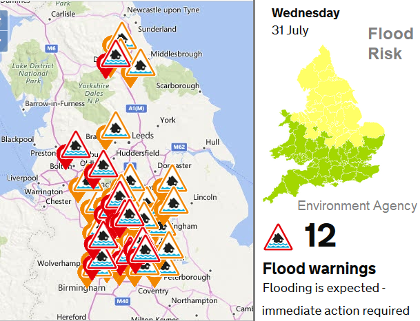
More rain lurking today for flood-hit North Yorkshire and the Midlands. The weather will settle down for the second half of the week. No repeat of the extreme heat from last week.
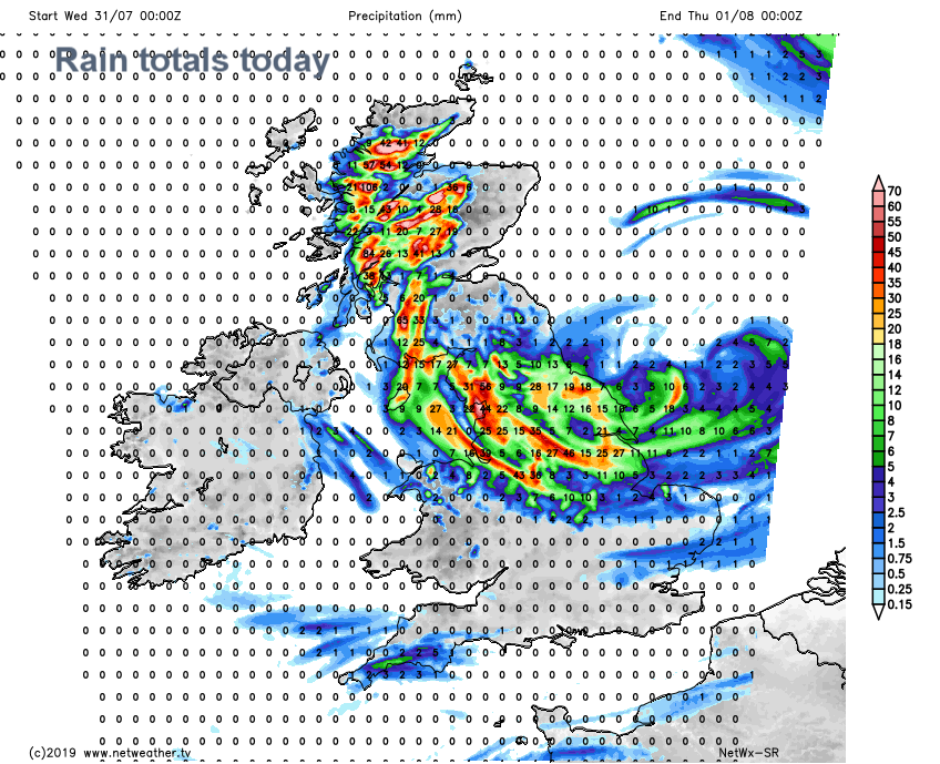
There will be more rain today over northern England and the Midlands, adding to the existing high totals. North Yorkshire has been feeling the effects of flooding with over 100mm of rain in 24 hours. The Yorkshire Dales have seen becks bursting their banks, a bridge collapse and road closures as the amount of water made them impassable. Tomorrow, until well into the weekend, looks much drier.
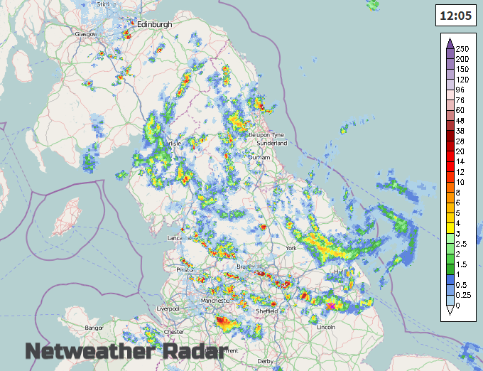
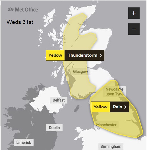
Tuesday’s low pressure has moved from SW England up to eastern England, slowly edging out over the North Sea today. The fronts wrapped around this will bring more rain today, which turns showery and brings the risk of thunderstorms, there is a yellow warning for rain today.
“Some parts of northern England could see as much as 40-60 mm of rain through Wednesday, while thunderstorms could produce as much as 30-40 mm in 1-2 hours” Met Office
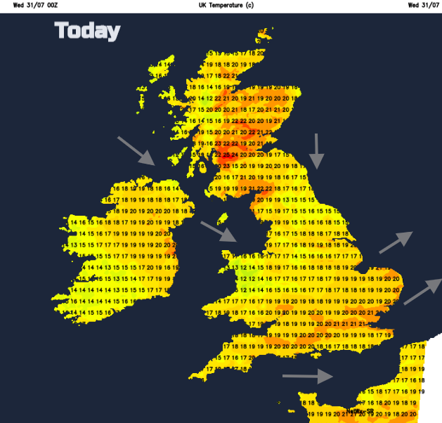
Northern Ireland, Wales and SW England feel cooler this morning but elsewhere there is still an early warmth, closeness in the air. Brisk west to SW winds are wrapped around the low over southern Britain and a curl of moderate northerly winds pick up this morning for NE England. Scotland could see some of the highest temperatures today with 24C forecast for Glasgow. However. thunderstorms are also forecast to break out over western Scotland this afternoon.
“Scattered thunderstorms developing for the afternoon, with 20 to 30 mm possible within an hour, and perhaps 50 mm in places within a few hours. Hail may occur in some locations.” Met Office for W.Scotland
After a cloudy start, Northern Ireland should brighten up this afternoon with a light NW wind and temperatures of 17 to 20C. Powys and south Wales should see temperatures of 19C today but elsewhere will be cooler in a brisk westerly wind. Showery rain continues to affect northern Wales this morning but then fades with sunny spells further south. The rain across a central swathe of Britain turns more showery, so many places missing the afternoon rain but still with some moderate downpours scattered about. Southern Britain will have a fine afternoon with temperatures up to 22C and eastern Scotland will fare well in the sunshine and warmth.
It will be slightly warmer in Wales and SE England on Thursday, mid 20sC for London with lighter winds. As the low still lurks in the North Sea there will be a cooler NE breeze for eastern England but less heavy rain. The flow from the north could still bring low cloud and rain to coastal NE England down to the North York moors as showers appear once more from Loch Lomond, across the Lake District and Peak District. Just a scattering.
The end of the week is relatively quiet by comparison, with a col setup as a larger low pressure forms out in the Atlantic. Temperatures on Friday will be in the low 20sC with a lot of dry weather.
Weekend
This weekend temperatures will be in the low 20sC. There will be much warmer air away to the SE which could lift temperatures higher on Sunday, mid to high temps. There will be early mist and fog, with the risk of showers from the west. Otherwise a lot of fair, bright weather, however, the showers will become heavier later on Sunday.
Nick Finnis's Thunderstorm/Convective forecast for Weds 31st July