More sharp showers and a scattering of thunderstorms on the way today, but just as we saw yesterday, not everyone will catch one.
More sharp showers and a scattering of thunderstorms on the way today, but just as we saw yesterday, not everyone will catch one. Away from them, there'll be more warm, humid July sunshine to be had.
The showers will perhaps be a bit more widespread than we saw yesterday though, but with a particular focus on eastern and especially northeastern parts of the country. This morning, we've still got some outbreaks of showery rain running west to east across Scotland and Northern England, leftover from overnight. It, and what have been quite cloudy skies to start the day elsewhere, will begin to clear to allow sunny spells to break through during the morning. And it's when that happens that the showers and storms will start to pop up.
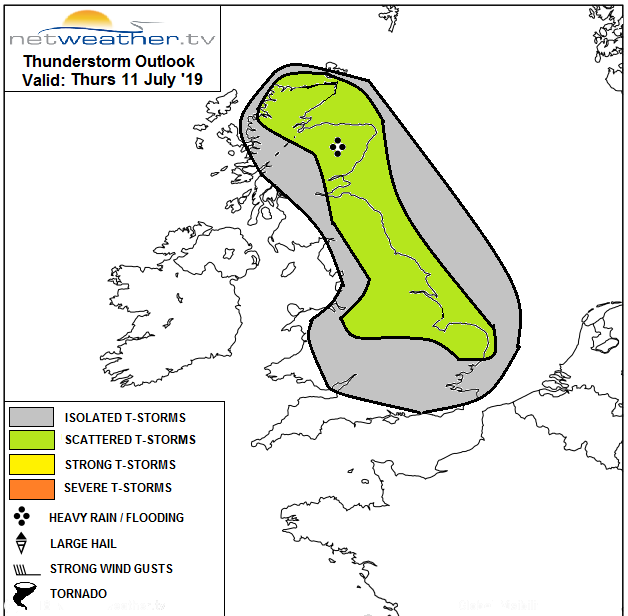
Our storm expert, Nick Finnis has issued a convective and storm forecast for today, with lots more detail on the storm threat, likely hazards and the setup causing it.
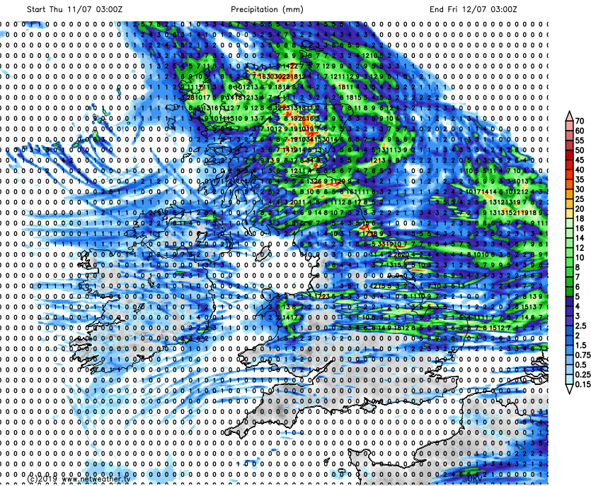
A look at the rainfall totals for today gives an excellent indication as to where the showers are expected to be most widespread. As you can see, much of southern England stays out of trouble, which is good news for Wimbledon even if the odd shower can't be entirely ruled out. For the cricket, there is the risk of a downpour or two at Edgbaston, but it's only on the cusp of the higher risk. So, a day to keep an eye on the radar.
Temperatures today, will reach a muggy 23-25c in the south. For most of the rest of England, Wales and southern Scotland, 19-22c is likely, with northern Scotland and Northern Ireland reaching 14-18c. A close night follows in the southeast especially, with parts of London perhaps not dropping below 18c or so. It'll be fresher the further north and west you are.
Friday then dawns with varying amounts of cloud, and the best of the sunny spells inland away from coasts exposed to the north or northwest wind. As the sun gets to work, we'll see showers popping up once again. They're likely to be most frequent in the east, with perhaps a few more affecting southern England for a time at least. Not all will catch a shower though, and where you don't, it'll be another warm day with sunny spells. Where you do catch one, it could well be heavy and thundery.
Temperatures will be on a par with Thursday's values, and it'll still feel humid.
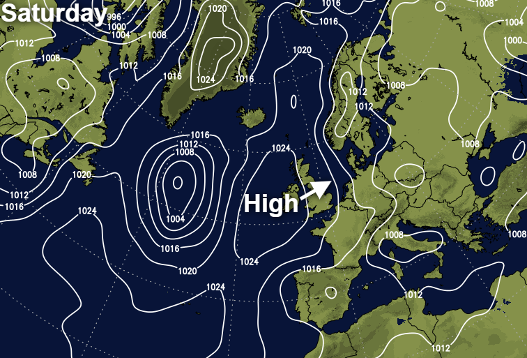
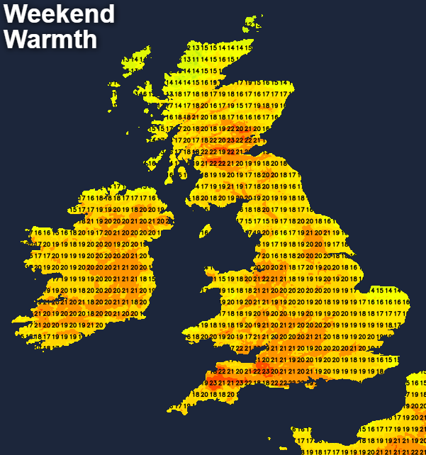
Into the weekend, high pressure will be arriving onto the scene from the west, so summery, and dry weather will be the norm. North Sea coasts may not fare so well though, with an onshore breeze regularly bringing murk and low cloud inland. There'll still be the risk of a few showers during Saturday in eastern and particularly southeastern parts, but that threat will fade through the day as the high drifts over the country.
As you may expect, North Sea coasts will buck the warm trend with maxes just about into the teens in those spots which are most prone to the cloud. Elsewhere though, 20-24c will be typical, with central and western parts seeing the warmest temperatures, with the east to northeast breeze just knocking a degree or two off further east.