
In the southerly flow, temperatures will rise into the low twenties with plenty of sunshine. However an easterly holds on for some and keeps a bit of an edge to the air in another dry spell.
There will be a lot of dry weather this week. Still with some cool nights, even frost in a few places but higher temperatures in the sunshine with the low twenties Celsius looking likely over the next few days. These highs aren’t for SE Britain though where the easterly wind keeps going. It will be northern and western parts of the UK feeling the warmth, with 23C possible in northern Scotland, 73F. No rain for days but a change by Friday or the weekend.
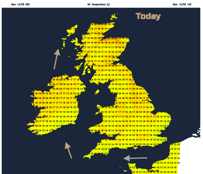
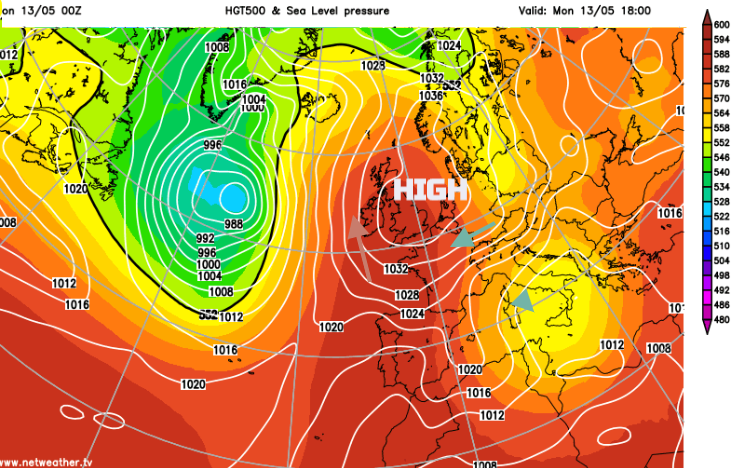
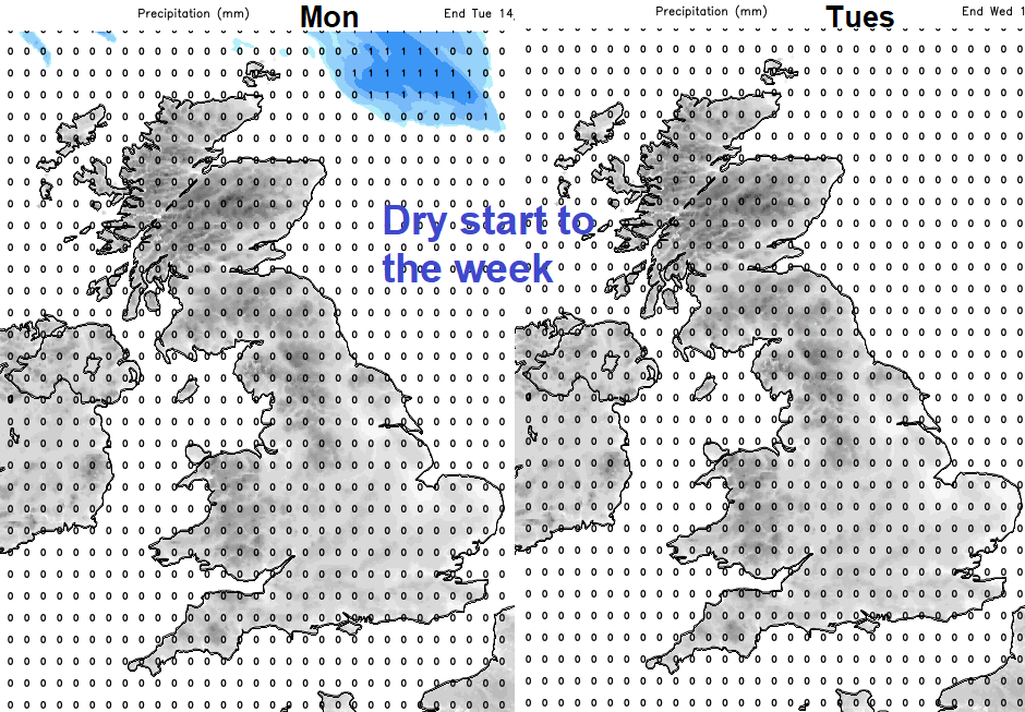
With high pressure over the UK to start the working week, we have plenty of fine, dry and settled weather. There is more cloud in the far north with a little rain for Shetland but that fades this morning. For many, it will remain dry all week. Temperatures will change.
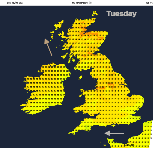
For Monday and Tuesday, there is a warmer flow from the south with temperatures rising into the high teens for much of mainland Britain. A few places could reach into the low twenties, northern Scotland on Monday and around 20C for parts of northern and western England and Wales by Tuesday.
However, for SE Britain, especially the coasts of East Anglia and Kent it will be cool with an easterly breeze off the sea. This is a different flow around the high reaching along the English Channel too. So, in sheltered sunshine, you will feel warm, but the air keeps a freshness for a day or two.
Gradually the high pressure shifts towards Scandinavia. Warmth remains for western Britain and Ireland but cooler air heads across the North Sea. With an easterly wind, eastern England then SE Scotland will notice this more as the week progresses. Low cloud will begin to appear by Thursday but still, there will be plenty of fine, bright and sunny weather about.
There will be moderate to high pollen levels, from oak trees and grass pollen is also starting now.
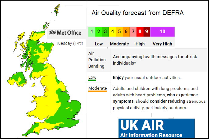
UV levels are rising, with strong sunshine. Air pollution levels are also set to rise under the stagnant anticyclonic setup. The DEFRA UK map shows the overall forecast for the UK, but levels will be higher at individual locations.
By the end of the week, rain will begin to appear. Not for everyone and there is some uncertainty about where it will appear and how much. By Friday showery outbreaks look likely moving across the UK in the easterly flow. Pulses appear coming in from the North Sea, with NE England and SE Scotland looking prone, another area across southern England even East Anglia. However, we will have to wait for developments during the week. These appear to push across to Wales, but NW England looks to be sheltered by the Pennines. It will feel cooler in the NE, with more cloud, the risk of rain for more of the UK. Temperatures look to be in the low to high teens by the weekend. The low twenties Celsius are more likely in the next few days with north/NW Scotland fairing very well in this setup.


